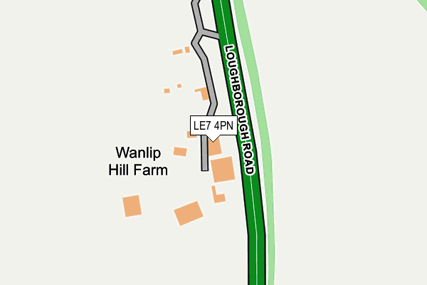
LE7 4PN lies on Loughborough Road in Wanlip, Leicester. LE7 4PN is located in the Rothley Brook electoral ward, within the local authority district of Charnwood and the English Parliamentary constituency of Charnwood. The Sub Integrated Care Board (ICB) Location is NHS Leicester, Leicestershire and Rutland ICB - 04V and the police force is Leicestershire. This postcode has been in use since August 1992.


GetTheData
Source: OS OpenMap – Local (Ordnance Survey)
Source: OS VectorMap District (Ordnance Survey)
Licence: Open Government Licence (requires attribution)
| Easting | 459110 |
| Northing | 311405 |
| Latitude | 52.697106 |
| Longitude | -1.126775 |
GetTheData
Source: Open Postcode Geo
Licence: Open Government Licence
| Street | Loughborough Road |
| Locality | Wanlip |
| Town/City | Leicester |
| Country | England |
| Postcode District | LE7 |
➜ See where LE7 is on a map | |
GetTheData
Source: Land Registry Price Paid Data
Licence: Open Government Licence
Elevation or altitude of LE7 4PN as distance above sea level:
| Metres | Feet | |
|---|---|---|
| Elevation | 70m | 230ft |
Elevation is measured from the approximate centre of the postcode, to the nearest point on an OS contour line from OS Terrain 50, which has contour spacing of ten vertical metres.
➜ How high above sea level am I? Find the elevation of your current position using your device's GPS.
GetTheData
Source: Open Postcode Elevation
Licence: Open Government Licence
| Ward | Rothley Brook |
| Constituency | Charnwood |
GetTheData
Source: ONS Postcode Database
Licence: Open Government Licence
| Birstall Park And Ride (Loughborough Road) | Birstall | 961m |
| Birstall Meadow Road (Loughborough Road) | Birstall | 997m |
| Woodcock Farm (Loughborough Road) | Rothley | 1,079m |
| Hallfields Lane | Rothley | 1,137m |
| Birstall Meadow Road (Loughborough Road) | Birstall | 1,150m |
| Syston Station | 3km |
| Sileby Station | 4km |
GetTheData
Source: NaPTAN
Licence: Open Government Licence
| Percentage of properties with Next Generation Access | 100.0% |
| Percentage of properties with Superfast Broadband | 0.0% |
| Percentage of properties with Ultrafast Broadband | 0.0% |
| Percentage of properties with Full Fibre Broadband | 0.0% |
Superfast Broadband is between 30Mbps and 300Mbps
Ultrafast Broadband is > 300Mbps
| Percentage of properties unable to receive 2Mbps | 0.0% |
| Percentage of properties unable to receive 5Mbps | 0.0% |
| Percentage of properties unable to receive 10Mbps | 0.0% |
| Percentage of properties unable to receive 30Mbps | 100.0% |
GetTheData
Source: Ofcom
Licence: Ofcom Terms of Use (requires attribution)
GetTheData
Source: ONS Postcode Database
Licence: Open Government Licence


➜ Get more ratings from the Food Standards Agency
GetTheData
Source: Food Standards Agency
Licence: FSA terms & conditions
| Last Collection | |||
|---|---|---|---|
| Location | Mon-Fri | Sat | Distance |
| Sycamore Road | 17:00 | 12:00 | 1,477m |
| Greengate Post Office | 17:00 | 12:00 | 1,721m |
| Poplar Avenue | 17:30 | 12:00 | 1,888m |
GetTheData
Source: Dracos
Licence: Creative Commons Attribution-ShareAlike
The below table lists the International Territorial Level (ITL) codes (formerly Nomenclature of Territorial Units for Statistics (NUTS) codes) and Local Administrative Units (LAU) codes for LE7 4PN:
| ITL 1 Code | Name |
|---|---|
| TLF | East Midlands (England) |
| ITL 2 Code | Name |
| TLF2 | Leicestershire, Rutland and Northamptonshire |
| ITL 3 Code | Name |
| TLF22 | Leicestershire CC and Rutland |
| LAU 1 Code | Name |
| E07000130 | Charnwood |
GetTheData
Source: ONS Postcode Directory
Licence: Open Government Licence
The below table lists the Census Output Area (OA), Lower Layer Super Output Area (LSOA), and Middle Layer Super Output Area (MSOA) for LE7 4PN:
| Code | Name | |
|---|---|---|
| OA | E00173331 | |
| LSOA | E01025679 | Charnwood 019A |
| MSOA | E02005363 | Charnwood 019 |
GetTheData
Source: ONS Postcode Directory
Licence: Open Government Licence
| LE4 3NA | Birstall Meadow Road | 914m |
| LE7 7SN | Farmers Way | 931m |
| LE4 3EL | Field Leys Way | 943m |
| LE4 3NL | Pen Lane Avenue | 944m |
| LE4 3NJ | Nine Riggs Square | 960m |
| LE4 3NB | Barn Meadow Road | 968m |
| LE7 7SX | Merttens Drive | 980m |
| LE7 7SY | Burtons Road | 999m |
| LE7 7RZ | Burrow Drive | 1008m |
| LE4 3EQ | Kevin Wood Close | 1008m |
GetTheData
Source: Open Postcode Geo; Land Registry Price Paid Data
Licence: Open Government Licence