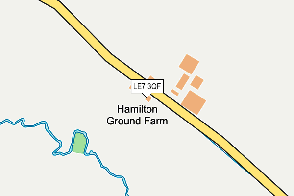
LE7 3QF is located in the South Charnwood electoral ward, within the local authority district of Charnwood and the English Parliamentary constituency of Charnwood. The Sub Integrated Care Board (ICB) Location is NHS Leicester, Leicestershire and Rutland ICB - 03W and the police force is Leicestershire. This postcode has been in use since August 1992.


GetTheData
Source: OS OpenMap – Local (Ordnance Survey)
Source: OS VectorMap District (Ordnance Survey)
Licence: Open Government Licence (requires attribution)
| Easting | 464144 |
| Northing | 307803 |
| Latitude | 52.664158 |
| Longitude | -1.052997 |
GetTheData
Source: Open Postcode Geo
Licence: Open Government Licence
| Country | England |
| Postcode District | LE7 |
➜ See where LE7 is on a map | |
GetTheData
Source: Land Registry Price Paid Data
Licence: Open Government Licence
Elevation or altitude of LE7 3QF as distance above sea level:
| Metres | Feet | |
|---|---|---|
| Elevation | 80m | 262ft |
Elevation is measured from the approximate centre of the postcode, to the nearest point on an OS contour line from OS Terrain 50, which has contour spacing of ten vertical metres.
➜ How high above sea level am I? Find the elevation of your current position using your device's GPS.
GetTheData
Source: Open Postcode Elevation
Licence: Open Government Licence
| Ward | South Charnwood |
| Constituency | Charnwood |
GetTheData
Source: ONS Postcode Database
Licence: Open Government Licence
| Bakers Way (Maidenhead Avnue) | Hamilton | 807m |
| Shipton Road (Sandhills Avenue) | Hamilton | 830m |
| Bakers Way (Maidenwell Avenue) | Hamilton | 830m |
| Shipton Road (Sandhills Avenue) | Hamilton | 837m |
| Celandine Road (Maidenwell Avenue) | Hamilton | 1,073m |
| Syston Station | 3.9km |
| Leicester Station | 6.1km |
GetTheData
Source: NaPTAN
Licence: Open Government Licence
| Percentage of properties with Next Generation Access | 100.0% |
| Percentage of properties with Superfast Broadband | 0.0% |
| Percentage of properties with Ultrafast Broadband | 0.0% |
| Percentage of properties with Full Fibre Broadband | 0.0% |
Superfast Broadband is between 30Mbps and 300Mbps
Ultrafast Broadband is > 300Mbps
| Percentage of properties unable to receive 2Mbps | 0.0% |
| Percentage of properties unable to receive 5Mbps | 100.0% |
| Percentage of properties unable to receive 10Mbps | 100.0% |
| Percentage of properties unable to receive 30Mbps | 100.0% |
GetTheData
Source: Ofcom
Licence: Ofcom Terms of Use (requires attribution)
GetTheData
Source: ONS Postcode Database
Licence: Open Government Licence


➜ Get more ratings from the Food Standards Agency
GetTheData
Source: Food Standards Agency
Licence: FSA terms & conditions
| Last Collection | |||
|---|---|---|---|
| Location | Mon-Fri | Sat | Distance |
| Maidenhead Avenue | 16:30 | 11:00 | 1,608m |
| Columbine Road | 17:30 | 12:00 | 1,677m |
| Grantham Road | 17:00 | 12:00 | 1,848m |
GetTheData
Source: Dracos
Licence: Creative Commons Attribution-ShareAlike
The below table lists the International Territorial Level (ITL) codes (formerly Nomenclature of Territorial Units for Statistics (NUTS) codes) and Local Administrative Units (LAU) codes for LE7 3QF:
| ITL 1 Code | Name |
|---|---|
| TLF | East Midlands (England) |
| ITL 2 Code | Name |
| TLF2 | Leicestershire, Rutland and Northamptonshire |
| ITL 3 Code | Name |
| TLF22 | Leicestershire CC and Rutland |
| LAU 1 Code | Name |
| E07000130 | Charnwood |
GetTheData
Source: ONS Postcode Directory
Licence: Open Government Licence
The below table lists the Census Output Area (OA), Lower Layer Super Output Area (LSOA), and Middle Layer Super Output Area (MSOA) for LE7 3QF:
| Code | Name | |
|---|---|---|
| OA | E00130544 | |
| LSOA | E01025730 | Charnwood 015C |
| MSOA | E02005359 | Charnwood 015 |
GetTheData
Source: ONS Postcode Directory
Licence: Open Government Licence
| LE5 1BT | Tollerton Close | 439m |
| LE5 1LY | Snape Close | 481m |
| LE5 1NS | Timble Road | 484m |
| LE5 1NZ | Kepwick Road | 539m |
| LE5 1NR | Sockburn Close | 633m |
| LE5 1AW | Copgrove Close | 634m |
| LE5 1WF | Padside Close | 662m |
| LE5 1NX | Pickhill Road | 664m |
| LE5 1PE | Padside Close | 690m |
| LE5 1PH | Swinton Close | 694m |
GetTheData
Source: Open Postcode Geo; Land Registry Price Paid Data
Licence: Open Government Licence