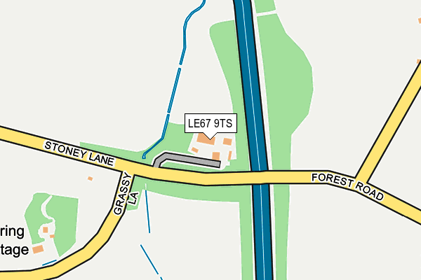
LE67 9TS is located in the Markfield, Stanton and Fieldhead electoral ward, within the local authority district of Hinckley and Bosworth and the English Parliamentary constituency of Bosworth. The Sub Integrated Care Board (ICB) Location is NHS Leicester, Leicestershire and Rutland ICB - 04V and the police force is Leicestershire. This postcode has been in use since August 1992.


GetTheData
Source: OS OpenMap – Local (Ordnance Survey)
Source: OS VectorMap District (Ordnance Survey)
Licence: Open Government Licence (requires attribution)
| Easting | 448062 |
| Northing | 310108 |
| Latitude | 52.686538 |
| Longitude | -1.290428 |
GetTheData
Source: Open Postcode Geo
Licence: Open Government Licence
| Country | England |
| Postcode District | LE67 |
➜ See where LE67 is on a map | |
GetTheData
Source: Land Registry Price Paid Data
Licence: Open Government Licence
Elevation or altitude of LE67 9TS as distance above sea level:
| Metres | Feet | |
|---|---|---|
| Elevation | 170m | 558ft |
Elevation is measured from the approximate centre of the postcode, to the nearest point on an OS contour line from OS Terrain 50, which has contour spacing of ten vertical metres.
➜ How high above sea level am I? Find the elevation of your current position using your device's GPS.
GetTheData
Source: Open Postcode Elevation
Licence: Open Government Licence
| Ward | Markfield, Stanton And Fieldhead |
| Constituency | Bosworth |
GetTheData
Source: ONS Postcode Database
Licence: Open Government Licence
| Church Drive (Forest Road) | Markfield | 558m |
| Croftway (Forest Road) | Markfield | 721m |
| The Green (Main Street) | Markfield | 754m |
| The Green (Main Street) | Markfield | 766m |
| Co-op (Main Street) | Markfield | 805m |
GetTheData
Source: NaPTAN
Licence: Open Government Licence
GetTheData
Source: ONS Postcode Database
Licence: Open Government Licence


➜ Get more ratings from the Food Standards Agency
GetTheData
Source: Food Standards Agency
Licence: FSA terms & conditions
| Last Collection | |||
|---|---|---|---|
| Location | Mon-Fri | Sat | Distance |
| Forest Road | 16:15 | 08:15 | 535m |
| Newtown Lane | 16:00 | 07:45 | 1,908m |
| Bradgate Road | 16:40 | 10:10 | 5,023m |
GetTheData
Source: Dracos
Licence: Creative Commons Attribution-ShareAlike
The below table lists the International Territorial Level (ITL) codes (formerly Nomenclature of Territorial Units for Statistics (NUTS) codes) and Local Administrative Units (LAU) codes for LE67 9TS:
| ITL 1 Code | Name |
|---|---|
| TLF | East Midlands (England) |
| ITL 2 Code | Name |
| TLF2 | Leicestershire, Rutland and Northamptonshire |
| ITL 3 Code | Name |
| TLF22 | Leicestershire CC and Rutland |
| LAU 1 Code | Name |
| E07000132 | Hinckley and Bosworth |
GetTheData
Source: ONS Postcode Directory
Licence: Open Government Licence
The below table lists the Census Output Area (OA), Lower Layer Super Output Area (LSOA), and Middle Layer Super Output Area (MSOA) for LE67 9TS:
| Code | Name | |
|---|---|---|
| OA | E00131271 | |
| LSOA | E01025871 | Hinckley and Bosworth 001D |
| MSOA | E02005377 | Hinckley and Bosworth 001 |
GetTheData
Source: ONS Postcode Directory
Licence: Open Government Licence
| LE67 9TE | Cliffe Hill | 411m |
| LE67 9UQ | Little Markfield | 451m |
| LE67 9XQ | Quarrymans Court | 544m |
| LE67 9UP | Hill Side | 551m |
| LE67 9WB | Queen Street | 552m |
| LE67 9UN | Forest Road | 557m |
| LE67 9PN | Hill Lane Industrial Estate | 686m |
| LE67 9PY | Hill Lane Close | 686m |
| LE67 9UH | Church Drive | 702m |
| LE67 9WD | The Green | 705m |
GetTheData
Source: Open Postcode Geo; Land Registry Price Paid Data
Licence: Open Government Licence