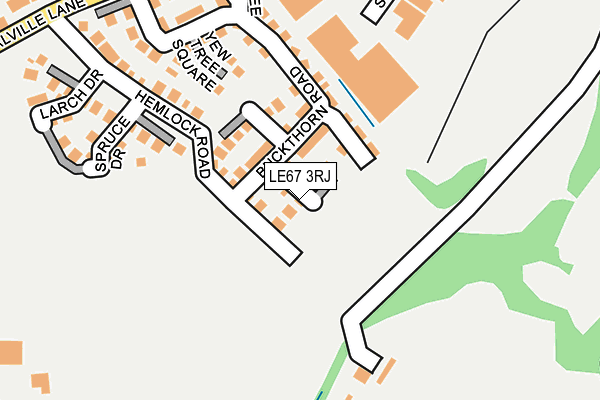
LE67 3RJ lies on Redwood Close in Ravenstone, Coalville. LE67 3RJ is located in the Snibston North electoral ward, within the local authority district of North West Leicestershire and the English Parliamentary constituency of North West Leicestershire. The Sub Integrated Care Board (ICB) Location is NHS Leicester, Leicestershire and Rutland ICB - 04V and the police force is Leicestershire. This postcode has been in use since June 2015.


GetTheData
Source: OS OpenMap – Local (Ordnance Survey)
Source: OS VectorMap District (Ordnance Survey)
Licence: Open Government Licence (requires attribution)
| Easting | 441324 |
| Northing | 314250 |
| Latitude | 52.724326 |
| Longitude | -1.389581 |
GetTheData
Source: Open Postcode Geo
Licence: Open Government Licence
| Street | Redwood Close |
| Locality | Ravenstone |
| Town/City | Coalville |
| Country | England |
| Postcode District | LE67 |
➜ See where LE67 is on a map ➜ Where is Coalville? | |
GetTheData
Source: Land Registry Price Paid Data
Licence: Open Government Licence
Elevation or altitude of LE67 3RJ as distance above sea level:
| Metres | Feet | |
|---|---|---|
| Elevation | 160m | 525ft |
Elevation is measured from the approximate centre of the postcode, to the nearest point on an OS contour line from OS Terrain 50, which has contour spacing of ten vertical metres.
➜ How high above sea level am I? Find the elevation of your current position using your device's GPS.
GetTheData
Source: Open Postcode Elevation
Licence: Open Government Licence
| Ward | Snibston North |
| Constituency | North West Leicestershire |
GetTheData
Source: ONS Postcode Database
Licence: Open Government Licence
10, REDWOOD CLOSE, RAVENSTONE, COALVILLE, LE67 3RJ 2022 29 JUL £255,000 |
10, REDWOOD CLOSE, RAVENSTONE, COALVILLE, LE67 3RJ 2022 25 MAR £265,000 |
9, REDWOOD CLOSE, RAVENSTONE, COALVILLE, LE67 3RJ 2020 27 MAR £225,000 |
10, REDWOOD CLOSE, RAVENSTONE, COALVILLE, LE67 3RJ 2017 24 NOV £205,000 |
4, REDWOOD CLOSE, RAVENSTONE, COALVILLE, LE67 3RJ 2016 12 DEC £283,995 |
10, REDWOOD CLOSE, RAVENSTONE, COALVILLE, LE67 3RJ 2015 24 JUL £178,995 |
9, REDWOOD CLOSE, RAVENSTONE, COALVILLE, LE67 3RJ 2015 29 MAY £182,995 |
GetTheData
Source: HM Land Registry Price Paid Data
Licence: Contains HM Land Registry data © Crown copyright and database right 2025. This data is licensed under the Open Government Licence v3.0.
| The Limes (Coalville Lane) | Ravenstone | 312m |
| The Limes (Coalville Lane) | Ravenstone | 326m |
| Registery Office (Ravenstone Road) | Coalville | 354m |
| Registery Office (Ravenstone Road) | Coalville | 385m |
| Swannington Road (Coalville Lane) | Ravenstone | 417m |
GetTheData
Source: NaPTAN
Licence: Open Government Licence
| Percentage of properties with Next Generation Access | 100.0% |
| Percentage of properties with Superfast Broadband | 100.0% |
| Percentage of properties with Ultrafast Broadband | 100.0% |
| Percentage of properties with Full Fibre Broadband | 0.0% |
Superfast Broadband is between 30Mbps and 300Mbps
Ultrafast Broadband is > 300Mbps
| Median download speed | 100.0Mbps |
| Average download speed | 100.7Mbps |
| Maximum download speed | 200.00Mbps |
| Median upload speed | 9.6Mbps |
| Average upload speed | 7.5Mbps |
| Maximum upload speed | 11.76Mbps |
| Percentage of properties unable to receive 2Mbps | 0.0% |
| Percentage of properties unable to receive 5Mbps | 0.0% |
| Percentage of properties unable to receive 10Mbps | 0.0% |
| Percentage of properties unable to receive 30Mbps | 0.0% |
GetTheData
Source: Ofcom
Licence: Ofcom Terms of Use (requires attribution)
GetTheData
Source: ONS Postcode Database
Licence: Open Government Licence


➜ Get more ratings from the Food Standards Agency
GetTheData
Source: Food Standards Agency
Licence: FSA terms & conditions
| Last Collection | |||
|---|---|---|---|
| Location | Mon-Fri | Sat | Distance |
| Church Lane/Beadmans Close | 16:45 | 12:00 | 510m |
| Belvoir Road | 18:30 | 11:30 | 627m |
| Thornborough Road | 16:45 | 11:30 | 1,543m |
GetTheData
Source: Dracos
Licence: Creative Commons Attribution-ShareAlike
The below table lists the International Territorial Level (ITL) codes (formerly Nomenclature of Territorial Units for Statistics (NUTS) codes) and Local Administrative Units (LAU) codes for LE67 3RJ:
| ITL 1 Code | Name |
|---|---|
| TLF | East Midlands (England) |
| ITL 2 Code | Name |
| TLF2 | Leicestershire, Rutland and Northamptonshire |
| ITL 3 Code | Name |
| TLF22 | Leicestershire CC and Rutland |
| LAU 1 Code | Name |
| E07000134 | North West Leicestershire |
GetTheData
Source: ONS Postcode Directory
Licence: Open Government Licence
The below table lists the Census Output Area (OA), Lower Layer Super Output Area (LSOA), and Middle Layer Super Output Area (MSOA) for LE67 3RJ:
| Code | Name | |
|---|---|---|
| OA | E00131733 | |
| LSOA | E01025958 | North West Leicestershire 011C |
| MSOA | E02005407 | North West Leicestershire 011 |
GetTheData
Source: ONS Postcode Directory
Licence: Open Government Licence
| LE67 3RH | Hornbeam Close | 92m |
| LE67 3QA | Buckthorn Road | 148m |
| LE67 3NZ | Hemlock Road | 161m |
| LE67 3QB | Buckthorn Road | 189m |
| LE67 3NT | Spruce Drive | 191m |
| LE67 3NL | Larch Drive | 276m |
| LE67 2NY | Floret Close | 333m |
| LE67 2LR | Coalville Lane | 350m |
| LE67 3NA | Ravenstone Road | 355m |
| LE67 2NJ | Pollard Way | 361m |
GetTheData
Source: Open Postcode Geo; Land Registry Price Paid Data
Licence: Open Government Licence