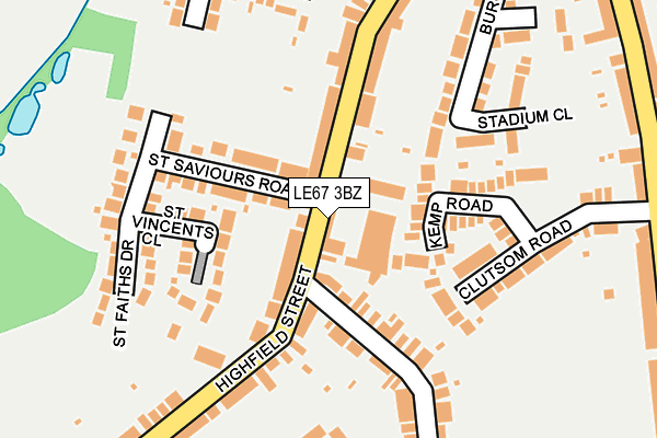
LE67 3BZ is located in the Snibston South electoral ward, within the local authority district of North West Leicestershire and the English Parliamentary constituency of North West Leicestershire. The Sub Integrated Care Board (ICB) Location is NHS Leicester, Leicestershire and Rutland ICB - 04V and the police force is Leicestershire. This postcode has been in use since December 1997.


GetTheData
Source: OS OpenMap – Local (Ordnance Survey)
Source: OS VectorMap District (Ordnance Survey)
Licence: Open Government Licence (requires attribution)
| Easting | 442218 |
| Northing | 313472 |
| Latitude | 52.717281 |
| Longitude | -1.376436 |
GetTheData
Source: Open Postcode Geo
Licence: Open Government Licence
| Country | England |
| Postcode District | LE67 |
➜ See where LE67 is on a map ➜ Where is Coalville? | |
GetTheData
Source: Land Registry Price Paid Data
Licence: Open Government Licence
Elevation or altitude of LE67 3BZ as distance above sea level:
| Metres | Feet | |
|---|---|---|
| Elevation | 160m | 525ft |
Elevation is measured from the approximate centre of the postcode, to the nearest point on an OS contour line from OS Terrain 50, which has contour spacing of ten vertical metres.
➜ How high above sea level am I? Find the elevation of your current position using your device's GPS.
GetTheData
Source: Open Postcode Elevation
Licence: Open Government Licence
| Ward | Snibston South |
| Constituency | North West Leicestershire |
GetTheData
Source: ONS Postcode Database
Licence: Open Government Licence
| St Saviour's Road (Highfield Street) | Coalville | 52m |
| St Saviour's Road (Highfield Street) | Coalville | 62m |
| Crescent Road (Highfield Street) | Coalville | 163m |
| Crescent Road (Highfield Street) | Coalville | 196m |
| North Avenue (Central Road) | Coalville | 301m |
GetTheData
Source: NaPTAN
Licence: Open Government Licence
GetTheData
Source: ONS Postcode Database
Licence: Open Government Licence


➜ Get more ratings from the Food Standards Agency
GetTheData
Source: Food Standards Agency
Licence: FSA terms & conditions
| Last Collection | |||
|---|---|---|---|
| Location | Mon-Fri | Sat | Distance |
| Central Road/Fairfield Road | 17:15 | 12:00 | 554m |
| Central Road | 17:00 | 12:00 | 682m |
| Ashburton Road | 17:15 | 12:15 | 686m |
GetTheData
Source: Dracos
Licence: Creative Commons Attribution-ShareAlike
The below table lists the International Territorial Level (ITL) codes (formerly Nomenclature of Territorial Units for Statistics (NUTS) codes) and Local Administrative Units (LAU) codes for LE67 3BZ:
| ITL 1 Code | Name |
|---|---|
| TLF | East Midlands (England) |
| ITL 2 Code | Name |
| TLF2 | Leicestershire, Rutland and Northamptonshire |
| ITL 3 Code | Name |
| TLF22 | Leicestershire CC and Rutland |
| LAU 1 Code | Name |
| E07000134 | North West Leicestershire |
GetTheData
Source: ONS Postcode Directory
Licence: Open Government Licence
The below table lists the Census Output Area (OA), Lower Layer Super Output Area (LSOA), and Middle Layer Super Output Area (MSOA) for LE67 3BZ:
| Code | Name | |
|---|---|---|
| OA | E00131724 | |
| LSOA | E01025957 | North West Leicestershire 010D |
| MSOA | E02005406 | North West Leicestershire 010 |
GetTheData
Source: ONS Postcode Directory
Licence: Open Government Licence
| LE67 3BN | Highfield Street | 63m |
| LE67 3DF | St Saviours Road | 81m |
| LE67 3DR | St Vincents Close | 104m |
| LE67 3BR | Highfield Street | 110m |
| LE67 3QL | Kemp Road | 123m |
| LE67 3BS | Highfield Street | 166m |
| LE67 3BL | Highfield Street | 166m |
| LE67 2BD | Crescent Road | 184m |
| LE67 3QF | Clutsom Road | 187m |
| LE67 2BF | Crescent Road | 188m |
GetTheData
Source: Open Postcode Geo; Land Registry Price Paid Data
Licence: Open Government Licence