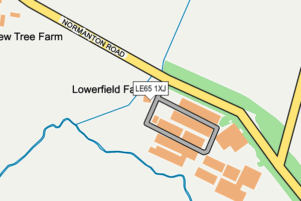
LE65 1XJ is located in the Ravenstone & Packington electoral ward, within the local authority district of North West Leicestershire and the English Parliamentary constituency of North West Leicestershire. The Sub Integrated Care Board (ICB) Location is NHS Leicester, Leicestershire and Rutland ICB - 04V and the police force is Leicestershire. This postcode has been in use since November 2016.


GetTheData
Source: OS OpenMap – Local (Ordnance Survey)
Source: OS VectorMap District (Ordnance Survey)
Licence: Open Government Licence (requires attribution)
| Easting | 436743 |
| Northing | 315263 |
| Latitude | 52.733779 |
| Longitude | -1.457285 |
GetTheData
Source: Open Postcode Geo
Licence: Open Government Licence
| Country | England |
| Postcode District | LE65 |
➜ See where LE65 is on a map | |
GetTheData
Source: Land Registry Price Paid Data
Licence: Open Government Licence
Elevation or altitude of LE65 1XJ as distance above sea level:
| Metres | Feet | |
|---|---|---|
| Elevation | 110m | 361ft |
Elevation is measured from the approximate centre of the postcode, to the nearest point on an OS contour line from OS Terrain 50, which has contour spacing of ten vertical metres.
➜ How high above sea level am I? Find the elevation of your current position using your device's GPS.
GetTheData
Source: Open Postcode Elevation
Licence: Open Government Licence
| Ward | Ravenstone & Packington |
| Constituency | North West Leicestershire |
GetTheData
Source: ONS Postcode Database
Licence: Open Government Licence
| Ashby Road | Packington | 568m |
| Ashby Road | Packington | 609m |
| Leicester Road | Ashby-de-la-zouch | 735m |
| Cambrian Way (Lower Packington Road) | Ashby-de-la-zouch | 810m |
| The Gables (Upper Packington Road) | Ashby-de-la-zouch | 814m |
GetTheData
Source: NaPTAN
Licence: Open Government Licence
GetTheData
Source: ONS Postcode Database
Licence: Open Government Licence


➜ Get more ratings from the Food Standards Agency
GetTheData
Source: Food Standards Agency
Licence: FSA terms & conditions
| Last Collection | |||
|---|---|---|---|
| Location | Mon-Fri | Sat | Distance |
| Packington Post Office | 17:15 | 11:45 | 791m |
| Mendip Close | 16:15 | 08:00 | 1,267m |
| Rockingham Close | 17:00 | 08:15 | 1,289m |
GetTheData
Source: Dracos
Licence: Creative Commons Attribution-ShareAlike
The below table lists the International Territorial Level (ITL) codes (formerly Nomenclature of Territorial Units for Statistics (NUTS) codes) and Local Administrative Units (LAU) codes for LE65 1XJ:
| ITL 1 Code | Name |
|---|---|
| TLF | East Midlands (England) |
| ITL 2 Code | Name |
| TLF2 | Leicestershire, Rutland and Northamptonshire |
| ITL 3 Code | Name |
| TLF22 | Leicestershire CC and Rutland |
| LAU 1 Code | Name |
| E07000134 | North West Leicestershire |
GetTheData
Source: ONS Postcode Directory
Licence: Open Government Licence
The below table lists the Census Output Area (OA), Lower Layer Super Output Area (LSOA), and Middle Layer Super Output Area (MSOA) for LE65 1XJ:
| Code | Name | |
|---|---|---|
| OA | E00131713 | |
| LSOA | E01025955 | North West Leicestershire 005A |
| MSOA | E02005401 | North West Leicestershire 005 |
GetTheData
Source: ONS Postcode Directory
Licence: Open Government Licence
| LE65 1TD | Ashby Road | 606m |
| LE65 1TP | Leicester Road | 648m |
| LE65 1WU | Spring Lane | 665m |
| LE65 1JE | Chapmans Meadows | 690m |
| LE65 1HG | Loweswater Grove | 700m |
| LE65 1TS | Lower Packington Road | 705m |
| LE65 1TQ | Leicester Road | 706m |
| LE65 1WS | Normanton Road | 725m |
| LE65 1WR | Normanton Road | 738m |
| LE65 1EH | The Gables | 742m |
GetTheData
Source: Open Postcode Geo; Land Registry Price Paid Data
Licence: Open Government Licence