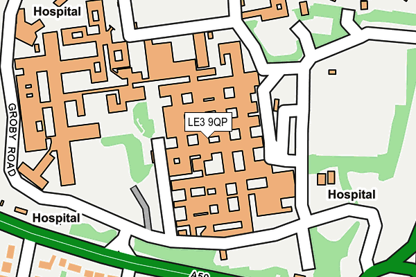
LE3 9QP is located in the Beaumont Leys electoral ward, within the unitary authority of Leicester and the English Parliamentary constituency of Leicester West. The Sub Integrated Care Board (ICB) Location is NHS Leicester, Leicestershire and Rutland ICB - 04C and the police force is Leicestershire. This postcode has been in use since February 1984.


GetTheData
Source: OS OpenMap – Local (Ordnance Survey)
Source: OS VectorMap District (Ordnance Survey)
Licence: Open Government Licence (requires attribution)
| Easting | 455566 |
| Northing | 306608 |
| Latitude | 52.654362 |
| Longitude | -1.180018 |
GetTheData
Source: Open Postcode Geo
Licence: Open Government Licence
| Country | England |
| Postcode District | LE3 |
➜ See where LE3 is on a map ➜ Where is Leicester? | |
GetTheData
Source: Land Registry Price Paid Data
Licence: Open Government Licence
Elevation or altitude of LE3 9QP as distance above sea level:
| Metres | Feet | |
|---|---|---|
| Elevation | 90m | 295ft |
Elevation is measured from the approximate centre of the postcode, to the nearest point on an OS contour line from OS Terrain 50, which has contour spacing of ten vertical metres.
➜ How high above sea level am I? Find the elevation of your current position using your device's GPS.
GetTheData
Source: Open Postcode Elevation
Licence: Open Government Licence
| Ward | Beaumont Leys |
| Constituency | Leicester West |
GetTheData
Source: ONS Postcode Database
Licence: Open Government Licence
| Glenfield Hospital (East Service Road) | Leicester | 107m |
| Glenfield Hospital (South Service Road) | Leicester | 158m |
| Glenfield Hospital (Groby Road) | Leicester | 190m |
| Glenfield Hospital (Groby Road) | Leicester | 243m |
| Glenfield Hospital (Leicester Road) | Leicester | 273m |
| Leicester Station | 4.5km |
GetTheData
Source: NaPTAN
Licence: Open Government Licence
GetTheData
Source: ONS Postcode Database
Licence: Open Government Licence


➜ Get more ratings from the Food Standards Agency
GetTheData
Source: Food Standards Agency
Licence: FSA terms & conditions
| Last Collection | |||
|---|---|---|---|
| Location | Mon-Fri | Sat | Distance |
| Aikman Avenue | 17:00 | 12:00 | 934m |
| Calver Hey Road | 17:30 | 12:00 | 943m |
| Boston Road | 18:30 | 1,227m | |
GetTheData
Source: Dracos
Licence: Creative Commons Attribution-ShareAlike
The below table lists the International Territorial Level (ITL) codes (formerly Nomenclature of Territorial Units for Statistics (NUTS) codes) and Local Administrative Units (LAU) codes for LE3 9QP:
| ITL 1 Code | Name |
|---|---|
| TLF | East Midlands (England) |
| ITL 2 Code | Name |
| TLF2 | Leicestershire, Rutland and Northamptonshire |
| ITL 3 Code | Name |
| TLF21 | Leicester |
| LAU 1 Code | Name |
| E06000016 | Leicester |
GetTheData
Source: ONS Postcode Directory
Licence: Open Government Licence
The below table lists the Census Output Area (OA), Lower Layer Super Output Area (LSOA), and Middle Layer Super Output Area (MSOA) for LE3 9QP:
| Code | Name | |
|---|---|---|
| OA | E00169544 | |
| LSOA | E01013617 | Leicester 004A |
| MSOA | E02002830 | Leicester 004 |
GetTheData
Source: ONS Postcode Directory
Licence: Open Government Licence
| LE3 9QD | Groby Road | 250m |
| LE3 9HY | Holmwood Court | 316m |
| LE3 9QR | Marion Close | 339m |
| LE3 9QS | Thorntree Close | 347m |
| LE3 9SR | Groby Road Gardens | 353m |
| LE3 9RZ | Strathern Road | 366m |
| LE3 9PT | Kemp Road | 368m |
| LE3 9LF | Holmwood Drive | 371m |
| LE3 9LG | Holmwood Drive | 375m |
| LE3 9QZ | Blakeshay Close | 413m |
GetTheData
Source: Open Postcode Geo; Land Registry Price Paid Data
Licence: Open Government Licence