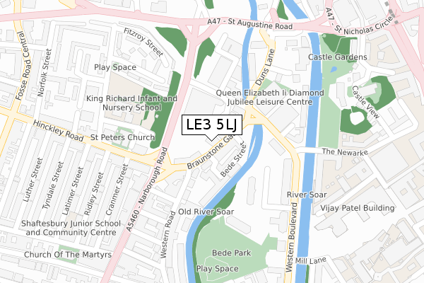
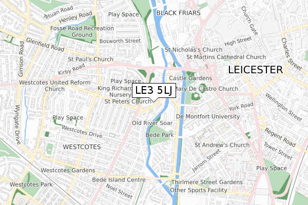
LE3 5LJ is located in the Westcotes electoral ward, within the unitary authority of Leicester and the English Parliamentary constituency of Leicester West. The Sub Integrated Care Board (ICB) Location is NHS Leicester, Leicestershire and Rutland ICB - 04C and the police force is Leicestershire. This postcode has been in use since August 2019.


GetTheData
Source: OS Open Zoomstack (Ordnance Survey)
Licence: Open Government Licence (requires attribution)
Attribution: Contains OS data © Crown copyright and database right 2024
Source: Open Postcode Geo
Licence: Open Government Licence (requires attribution)
Attribution: Contains OS data © Crown copyright and database right 2024; Contains Royal Mail data © Royal Mail copyright and database right 2024; Source: Office for National Statistics licensed under the Open Government Licence v.3.0
| Easting | 457918 |
| Northing | 304068 |
| Latitude | 52.631303 |
| Longitude | -1.145690 |
GetTheData
Source: Open Postcode Geo
Licence: Open Government Licence
| Country | England |
| Postcode District | LE3 |
| ➜ LE3 open data dashboard ➜ See where LE3 is on a map ➜ Where is Leicester? | |
GetTheData
Source: Land Registry Price Paid Data
Licence: Open Government Licence
| Ward | Westcotes |
| Constituency | Leicester West |
GetTheData
Source: ONS Postcode Database
Licence: Open Government Licence
| January 2024 | Violence and sexual offences | On or near Westbridge Close | 231m |
| January 2024 | Drugs | On or near Briton Street | 380m |
| January 2024 | Public order | On or near Briton Street | 380m |
| ➜ Get more crime data in our Crime section | |||
GetTheData
Source: data.police.uk
Licence: Open Government Licence
| Foxon Street (Braunstone Gate) | West Bridge | 15m |
| Ruding Road (Narborough Road) | West Bridge | 161m |
| New Park Street (Duns Lane) | West Bridge | 176m |
| New Park Street (Duns Lane) | West Bridge | 184m |
| Narborough Road (Hinckley Road) | West Bridge | 185m |
| Leicester Station | 1.4km |
GetTheData
Source: NaPTAN
Licence: Open Government Licence
GetTheData
Source: ONS Postcode Database
Licence: Open Government Licence


➜ Get more ratings from the Food Standards Agency
GetTheData
Source: Food Standards Agency
Licence: FSA terms & conditions
| Last Collection | |||
|---|---|---|---|
| Location | Mon-Fri | Sat | Distance |
| Mill Lane | 17:30 | 12:00 | 206m |
| Hinckley Road | 17:30 | 12:00 | 311m |
| The Newarke | 18:30 | 12:00 | 444m |
GetTheData
Source: Dracos
Licence: Creative Commons Attribution-ShareAlike
| Facility | Distance |
|---|---|
| The Queen Elizabeth Ii Diamond Jubilee Leisure Centre Duns Lane, Leicester Health and Fitness Gym, Sports Hall, Swimming Pool, Studio | 171m |
| John Sandford Sports Centre (Closed) Western Boulevard, Leicester Health and Fitness Gym, Sports Hall, Squash Courts | 178m |
| Spirit Health Club (Leicester) (Closed) St. Nicholas Circle, Leicester Health and Fitness Gym, Swimming Pool | 444m |
GetTheData
Source: Active Places
Licence: Open Government Licence
| School | Phase of Education | Distance |
|---|---|---|
| King Richard III Infant and Nursery School Andrewes Street, Leicester, LE3 5PA | Primary | 215m |
| Shaftesbury Junior School Latimer Street, Shaftesbury Junior School, Leicester, LE3 0QE | Primary | 401m |
| Brook Mead Academy 31 St. Augustine Road, Leicester, LE3 5QS | Secondary | 409m |
GetTheData
Source: Edubase
Licence: Open Government Licence
| Risk of LE3 5LJ flooding from rivers and sea | High |
| ➜ LE3 5LJ flood map | |
GetTheData
Source: Open Flood Risk by Postcode
Licence: Open Government Licence
The below table lists the International Territorial Level (ITL) codes (formerly Nomenclature of Territorial Units for Statistics (NUTS) codes) and Local Administrative Units (LAU) codes for LE3 5LJ:
| ITL 1 Code | Name |
|---|---|
| TLF | East Midlands (England) |
| ITL 2 Code | Name |
| TLF2 | Leicestershire, Rutland and Northamptonshire |
| ITL 3 Code | Name |
| TLF21 | Leicester |
| LAU 1 Code | Name |
| E06000016 | Leicester |
GetTheData
Source: ONS Postcode Directory
Licence: Open Government Licence
The below table lists the Census Output Area (OA), Lower Layer Super Output Area (LSOA), and Middle Layer Super Output Area (MSOA) for LE3 5LJ:
| Code | Name | |
|---|---|---|
| OA | E00169466 | |
| LSOA | E01013778 | Leicester 023C |
| MSOA | E02002849 | Leicester 023 |
GetTheData
Source: ONS Postcode Directory
Licence: Open Government Licence
| LE3 5LT | Foxon Street | 13m |
| LE3 5LG | Braunstone Gate | 38m |
| LE3 5LH | Braunstone Gate | 42m |
| LE3 5NQ | Thorpe Street | 56m |
| LE3 5LD | Bede Street | 66m |
| LE3 0GR | Western Road | 123m |
| LE3 0BN | Ruding Road | 184m |
| LE3 0GD | Western Road | 190m |
| LE3 0RA | Hinckley Road | 194m |
| LE3 0BP | Ruding Terrace | 196m |
GetTheData
Source: Open Postcode Geo; Land Registry Price Paid Data
Licence: Open Government Licence