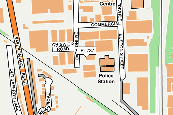
LE2 7SZ is located in the Saffron electoral ward, within the unitary authority of Leicester and the English Parliamentary constituency of Leicester South. The Sub Integrated Care Board (ICB) Location is NHS Leicester, Leicestershire and Rutland ICB - 04C and the police force is Leicestershire. This postcode has been in use since January 1980.


GetTheData
Source: OS OpenMap – Local (Ordnance Survey)
Source: OS VectorMap District (Ordnance Survey)
Licence: Open Government Licence (requires attribution)
| Easting | 458717 |
| Northing | 302354 |
| Latitude | 52.615811 |
| Longitude | -1.134190 |
GetTheData
Source: Open Postcode Geo
Licence: Open Government Licence
| Country | England |
| Postcode District | LE2 |
➜ See where LE2 is on a map ➜ Where is Leicester? | |
GetTheData
Source: Land Registry Price Paid Data
Licence: Open Government Licence
Elevation or altitude of LE2 7SZ as distance above sea level:
| Metres | Feet | |
|---|---|---|
| Elevation | 70m | 230ft |
Elevation is measured from the approximate centre of the postcode, to the nearest point on an OS contour line from OS Terrain 50, which has contour spacing of ten vertical metres.
➜ How high above sea level am I? Find the elevation of your current position using your device's GPS.
GetTheData
Source: Open Postcode Elevation
Licence: Open Government Licence
| Ward | Saffron |
| Constituency | Leicester South |
GetTheData
Source: ONS Postcode Database
Licence: Open Government Licence
| Aylestone Road (Saffron Lane) | Aylestone | 332m |
| Aylestone Road (Saffron Lane) | Aylestone | 341m |
| Lothair Road (Saffron Lane) | Aylestone | 390m |
| Saffron Lane (Aylestone Road) | Aylestone | 392m |
| Saffron Lane (Aylestone Road) | Aylestone | 414m |
| Leicester Station | 1.8km |
| South Wigston Station | 3.7km |
GetTheData
Source: NaPTAN
Licence: Open Government Licence
GetTheData
Source: ONS Postcode Database
Licence: Open Government Licence


➜ Get more ratings from the Food Standards Agency
GetTheData
Source: Food Standards Agency
Licence: FSA terms & conditions
| Last Collection | |||
|---|---|---|---|
| Location | Mon-Fri | Sat | Distance |
| Knighton Fields Road West | 17:30 | 12:00 | 462m |
| Westbury Road | 17:30 | 12:00 | 535m |
| Boundary Road | 17:30 | 12:00 | 558m |
GetTheData
Source: Dracos
Licence: Creative Commons Attribution-ShareAlike
The below table lists the International Territorial Level (ITL) codes (formerly Nomenclature of Territorial Units for Statistics (NUTS) codes) and Local Administrative Units (LAU) codes for LE2 7SZ:
| ITL 1 Code | Name |
|---|---|
| TLF | East Midlands (England) |
| ITL 2 Code | Name |
| TLF2 | Leicestershire, Rutland and Northamptonshire |
| ITL 3 Code | Name |
| TLF21 | Leicester |
| LAU 1 Code | Name |
| E06000016 | Leicester |
GetTheData
Source: ONS Postcode Directory
Licence: Open Government Licence
The below table lists the Census Output Area (OA), Lower Layer Super Output Area (LSOA), and Middle Layer Super Output Area (MSOA) for LE2 7SZ:
| Code | Name | |
|---|---|---|
| OA | E00069112 | |
| LSOA | E01013688 | Leicester 031D |
| MSOA | E02002857 | Leicester 031 |
GetTheData
Source: ONS Postcode Directory
Licence: Open Government Licence
| LE2 7ST | Euston Street | 164m |
| LE2 7ND | Saffron Lane | 213m |
| LE2 7NA | Saffron Lane | 281m |
| LE2 7NL | Shakespeare Street | 347m |
| LE2 7NN | Shakespeare Street | 370m |
| LE2 7NG | Sheridan Street | 399m |
| LE2 7NB | Saffron Lane | 406m |
| LE2 7NH | Sheridan Street | 426m |
| LE2 7PX | Hughenden Drive | 433m |
| LE2 7NE | Saffron Lane | 434m |
GetTheData
Source: Open Postcode Geo; Land Registry Price Paid Data
Licence: Open Government Licence