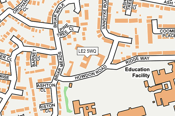
LE2 5WQ is located in the Oadby Brocks Hill electoral ward, within the local authority district of Oadby and Wigston and the English Parliamentary constituency of Harborough. The Sub Integrated Care Board (ICB) Location is NHS Leicester, Leicestershire and Rutland ICB - 03W and the police force is Leicestershire. This postcode has been in use since January 1980.


GetTheData
Source: OS OpenMap – Local (Ordnance Survey)
Source: OS VectorMap District (Ordnance Survey)
Licence: Open Government Licence (requires attribution)
| Easting | 462669 |
| Northing | 299467 |
| Latitude | 52.589402 |
| Longitude | -1.076382 |
GetTheData
Source: Open Postcode Geo
Licence: Open Government Licence
| Country | England |
| Postcode District | LE2 |
➜ See where LE2 is on a map ➜ Where is Oadby? | |
GetTheData
Source: Land Registry Price Paid Data
Licence: Open Government Licence
Elevation or altitude of LE2 5WQ as distance above sea level:
| Metres | Feet | |
|---|---|---|
| Elevation | 110m | 361ft |
Elevation is measured from the approximate centre of the postcode, to the nearest point on an OS contour line from OS Terrain 50, which has contour spacing of ten vertical metres.
➜ How high above sea level am I? Find the elevation of your current position using your device's GPS.
GetTheData
Source: Open Postcode Elevation
Licence: Open Government Licence
| Ward | Oadby Brocks Hill |
| Constituency | Harborough |
GetTheData
Source: ONS Postcode Database
Licence: Open Government Licence
| Brocks Hill School (Howdon Road) | Oadby | 69m |
| Pine Tree Close (Briar Walk) | Oadby | 137m |
| Vandyke Road (Ash Tree Road) | Oadby | 230m |
| Vandyke Road (Ash Tree Road) | Oadby | 242m |
| Turner Rise (Ash Tree Road) | Oadby | 317m |
| South Wigston Station | 4km |
| Leicester Station | 5.7km |
GetTheData
Source: NaPTAN
Licence: Open Government Licence
| Percentage of properties with Next Generation Access | 100.0% |
| Percentage of properties with Superfast Broadband | 100.0% |
| Percentage of properties with Ultrafast Broadband | 0.0% |
| Percentage of properties with Full Fibre Broadband | 0.0% |
Superfast Broadband is between 30Mbps and 300Mbps
Ultrafast Broadband is > 300Mbps
| Median download speed | 79.7Mbps |
| Average download speed | 72.0Mbps |
| Maximum download speed | 80.00Mbps |
| Median upload speed | 20.0Mbps |
| Average upload speed | 19.0Mbps |
| Maximum upload speed | 20.00Mbps |
| Percentage of properties unable to receive 2Mbps | 0.0% |
| Percentage of properties unable to receive 5Mbps | 0.0% |
| Percentage of properties unable to receive 10Mbps | 0.0% |
| Percentage of properties unable to receive 30Mbps | 0.0% |
GetTheData
Source: Ofcom
Licence: Ofcom Terms of Use (requires attribution)
GetTheData
Source: ONS Postcode Database
Licence: Open Government Licence


➜ Get more ratings from the Food Standards Agency
GetTheData
Source: Food Standards Agency
Licence: FSA terms & conditions
| Last Collection | |||
|---|---|---|---|
| Location | Mon-Fri | Sat | Distance |
| Stoughton Drive South | 17:30 | 12:00 | 61m |
| Ashtree Road | 17:30 | 11:30 | 368m |
| Elizabeth Drive | 17:30 | 12:00 | 705m |
GetTheData
Source: Dracos
Licence: Creative Commons Attribution-ShareAlike
The below table lists the International Territorial Level (ITL) codes (formerly Nomenclature of Territorial Units for Statistics (NUTS) codes) and Local Administrative Units (LAU) codes for LE2 5WQ:
| ITL 1 Code | Name |
|---|---|
| TLF | East Midlands (England) |
| ITL 2 Code | Name |
| TLF2 | Leicestershire, Rutland and Northamptonshire |
| ITL 3 Code | Name |
| TLF22 | Leicestershire CC and Rutland |
| LAU 1 Code | Name |
| E07000135 | Oadby and Wigston |
GetTheData
Source: ONS Postcode Directory
Licence: Open Government Licence
The below table lists the Census Output Area (OA), Lower Layer Super Output Area (LSOA), and Middle Layer Super Output Area (MSOA) for LE2 5WQ:
| Code | Name | |
|---|---|---|
| OA | E00131785 | |
| LSOA | E01025972 | Oadby and Wigston 003C |
| MSOA | E02005412 | Oadby and Wigston 003 |
GetTheData
Source: ONS Postcode Directory
Licence: Open Government Licence
| LE2 5US | Pine Tree Close | 99m |
| LE2 5UB | Vandyke Road | 129m |
| LE2 5UT | Pine Tree Gardens | 143m |
| LE2 5UW | Margaret Anne Road | 145m |
| LE2 5WH | Ashton Close | 181m |
| LE2 5WD | Briarmeads | 186m |
| LE2 5TA | Ashtree Close | 194m |
| LE2 5TN | Ridge Way | 202m |
| LE2 5UF | Briar Walk | 203m |
| LE2 5WA | Barnet Close | 207m |
GetTheData
Source: Open Postcode Geo; Land Registry Price Paid Data
Licence: Open Government Licence