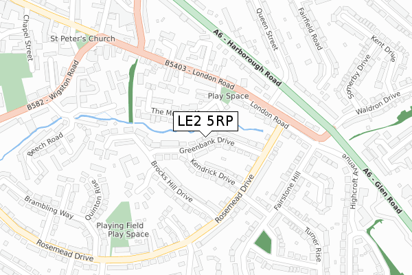
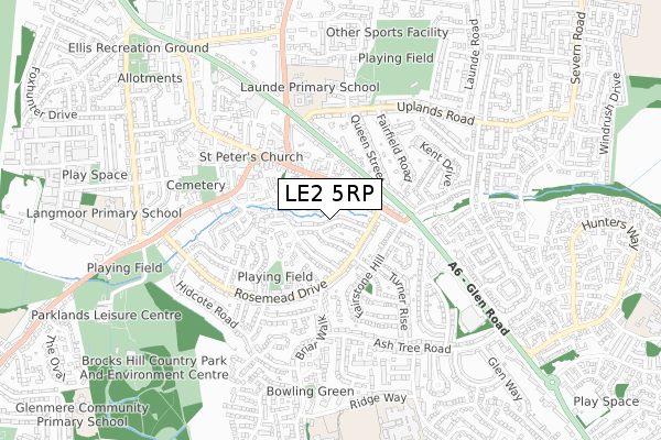
LE2 5RP lies on Greenbank Drive in Oadby, Leicester. LE2 5RP is located in the Oadby St Peter's electoral ward, within the local authority district of Oadby and Wigston and the English Parliamentary constituency of Harborough. The Sub Integrated Care Board (ICB) Location is NHS Leicester, Leicestershire and Rutland ICB - 03W and the police force is Leicestershire. This postcode has been in use since January 1980.


GetTheData
Source: OS Open Zoomstack (Ordnance Survey)
Licence: Open Government Licence (requires attribution)
Attribution: Contains OS data © Crown copyright and database right 2025
Source: Open Postcode Geo
Licence: Open Government Licence (requires attribution)
Attribution: Contains OS data © Crown copyright and database right 2025; Contains Royal Mail data © Royal Mail copyright and database right 2025; Source: Office for National Statistics licensed under the Open Government Licence v.3.0
| Easting | 462680 |
| Northing | 300139 |
| Latitude | 52.595441 |
| Longitude | -1.076092 |
GetTheData
Source: Open Postcode Geo
Licence: Open Government Licence
| Street | Greenbank Drive |
| Locality | Oadby |
| Town/City | Leicester |
| Country | England |
| Postcode District | LE2 |
➜ See where LE2 is on a map ➜ Where is Oadby? | |
GetTheData
Source: Land Registry Price Paid Data
Licence: Open Government Licence
Elevation or altitude of LE2 5RP as distance above sea level:
| Metres | Feet | |
|---|---|---|
| Elevation | 100m | 328ft |
Elevation is measured from the approximate centre of the postcode, to the nearest point on an OS contour line from OS Terrain 50, which has contour spacing of ten vertical metres.
➜ How high above sea level am I? Find the elevation of your current position using your device's GPS.
GetTheData
Source: Open Postcode Elevation
Licence: Open Government Licence
| Ward | Oadby St Peter's |
| Constituency | Harborough |
GetTheData
Source: ONS Postcode Database
Licence: Open Government Licence
2021 14 JUN £340,000 |
2010 19 FEB £213,000 |
GetTheData
Source: HM Land Registry Price Paid Data
Licence: Contains HM Land Registry data © Crown copyright and database right 2025. This data is licensed under the Open Government Licence v3.0.
| The Wheel Inn (London Road) | Oadby | 149m |
| Queen Street (London Road) | Oadby | 166m |
| Alexandra Court (London Road) | Oadby | 170m |
| London Road (Queen Street) | Oadby | 188m |
| Brocks Hill Drive (Rosemead Drive) | Oadby | 208m |
| South Wigston Station | 4.2km |
| Leicester Station | 5.2km |
GetTheData
Source: NaPTAN
Licence: Open Government Licence
| Percentage of properties with Next Generation Access | 100.0% |
| Percentage of properties with Superfast Broadband | 100.0% |
| Percentage of properties with Ultrafast Broadband | 100.0% |
| Percentage of properties with Full Fibre Broadband | 0.0% |
Superfast Broadband is between 30Mbps and 300Mbps
Ultrafast Broadband is > 300Mbps
| Median download speed | 68.8Mbps |
| Average download speed | 69.3Mbps |
| Maximum download speed | 200.00Mbps |
| Median upload speed | 19.5Mbps |
| Average upload speed | 14.3Mbps |
| Maximum upload speed | 20.00Mbps |
| Percentage of properties unable to receive 2Mbps | 0.0% |
| Percentage of properties unable to receive 5Mbps | 0.0% |
| Percentage of properties unable to receive 10Mbps | 0.0% |
| Percentage of properties unable to receive 30Mbps | 0.0% |
GetTheData
Source: Ofcom
Licence: Ofcom Terms of Use (requires attribution)
Estimated total energy consumption in LE2 5RP by fuel type, 2015.
| Consumption (kWh) | 411,994 |
|---|---|
| Meter count | 27 |
| Mean (kWh/meter) | 15,259 |
| Median (kWh/meter) | 15,071 |
| Consumption (kWh) | 106,809 |
|---|---|
| Meter count | 27 |
| Mean (kWh/meter) | 3,956 |
| Median (kWh/meter) | 3,144 |
GetTheData
Source: Postcode level gas estimates: 2015 (experimental)
Source: Postcode level electricity estimates: 2015 (experimental)
Licence: Open Government Licence
GetTheData
Source: ONS Postcode Database
Licence: Open Government Licence


➜ Get more ratings from the Food Standards Agency
GetTheData
Source: Food Standards Agency
Licence: FSA terms & conditions
| Last Collection | |||
|---|---|---|---|
| Location | Mon-Fri | Sat | Distance |
| London Road | 17:30 | 12:00 | 157m |
| Ashtree Road | 17:30 | 11:30 | 577m |
| Elizabeth Drive | 17:30 | 12:00 | 633m |
GetTheData
Source: Dracos
Licence: Creative Commons Attribution-ShareAlike
The below table lists the International Territorial Level (ITL) codes (formerly Nomenclature of Territorial Units for Statistics (NUTS) codes) and Local Administrative Units (LAU) codes for LE2 5RP:
| ITL 1 Code | Name |
|---|---|
| TLF | East Midlands (England) |
| ITL 2 Code | Name |
| TLF2 | Leicestershire, Rutland and Northamptonshire |
| ITL 3 Code | Name |
| TLF22 | Leicestershire CC and Rutland |
| LAU 1 Code | Name |
| E07000135 | Oadby and Wigston |
GetTheData
Source: ONS Postcode Directory
Licence: Open Government Licence
The below table lists the Census Output Area (OA), Lower Layer Super Output Area (LSOA), and Middle Layer Super Output Area (MSOA) for LE2 5RP:
| Code | Name | |
|---|---|---|
| OA | E00131811 | |
| LSOA | E01025978 | Oadby and Wigston 003F |
| MSOA | E02005412 | Oadby and Wigston 003 |
GetTheData
Source: ONS Postcode Directory
Licence: Open Government Licence
| LE2 5RQ | Greenbank Drive | 28m |
| LE2 5RR | Kendrick Drive | 96m |
| LE2 5ED | The Morwoods | 98m |
| LE2 5AQ | Ward's End | 98m |
| LE2 5AU | Onderby Mews | 126m |
| LE2 5RD | Brocks Hill Drive | 128m |
| LE2 5DJ | London Road | 128m |
| LE2 5SE | Rosemead Drive | 132m |
| LE2 5DP | London Road | 162m |
| LE2 5SB | Rosemead Drive | 169m |
GetTheData
Source: Open Postcode Geo; Land Registry Price Paid Data
Licence: Open Government Licence