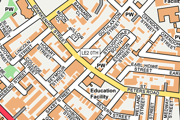
LE2 0TH is located in the Wycliffe electoral ward, within the unitary authority of Leicester and the English Parliamentary constituency of Leicester South. The Sub Integrated Care Board (ICB) Location is NHS Leicester, Leicestershire and Rutland ICB - 04C and the police force is Leicestershire. This postcode has been in use since January 1980.


GetTheData
Source: OS OpenMap – Local (Ordnance Survey)
Source: OS VectorMap District (Ordnance Survey)
Licence: Open Government Licence (requires attribution)
| Easting | 459767 |
| Northing | 304023 |
| Latitude | 52.630680 |
| Longitude | -1.118390 |
GetTheData
Source: Open Postcode Geo
Licence: Open Government Licence
| Country | England |
| Postcode District | LE2 |
➜ See where LE2 is on a map ➜ Where is Leicester? | |
GetTheData
Source: Land Registry Price Paid Data
Licence: Open Government Licence
Elevation or altitude of LE2 0TH as distance above sea level:
| Metres | Feet | |
|---|---|---|
| Elevation | 80m | 262ft |
Elevation is measured from the approximate centre of the postcode, to the nearest point on an OS contour line from OS Terrain 50, which has contour spacing of ten vertical metres.
➜ How high above sea level am I? Find the elevation of your current position using your device's GPS.
GetTheData
Source: Open Postcode Elevation
Licence: Open Government Licence
| Ward | Wycliffe |
| Constituency | Leicester South |
GetTheData
Source: ONS Postcode Database
Licence: Open Government Licence
| Highfield Street (Sparkenhoe Street) | Highfields | 117m |
| Lincoln Street (Sparkenhoe Street) | Highfields | 148m |
| Lincoln Street (Sparkenhoe Street) | Highfields | 155m |
| Highfield Street (St Peter's Road) | Highfields | 195m |
| Melbourne Road (St Peter's Road) | Highfields | 266m |
| Leicester Station | 0.5km |
GetTheData
Source: NaPTAN
Licence: Open Government Licence
GetTheData
Source: ONS Postcode Database
Licence: Open Government Licence


➜ Get more ratings from the Food Standards Agency
GetTheData
Source: Food Standards Agency
Licence: FSA terms & conditions
| Last Collection | |||
|---|---|---|---|
| Location | Mon-Fri | Sat | Distance |
| Sparkenhoe Street | 17:30 | 12:00 | 18m |
| London Road P.o. | 18:30 | 12:00 | 361m |
| De Montfort Street | 18:30 | 12:00 | 365m |
GetTheData
Source: Dracos
Licence: Creative Commons Attribution-ShareAlike
The below table lists the International Territorial Level (ITL) codes (formerly Nomenclature of Territorial Units for Statistics (NUTS) codes) and Local Administrative Units (LAU) codes for LE2 0TH:
| ITL 1 Code | Name |
|---|---|
| TLF | East Midlands (England) |
| ITL 2 Code | Name |
| TLF2 | Leicestershire, Rutland and Northamptonshire |
| ITL 3 Code | Name |
| TLF21 | Leicester |
| LAU 1 Code | Name |
| E06000016 | Leicester |
GetTheData
Source: ONS Postcode Directory
Licence: Open Government Licence
The below table lists the Census Output Area (OA), Lower Layer Super Output Area (LSOA), and Middle Layer Super Output Area (MSOA) for LE2 0TH:
| Code | Name | |
|---|---|---|
| OA | E00069364 | |
| LSOA | E01013748 | Leicester 018D |
| MSOA | E02002844 | Leicester 018 |
GetTheData
Source: ONS Postcode Directory
Licence: Open Government Licence
| LE2 0SD | Guthlaxton Avenue | 23m |
| LE2 0TA | Sparkenhoe Street | 63m |
| LE2 0TD | Sparkenhoe Street | 76m |
| LE2 0SF | Guthlaxton Street | 100m |
| LE2 0SH | Stoughton Street South | 102m |
| LE2 0LB | Seymour Street | 105m |
| LE2 0NE | Saxby Street | 111m |
| LE2 0SA | Evington Street | 129m |
| LE2 0DL | Gopsall Street | 139m |
| LE2 0NN | Severn Street | 144m |
GetTheData
Source: Open Postcode Geo; Land Registry Price Paid Data
Licence: Open Government Licence