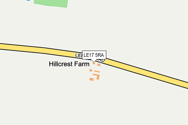
LE17 5RA is located in the Broughton Astley South & Leire electoral ward, within the local authority district of Harborough and the English Parliamentary constituency of South Leicestershire. The Sub Integrated Care Board (ICB) Location is NHS Leicester, Leicestershire and Rutland ICB - 03W and the police force is Leicestershire. This postcode has been in use since January 1980.


GetTheData
Source: OS OpenMap – Local (Ordnance Survey)
Source: OS VectorMap District (Ordnance Survey)
Licence: Open Government Licence (requires attribution)
| Easting | 451472 |
| Northing | 290191 |
| Latitude | 52.507210 |
| Longitude | -1.243067 |
GetTheData
Source: Open Postcode Geo
Licence: Open Government Licence
| Country | England |
| Postcode District | LE17 |
➜ See where LE17 is on a map | |
GetTheData
Source: Land Registry Price Paid Data
Licence: Open Government Licence
Elevation or altitude of LE17 5RA as distance above sea level:
| Metres | Feet | |
|---|---|---|
| Elevation | 110m | 361ft |
Elevation is measured from the approximate centre of the postcode, to the nearest point on an OS contour line from OS Terrain 50, which has contour spacing of ten vertical metres.
➜ How high above sea level am I? Find the elevation of your current position using your device's GPS.
GetTheData
Source: Open Postcode Elevation
Licence: Open Government Licence
| Ward | Broughton Astley South & Leire |
| Constituency | South Leicestershire |
GetTheData
Source: ONS Postcode Database
Licence: Open Government Licence
| Frolesworth Road (Leire Road) | Frolesworth | 728m |
| Frolesworth Road (Leire Road) | Frolesworth | 741m |
| The Green (Frolesworth Road) | Leire | 974m |
| The Green (Frolesworth Road) | Leire | 1,015m |
| Poplar Farm (Leire Lane) | Leire | 1,311m |
GetTheData
Source: NaPTAN
Licence: Open Government Licence
| Percentage of properties with Next Generation Access | 0.0% |
| Percentage of properties with Superfast Broadband | 0.0% |
| Percentage of properties with Ultrafast Broadband | 0.0% |
| Percentage of properties with Full Fibre Broadband | 0.0% |
Superfast Broadband is between 30Mbps and 300Mbps
Ultrafast Broadband is > 300Mbps
| Percentage of properties unable to receive 2Mbps | 0.0% |
| Percentage of properties unable to receive 5Mbps | 0.0% |
| Percentage of properties unable to receive 10Mbps | 0.0% |
| Percentage of properties unable to receive 30Mbps | 100.0% |
GetTheData
Source: Ofcom
Licence: Ofcom Terms of Use (requires attribution)
GetTheData
Source: ONS Postcode Database
Licence: Open Government Licence


➜ Get more ratings from the Food Standards Agency
GetTheData
Source: Food Standards Agency
Licence: FSA terms & conditions
| Last Collection | |||
|---|---|---|---|
| Location | Mon-Fri | Sat | Distance |
| Leire Rso | 16:40 | 10:30 | 1,045m |
| Ashby Parva | 17:00 | 10:30 | 2,228m |
| Station Road | 16:45 | 10:00 | 2,727m |
GetTheData
Source: Dracos
Licence: Creative Commons Attribution-ShareAlike
The below table lists the International Territorial Level (ITL) codes (formerly Nomenclature of Territorial Units for Statistics (NUTS) codes) and Local Administrative Units (LAU) codes for LE17 5RA:
| ITL 1 Code | Name |
|---|---|
| TLF | East Midlands (England) |
| ITL 2 Code | Name |
| TLF2 | Leicestershire, Rutland and Northamptonshire |
| ITL 3 Code | Name |
| TLF22 | Leicestershire CC and Rutland |
| LAU 1 Code | Name |
| E07000131 | Harborough |
GetTheData
Source: ONS Postcode Directory
Licence: Open Government Licence
The below table lists the Census Output Area (OA), Lower Layer Super Output Area (LSOA), and Middle Layer Super Output Area (MSOA) for LE17 5RA:
| Code | Name | |
|---|---|---|
| OA | E00130790 | |
| LSOA | E01025777 | Harborough 006A |
| MSOA | E02005372 | Harborough 006 |
GetTheData
Source: ONS Postcode Directory
Licence: Open Government Licence
| LE17 5EB | Ashby Road | 568m |
| LE17 5HP | Frolesworth Road | 716m |
| LE17 5EA | Leire Road | 736m |
| LE17 5EN | Ullesthorpe Road | 797m |
| LE17 5EG | Main Street | 819m |
| LE17 5EQ | The Square | 836m |
| LE17 5HW | St Margarets Drive | 901m |
| LE17 5HN | Oak Avenue | 913m |
| LE17 5EZ | Back Lane | 972m |
| LE17 5ES | Wales Orchard | 991m |
GetTheData
Source: Open Postcode Geo; Land Registry Price Paid Data
Licence: Open Government Licence