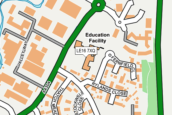
LE16 7XQ is located in the Market Harborough-Little Bowden electoral ward, within the local authority district of Harborough and the English Parliamentary constituency of Harborough. The Sub Integrated Care Board (ICB) Location is NHS Leicester, Leicestershire and Rutland ICB - 03W and the police force is Leicestershire. This postcode has been in use since December 2000.


GetTheData
Source: OS OpenMap – Local (Ordnance Survey)
Source: OS VectorMap District (Ordnance Survey)
Licence: Open Government Licence (requires attribution)
| Easting | 474819 |
| Northing | 287604 |
| Latitude | 52.481241 |
| Longitude | -0.899738 |
GetTheData
Source: Open Postcode Geo
Licence: Open Government Licence
| Country | England |
| Postcode District | LE16 |
➜ See where LE16 is on a map ➜ Where is Market Harborough? | |
GetTheData
Source: Land Registry Price Paid Data
Licence: Open Government Licence
Elevation or altitude of LE16 7XQ as distance above sea level:
| Metres | Feet | |
|---|---|---|
| Elevation | 80m | 262ft |
Elevation is measured from the approximate centre of the postcode, to the nearest point on an OS contour line from OS Terrain 50, which has contour spacing of ten vertical metres.
➜ How high above sea level am I? Find the elevation of your current position using your device's GPS.
GetTheData
Source: Open Postcode Elevation
Licence: Open Government Licence
| Ward | Market Harborough-little Bowden |
| Constituency | Harborough |
GetTheData
Source: ONS Postcode Database
Licence: Open Government Licence
| Valley Way (Rockingham Road) | Little Bowden | 103m |
| Valley Way (Rockingham Road) | Little Bowden | 118m |
| Ashley Way (Rockingham Road) | Little Bowden | 140m |
| Stinford Leys (Ashley Way) | Little Bowden | 529m |
| Hartland Drive (Gores Lane) | Little Bowden | 583m |
| Market Harborough Station | 0.7km |
GetTheData
Source: NaPTAN
Licence: Open Government Licence
GetTheData
Source: ONS Postcode Database
Licence: Open Government Licence


➜ Get more ratings from the Food Standards Agency
GetTheData
Source: Food Standards Agency
Licence: FSA terms & conditions
| Last Collection | |||
|---|---|---|---|
| Location | Mon-Fri | Sat | Distance |
| Riverside | 476m | ||
| Riverside Industrial Estate | 18:30 | 11:30 | 566m |
| Gores Lane | 17:30 | 10:45 | 597m |
GetTheData
Source: Dracos
Licence: Creative Commons Attribution-ShareAlike
The below table lists the International Territorial Level (ITL) codes (formerly Nomenclature of Territorial Units for Statistics (NUTS) codes) and Local Administrative Units (LAU) codes for LE16 7XQ:
| ITL 1 Code | Name |
|---|---|
| TLF | East Midlands (England) |
| ITL 2 Code | Name |
| TLF2 | Leicestershire, Rutland and Northamptonshire |
| ITL 3 Code | Name |
| TLF22 | Leicestershire CC and Rutland |
| LAU 1 Code | Name |
| E07000131 | Harborough |
GetTheData
Source: ONS Postcode Directory
Licence: Open Government Licence
The below table lists the Census Output Area (OA), Lower Layer Super Output Area (LSOA), and Middle Layer Super Output Area (MSOA) for LE16 7XQ:
| Code | Name | |
|---|---|---|
| OA | E00170652 | |
| LSOA | E01025799 | Harborough 009B |
| MSOA | E02005375 | Harborough 009 |
GetTheData
Source: ONS Postcode Directory
Licence: Open Government Licence
| LE16 7FP | Trojan Place | 134m |
| LE16 7XE | Ryelands Close | 146m |
| LE16 7XW | Fernfield Close | 150m |
| LE16 7XF | Stockwell Close | 172m |
| LE16 7XH | Thatch Meadow Drive | 221m |
| LE16 7XG | Woodbreach Drive | 296m |
| LE16 7XS | Simborough Way | 329m |
| LE16 7XL | The Furlongs | 360m |
| LE16 7XJ | Long Brimley Close | 371m |
| LE16 7PT | Riverside | 372m |
GetTheData
Source: Open Postcode Geo; Land Registry Price Paid Data
Licence: Open Government Licence