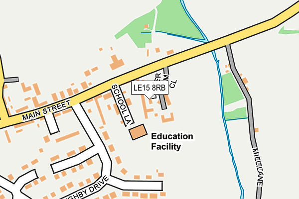
LE15 8RB lies on Lower Farm Close in Empingham, Oakham. LE15 8RB is located in the Normanton electoral ward, within the unitary authority of Rutland and the English Parliamentary constituency of Rutland and Melton. The Sub Integrated Care Board (ICB) Location is NHS Leicester, Leicestershire and Rutland ICB - 03W and the police force is Leicestershire. This postcode has been in use since June 1998.


GetTheData
Source: OS OpenMap – Local (Ordnance Survey)
Source: OS VectorMap District (Ordnance Survey)
Licence: Open Government Licence (requires attribution)
| Easting | 495576 |
| Northing | 308805 |
| Latitude | 52.668540 |
| Longitude | -0.588079 |
GetTheData
Source: Open Postcode Geo
Licence: Open Government Licence
| Street | Lower Farm Close |
| Locality | Empingham |
| Town/City | Oakham |
| Country | England |
| Postcode District | LE15 |
➜ See where LE15 is on a map ➜ Where is Empingham? | |
GetTheData
Source: Land Registry Price Paid Data
Licence: Open Government Licence
Elevation or altitude of LE15 8RB as distance above sea level:
| Metres | Feet | |
|---|---|---|
| Elevation | 60m | 197ft |
Elevation is measured from the approximate centre of the postcode, to the nearest point on an OS contour line from OS Terrain 50, which has contour spacing of ten vertical metres.
➜ How high above sea level am I? Find the elevation of your current position using your device's GPS.
GetTheData
Source: Open Postcode Elevation
Licence: Open Government Licence
| Ward | Normanton |
| Constituency | Rutland And Melton |
GetTheData
Source: ONS Postcode Database
Licence: Open Government Licence
2024 4 NOV £1,425,000 |
2022 14 OCT £1,460,000 |
MILL VIEW, LOWER FARM CLOSE, EMPINGHAM, OAKHAM, LE15 8RB 2020 18 DEC £900,000 |
2010 27 AUG £1,062,500 |
1999 15 MAR £350,000 |
WILLOW BARN, LOWER FARM CLOSE, EMPINGHAM, OAKHAM, LE15 8RB 1999 12 FEB £220,000 |
GetTheData
Source: HM Land Registry Price Paid Data
Licence: Contains HM Land Registry data © Crown copyright and database right 2025. This data is licensed under the Open Government Licence v3.0.
| School Lane (Main Street) | Empingham | 96m |
| School Lane (Main Street) | Empingham | 97m |
| Wiloughby Drive (Main Street) | Empingham | 321m |
| Wiloughby Drive (Main Street) | Empingham | 401m |
| Exton Road (Main Street) | Empingham | 688m |
GetTheData
Source: NaPTAN
Licence: Open Government Licence
| Percentage of properties with Next Generation Access | 100.0% |
| Percentage of properties with Superfast Broadband | 100.0% |
| Percentage of properties with Ultrafast Broadband | 0.0% |
| Percentage of properties with Full Fibre Broadband | 0.0% |
Superfast Broadband is between 30Mbps and 300Mbps
Ultrafast Broadband is > 300Mbps
| Median download speed | 49.3Mbps |
| Average download speed | 48.3Mbps |
| Maximum download speed | 68.87Mbps |
| Median upload speed | 10.5Mbps |
| Average upload speed | 10.2Mbps |
| Maximum upload speed | 16.87Mbps |
| Percentage of properties unable to receive 2Mbps | 0.0% |
| Percentage of properties unable to receive 5Mbps | 0.0% |
| Percentage of properties unable to receive 10Mbps | 0.0% |
| Percentage of properties unable to receive 30Mbps | 0.0% |
GetTheData
Source: Ofcom
Licence: Ofcom Terms of Use (requires attribution)
GetTheData
Source: ONS Postcode Database
Licence: Open Government Licence


➜ Get more ratings from the Food Standards Agency
GetTheData
Source: Food Standards Agency
Licence: FSA terms & conditions
| Last Collection | |||
|---|---|---|---|
| Location | Mon-Fri | Sat | Distance |
| Cross Roads | 16:15 | 11:00 | 1,484m |
| Tickencote | 16:30 | 11:00 | 3,479m |
| High Street | 16:00 | 08:15 | 3,950m |
GetTheData
Source: Dracos
Licence: Creative Commons Attribution-ShareAlike
The below table lists the International Territorial Level (ITL) codes (formerly Nomenclature of Territorial Units for Statistics (NUTS) codes) and Local Administrative Units (LAU) codes for LE15 8RB:
| ITL 1 Code | Name |
|---|---|
| TLF | East Midlands (England) |
| ITL 2 Code | Name |
| TLF2 | Leicestershire, Rutland and Northamptonshire |
| ITL 3 Code | Name |
| TLF22 | Leicestershire CC and Rutland |
| LAU 1 Code | Name |
| E06000017 | Rutland |
GetTheData
Source: ONS Postcode Directory
Licence: Open Government Licence
The below table lists the Census Output Area (OA), Lower Layer Super Output Area (LSOA), and Middle Layer Super Output Area (MSOA) for LE15 8RB:
| Code | Name | |
|---|---|---|
| OA | E00069593 | |
| LSOA | E01013796 | Rutland 001D |
| MSOA | E02002863 | Rutland 001 |
GetTheData
Source: ONS Postcode Directory
Licence: Open Government Licence
| LE15 8PQ | School Lane | 42m |
| LE15 8PZ | Willoughby Drive | 244m |
| LE15 8QF | Glebe Close | 248m |
| LE15 8PS | Main Street | 258m |
| LE15 8PY | Willoughby Drive | 269m |
| LE15 8PP | Loves Lane | 325m |
| LE15 8QJ | Walnut Close | 359m |
| LE15 8PJ | Bayleys Close | 392m |
| LE15 8PR | Main Street | 397m |
| LE15 8PL | Beckworth Grove | 445m |
GetTheData
Source: Open Postcode Geo; Land Registry Price Paid Data
Licence: Open Government Licence