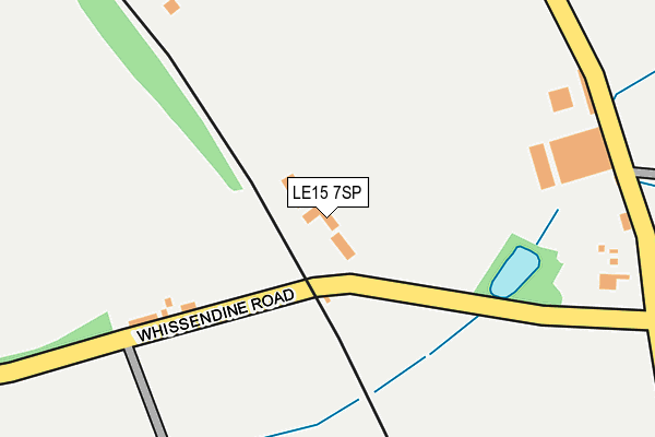
LE15 7SP is located in the Exton electoral ward, within the unitary authority of Rutland and the English Parliamentary constituency of Rutland and Melton. The Sub Integrated Care Board (ICB) Location is NHS Leicester, Leicestershire and Rutland ICB - 03W and the police force is Leicestershire. This postcode has been in use since January 2009.


GetTheData
Source: OS OpenMap – Local (Ordnance Survey)
Source: OS VectorMap District (Ordnance Survey)
Licence: Open Government Licence (requires attribution)
| Easting | 486139 |
| Northing | 313869 |
| Latitude | 52.715632 |
| Longitude | -0.726268 |
GetTheData
Source: Open Postcode Geo
Licence: Open Government Licence
| Country | England |
| Postcode District | LE15 |
➜ See where LE15 is on a map | |
GetTheData
Source: Land Registry Price Paid Data
Licence: Open Government Licence
Elevation or altitude of LE15 7SP as distance above sea level:
| Metres | Feet | |
|---|---|---|
| Elevation | 110m | 361ft |
Elevation is measured from the approximate centre of the postcode, to the nearest point on an OS contour line from OS Terrain 50, which has contour spacing of ten vertical metres.
➜ How high above sea level am I? Find the elevation of your current position using your device's GPS.
GetTheData
Source: Open Postcode Elevation
Licence: Open Government Licence
| Ward | Exton |
| Constituency | Rutland And Melton |
GetTheData
Source: ONS Postcode Database
Licence: Open Government Licence
| Ashwell Garage (Oakham Road) | Ashwell | 560m |
| Ashwell Garage (Oakham Road) | Ashwell | 562m |
| Oakham Station | 4.9km |
GetTheData
Source: NaPTAN
Licence: Open Government Licence
GetTheData
Source: ONS Postcode Database
Licence: Open Government Licence


➜ Get more ratings from the Food Standards Agency
GetTheData
Source: Food Standards Agency
Licence: FSA terms & conditions
| Last Collection | |||
|---|---|---|---|
| Location | Mon-Fri | Sat | Distance |
| Cottesmore Road | 17:00 | 11:00 | 530m |
| Melton Road/Well Street | 16:50 | 10:20 | 3,480m |
| West End | 16:30 | 10:00 | 3,635m |
GetTheData
Source: Dracos
Licence: Creative Commons Attribution-ShareAlike
The below table lists the International Territorial Level (ITL) codes (formerly Nomenclature of Territorial Units for Statistics (NUTS) codes) and Local Administrative Units (LAU) codes for LE15 7SP:
| ITL 1 Code | Name |
|---|---|
| TLF | East Midlands (England) |
| ITL 2 Code | Name |
| TLF2 | Leicestershire, Rutland and Northamptonshire |
| ITL 3 Code | Name |
| TLF22 | Leicestershire CC and Rutland |
| LAU 1 Code | Name |
| E06000017 | Rutland |
GetTheData
Source: ONS Postcode Directory
Licence: Open Government Licence
The below table lists the Census Output Area (OA), Lower Layer Super Output Area (LSOA), and Middle Layer Super Output Area (MSOA) for LE15 7SP:
| Code | Name | |
|---|---|---|
| OA | E00069560 | |
| LSOA | E01013789 | Rutland 001B |
| MSOA | E02002863 | Rutland 001 |
GetTheData
Source: ONS Postcode Directory
Licence: Open Government Licence
| LE15 7LN | Langham Road | 422m |
| LE15 7LP | Church Close | 490m |
| LE15 7PZ | Swallows Dene | 526m |
| LE15 7LW | Oakham Road | 557m |
| LE15 7LQ | Brookdene | 614m |
| LE15 7LL | Croft Lane | 640m |
| LE15 7LX | Woodside | 671m |
| LE15 7LS | Water Lane | 689m |
| LE15 7LJ | Cottesmore Road | 846m |
| LE15 7LT | Whissendine Road | 1063m |
GetTheData
Source: Open Postcode Geo; Land Registry Price Paid Data
Licence: Open Government Licence