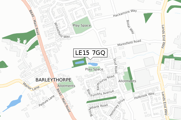
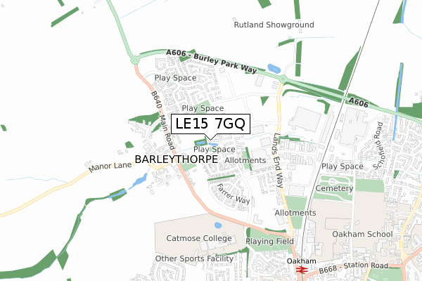
LE15 7GQ is located in the Barleythorpe electoral ward, within the unitary authority of Rutland and the English Parliamentary constituency of Rutland and Melton. The Sub Integrated Care Board (ICB) Location is NHS Leicester, Leicestershire and Rutland ICB - 03W and the police force is Leicestershire. This postcode has been in use since July 2010.


GetTheData
Source: OS Open Zoomstack (Ordnance Survey)
Licence: Open Government Licence (requires attribution)
Attribution: Contains OS data © Crown copyright and database right 2025
Source: Open Postcode Geo
Licence: Open Government Licence (requires attribution)
Attribution: Contains OS data © Crown copyright and database right 2025; Contains Royal Mail data © Royal Mail copyright and database right 2025; Source: Office for National Statistics licensed under the Open Government Licence v.3.0
| Easting | 485139 |
| Northing | 309810 |
| Latitude | 52.679310 |
| Longitude | -0.742116 |
GetTheData
Source: Open Postcode Geo
Licence: Open Government Licence
| Country | England |
| Postcode District | LE15 |
➜ See where LE15 is on a map ➜ Where is Oakham? | |
GetTheData
Source: Land Registry Price Paid Data
Licence: Open Government Licence
Elevation or altitude of LE15 7GQ as distance above sea level:
| Metres | Feet | |
|---|---|---|
| Elevation | 120m | 394ft |
Elevation is measured from the approximate centre of the postcode, to the nearest point on an OS contour line from OS Terrain 50, which has contour spacing of ten vertical metres.
➜ How high above sea level am I? Find the elevation of your current position using your device's GPS.
GetTheData
Source: Open Postcode Elevation
Licence: Open Government Licence
| Ward | Barleythorpe |
| Constituency | Rutland And Melton |
GetTheData
Source: ONS Postcode Database
Licence: Open Government Licence
| Pasture Lane (A606 Main Road) | Barleythorpe | 225m |
| Pasture Lane (Main Road) | Barleythorpe | 255m |
| Lands End Way (Bosal Road) | Oakham | 284m |
| Rutland College (Main Road) | Barleythorpe | 296m |
| Lands End Way (Bosal Road) | Oakham | 303m |
| Oakham Station | 1km |
GetTheData
Source: NaPTAN
Licence: Open Government Licence
| Percentage of properties with Next Generation Access | 100.0% |
| Percentage of properties with Superfast Broadband | 100.0% |
| Percentage of properties with Ultrafast Broadband | 0.0% |
| Percentage of properties with Full Fibre Broadband | 0.0% |
Superfast Broadband is between 30Mbps and 300Mbps
Ultrafast Broadband is > 300Mbps
| Median download speed | 38.3Mbps |
| Average download speed | 34.8Mbps |
| Maximum download speed | 80.00Mbps |
| Median upload speed | 10.0Mbps |
| Average upload speed | 8.9Mbps |
| Maximum upload speed | 20.00Mbps |
| Percentage of properties unable to receive 2Mbps | 0.0% |
| Percentage of properties unable to receive 5Mbps | 0.0% |
| Percentage of properties unable to receive 10Mbps | 0.0% |
| Percentage of properties unable to receive 30Mbps | 0.0% |
GetTheData
Source: Ofcom
Licence: Ofcom Terms of Use (requires attribution)
Estimated total energy consumption in LE15 7GQ by fuel type, 2015.
| Consumption (kWh) | 59,111 |
|---|---|
| Meter count | 7 |
| Mean (kWh/meter) | 8,444 |
| Median (kWh/meter) | 6,783 |
| Consumption (kWh) | 32,998 |
|---|---|
| Meter count | 9 |
| Mean (kWh/meter) | 3,666 |
| Median (kWh/meter) | 4,037 |
GetTheData
Source: Postcode level gas estimates: 2015 (experimental)
Source: Postcode level electricity estimates: 2015 (experimental)
Licence: Open Government Licence
GetTheData
Source: ONS Postcode Database
Licence: Open Government Licence


➜ Get more ratings from the Food Standards Agency
GetTheData
Source: Food Standards Agency
Licence: FSA terms & conditions
| Last Collection | |||
|---|---|---|---|
| Location | Mon-Fri | Sat | Distance |
| Barleythorpe | 17:00 | 07:00 | 257m |
| Pillings Road | 17:30 | 08:00 | 494m |
| Cold Overton Road | 17:30 | 11:00 | 943m |
GetTheData
Source: Dracos
Licence: Creative Commons Attribution-ShareAlike
The below table lists the International Territorial Level (ITL) codes (formerly Nomenclature of Territorial Units for Statistics (NUTS) codes) and Local Administrative Units (LAU) codes for LE15 7GQ:
| ITL 1 Code | Name |
|---|---|
| TLF | East Midlands (England) |
| ITL 2 Code | Name |
| TLF2 | Leicestershire, Rutland and Northamptonshire |
| ITL 3 Code | Name |
| TLF22 | Leicestershire CC and Rutland |
| LAU 1 Code | Name |
| E06000017 | Rutland |
GetTheData
Source: ONS Postcode Directory
Licence: Open Government Licence
The below table lists the Census Output Area (OA), Lower Layer Super Output Area (LSOA), and Middle Layer Super Output Area (MSOA) for LE15 7GQ:
| Code | Name | |
|---|---|---|
| OA | E00069608 | |
| LSOA | E01013801 | Rutland 002C |
| MSOA | E02002864 | Rutland 002 |
GetTheData
Source: ONS Postcode Directory
Licence: Open Government Licence
| LE15 7GU | Paddock Avenue | 85m |
| LE15 7GP | Pelham Court | 87m |
| LE15 7FX | Pelham Court | 91m |
| LE15 7GB | Coltsfoot Close | 105m |
| LE15 7TF | Racecourse Road | 123m |
| LE15 7SW | Halter Close | 136m |
| LE15 7TG | Bridle Close | 154m |
| LE15 7GL | Horseshoe Close | 168m |
| LE15 7TH | Martingale Mews | 175m |
| LE15 7GJ | Grooms Close | 190m |
GetTheData
Source: Open Postcode Geo; Land Registry Price Paid Data
Licence: Open Government Licence