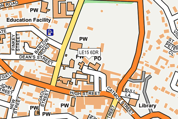
LE15 6DR lies on Church Passage in Oakham. LE15 6DR is located in the Oakham North East electoral ward, within the unitary authority of Rutland and the English Parliamentary constituency of Rutland and Melton. The Sub Integrated Care Board (ICB) Location is NHS Leicester, Leicestershire and Rutland ICB - 03W and the police force is Leicestershire. This postcode has been in use since October 1985.


GetTheData
Source: OS OpenMap – Local (Ordnance Survey)
Source: OS VectorMap District (Ordnance Survey)
Licence: Open Government Licence (requires attribution)
| Easting | 486109 |
| Northing | 308861 |
| Latitude | 52.670628 |
| Longitude | -0.728020 |
GetTheData
Source: Open Postcode Geo
Licence: Open Government Licence
| Street | Church Passage |
| Town/City | Oakham |
| Country | England |
| Postcode District | LE15 |
➜ See where LE15 is on a map ➜ Where is Oakham? | |
GetTheData
Source: Land Registry Price Paid Data
Licence: Open Government Licence
Elevation or altitude of LE15 6DR as distance above sea level:
| Metres | Feet | |
|---|---|---|
| Elevation | 110m | 361ft |
Elevation is measured from the approximate centre of the postcode, to the nearest point on an OS contour line from OS Terrain 50, which has contour spacing of ten vertical metres.
➜ How high above sea level am I? Find the elevation of your current position using your device's GPS.
GetTheData
Source: Open Postcode Elevation
Licence: Open Government Licence
| Ward | Oakham North East |
| Constituency | Rutland And Melton |
GetTheData
Source: ONS Postcode Database
Licence: Open Government Licence
| Market Place (High Street) | Oakham | 113m |
| Market Place (High Street) | Oakham | 128m |
| Bus Station (John Street) | Oakham | 286m |
| Council Offices (Uppingham Road) | Oakham | 323m |
| Council Offices (Uppingham Road) | Oakham | 335m |
| Oakham Station | 0.5km |
GetTheData
Source: NaPTAN
Licence: Open Government Licence
GetTheData
Source: ONS Postcode Database
Licence: Open Government Licence


➜ Get more ratings from the Food Standards Agency
GetTheData
Source: Food Standards Agency
Licence: FSA terms & conditions
| Last Collection | |||
|---|---|---|---|
| Location | Mon-Fri | Sat | Distance |
| High Street | 16:45 | 07:00 | 42m |
| High Street | 17:30 | 11:00 | 231m |
| Station Road | 17:30 | 11:00 | 257m |
GetTheData
Source: Dracos
Licence: Creative Commons Attribution-ShareAlike
The below table lists the International Territorial Level (ITL) codes (formerly Nomenclature of Territorial Units for Statistics (NUTS) codes) and Local Administrative Units (LAU) codes for LE15 6DR:
| ITL 1 Code | Name |
|---|---|
| TLF | East Midlands (England) |
| ITL 2 Code | Name |
| TLF2 | Leicestershire, Rutland and Northamptonshire |
| ITL 3 Code | Name |
| TLF22 | Leicestershire CC and Rutland |
| LAU 1 Code | Name |
| E06000017 | Rutland |
GetTheData
Source: ONS Postcode Directory
Licence: Open Government Licence
The below table lists the Census Output Area (OA), Lower Layer Super Output Area (LSOA), and Middle Layer Super Output Area (MSOA) for LE15 6DR:
| Code | Name | |
|---|---|---|
| OA | E00069606 | |
| LSOA | E01013799 | Rutland 003B |
| MSOA | E02002865 | Rutland 003 |
GetTheData
Source: ONS Postcode Directory
Licence: Open Government Licence
| LE15 6DT | Market Place | 59m |
| LE15 6AH | High Street | 107m |
| LE15 6AA | Church Street | 109m |
| LE15 6AL | High Street | 132m |
| LE15 6HR | Alwyne Close | 166m |
| LE15 6DH | Burley Road | 167m |
| LE15 6AJ | High Street | 168m |
| LE15 6EA | Mill Street | 199m |
| LE15 6AE | Crown Street | 205m |
| LE15 6AF | Deans Street | 212m |
GetTheData
Source: Open Postcode Geo; Land Registry Price Paid Data
Licence: Open Government Licence