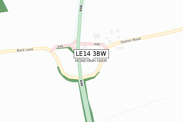
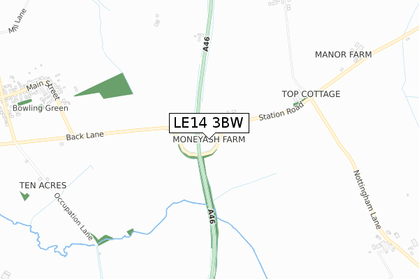
LE14 3BW is located in the Nevile & Langar electoral ward, within the local authority district of Rushcliffe and the English Parliamentary constituency of Rushcliffe. The Sub Integrated Care Board (ICB) Location is NHS Nottingham and Nottinghamshire ICB - 52R and the police force is Nottinghamshire. This postcode has been in use since January 1980.


GetTheData
Source: OS Open Zoomstack (Ordnance Survey)
Licence: Open Government Licence (requires attribution)
Attribution: Contains OS data © Crown copyright and database right 2025
Source: Open Postcode Geo
Licence: Open Government Licence (requires attribution)
Attribution: Contains OS data © Crown copyright and database right 2025; Contains Royal Mail data © Royal Mail copyright and database right 2025; Source: Office for National Statistics licensed under the Open Government Licence v.3.0
| Easting | 465015 |
| Northing | 325104 |
| Latitude | 52.819561 |
| Longitude | -1.036698 |
GetTheData
Source: Open Postcode Geo
Licence: Open Government Licence
| Country | England |
| Postcode District | LE14 |
➜ See where LE14 is on a map | |
GetTheData
Source: Land Registry Price Paid Data
Licence: Open Government Licence
Elevation or altitude of LE14 3BW as distance above sea level:
| Metres | Feet | |
|---|---|---|
| Elevation | 110m | 361ft |
Elevation is measured from the approximate centre of the postcode, to the nearest point on an OS contour line from OS Terrain 50, which has contour spacing of ten vertical metres.
➜ How high above sea level am I? Find the elevation of your current position using your device's GPS.
GetTheData
Source: Open Postcode Elevation
Licence: Open Government Licence
| Ward | Nevile & Langar |
| Constituency | Rushcliffe |
GetTheData
Source: ONS Postcode Database
Licence: Open Government Licence
| Main Street | Willoughby On The Wolds | 1,278m |
| Main Street | Willoughby On The Wolds | 1,283m |
GetTheData
Source: NaPTAN
Licence: Open Government Licence
| Percentage of properties with Next Generation Access | 100.0% |
| Percentage of properties with Superfast Broadband | 0.0% |
| Percentage of properties with Ultrafast Broadband | 0.0% |
| Percentage of properties with Full Fibre Broadband | 0.0% |
Superfast Broadband is between 30Mbps and 300Mbps
Ultrafast Broadband is > 300Mbps
| Percentage of properties unable to receive 2Mbps | 0.0% |
| Percentage of properties unable to receive 5Mbps | 100.0% |
| Percentage of properties unable to receive 10Mbps | 100.0% |
| Percentage of properties unable to receive 30Mbps | 100.0% |
GetTheData
Source: Ofcom
Licence: Ofcom Terms of Use (requires attribution)
GetTheData
Source: ONS Postcode Database
Licence: Open Government Licence


➜ Get more ratings from the Food Standards Agency
GetTheData
Source: Food Standards Agency
Licence: FSA terms & conditions
| Last Collection | |||
|---|---|---|---|
| Location | Mon-Fri | Sat | Distance |
| Willoughby On The Wolds P.o. | 16:00 | 11:00 | 1,248m |
| Westhorpe | 16:00 | 11:00 | 1,893m |
| Bridegate Lane | 16:45 | 07:30 | 3,063m |
GetTheData
Source: Dracos
Licence: Creative Commons Attribution-ShareAlike
The below table lists the International Territorial Level (ITL) codes (formerly Nomenclature of Territorial Units for Statistics (NUTS) codes) and Local Administrative Units (LAU) codes for LE14 3BW:
| ITL 1 Code | Name |
|---|---|
| TLF | East Midlands (England) |
| ITL 2 Code | Name |
| TLF1 | Derbyshire and Nottinghamshire |
| ITL 3 Code | Name |
| TLF16 | South Nottinghamshire |
| LAU 1 Code | Name |
| E07000176 | Rushcliffe |
GetTheData
Source: ONS Postcode Directory
Licence: Open Government Licence
The below table lists the Census Output Area (OA), Lower Layer Super Output Area (LSOA), and Middle Layer Super Output Area (MSOA) for LE14 3BW:
| Code | Name | |
|---|---|---|
| OA | E00144721 | |
| LSOA | E01028402 | Rushcliffe 010A |
| MSOA | E02005915 | Rushcliffe 010 |
GetTheData
Source: ONS Postcode Directory
Licence: Open Government Licence
| LE14 3BH | Station Road | 666m |
| LE12 6SH | Holme Farm Close | 1004m |
| LE12 6TB | New Row | 1048m |
| LE12 6SN | Horseshoe Close | 1114m |
| LE12 6SG | Baileys Croft | 1176m |
| LE12 6SX | London Lane | 1202m |
| LE12 6SQ | Cross Hill | 1254m |
| LE12 6SY | Main Street | 1327m |
| LE12 6SR | Chapel Lane | 1337m |
| LE12 6SZ | Main Street | 1343m |
GetTheData
Source: Open Postcode Geo; Land Registry Price Paid Data
Licence: Open Government Licence