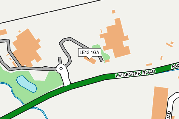
LE13 1GA is located in the Melton Dorian electoral ward, within the local authority district of Melton and the English Parliamentary constituency of Rutland and Melton. The Sub Integrated Care Board (ICB) Location is NHS Leicester, Leicestershire and Rutland ICB - 03W and the police force is Leicestershire. This postcode has been in use since December 1998.


GetTheData
Source: OS OpenMap – Local (Ordnance Survey)
Source: OS VectorMap District (Ordnance Survey)
Licence: Open Government Licence (requires attribution)
| Easting | 473351 |
| Northing | 317964 |
| Latitude | 52.754320 |
| Longitude | -0.914623 |
GetTheData
Source: Open Postcode Geo
Licence: Open Government Licence
| Country | England |
| Postcode District | LE13 |
➜ See where LE13 is on a map ➜ Where is Melton Mowbray? | |
GetTheData
Source: Land Registry Price Paid Data
Licence: Open Government Licence
Elevation or altitude of LE13 1GA as distance above sea level:
| Metres | Feet | |
|---|---|---|
| Elevation | 80m | 262ft |
Elevation is measured from the approximate centre of the postcode, to the nearest point on an OS contour line from OS Terrain 50, which has contour spacing of ten vertical metres.
➜ How high above sea level am I? Find the elevation of your current position using your device's GPS.
GetTheData
Source: Open Postcode Elevation
Licence: Open Government Licence
| Ward | Melton Dorian |
| Constituency | Rutland And Melton |
GetTheData
Source: ONS Postcode Database
Licence: Open Government Licence
| Edendale Road (Leicester Road) | Melton Mowbray | 973m |
| Edendale Road (Leicester Road) | Melton Mowbray | 990m |
| Cowslip Drive (Heather Crescent) | Melton Mowbray | 1,049m |
| Kennet Way (Edendale Road) | Melton Mowbray | 1,111m |
| Kennet Way (Edendale Road) | Melton Mowbray | 1,121m |
| Melton Mowbray Station | 2.1km |
GetTheData
Source: NaPTAN
Licence: Open Government Licence
GetTheData
Source: ONS Postcode Database
Licence: Open Government Licence


➜ Get more ratings from the Food Standards Agency
GetTheData
Source: Food Standards Agency
Licence: FSA terms & conditions
| Last Collection | |||
|---|---|---|---|
| Location | Mon-Fri | Sat | Distance |
| Valley Road Post Office | 17:30 | 11:45 | 1,349m |
| Wilton Court | 17:15 | 11:45 | 1,779m |
| Asfordby Road | 17:15 | 11:30 | 2,016m |
GetTheData
Source: Dracos
Licence: Creative Commons Attribution-ShareAlike
The below table lists the International Territorial Level (ITL) codes (formerly Nomenclature of Territorial Units for Statistics (NUTS) codes) and Local Administrative Units (LAU) codes for LE13 1GA:
| ITL 1 Code | Name |
|---|---|
| TLF | East Midlands (England) |
| ITL 2 Code | Name |
| TLF2 | Leicestershire, Rutland and Northamptonshire |
| ITL 3 Code | Name |
| TLF22 | Leicestershire CC and Rutland |
| LAU 1 Code | Name |
| E07000133 | Melton |
GetTheData
Source: ONS Postcode Directory
Licence: Open Government Licence
The below table lists the Census Output Area (OA), Lower Layer Super Output Area (LSOA), and Middle Layer Super Output Area (MSOA) for LE13 1GA:
| Code | Name | |
|---|---|---|
| OA | E00131408 | |
| LSOA | E01025896 | Melton 004A |
| MSOA | E02005394 | Melton 004 |
GetTheData
Source: ONS Postcode Directory
Licence: Open Government Licence
| LE13 0RG | Pate Road | 394m |
| LE13 0DG | Beler Way | 476m |
| LE13 0RQ | Digby Drive | 555m |
| LE13 0DB | Leicester Road | 978m |
| LE13 0FQ | Foxglove Avenue | 995m |
| LE13 0FF | Cowslip Drive | 1009m |
| LE13 0FS | Teasel Drive | 1014m |
| LE13 0EU | Redbrook Crescent | 1051m |
| LE13 0ES | Trent Bank | 1052m |
| LE13 0FG | Bluebell Row | 1056m |
GetTheData
Source: Open Postcode Geo; Land Registry Price Paid Data
Licence: Open Government Licence