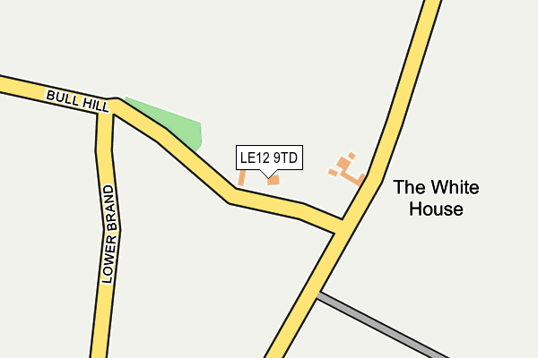
LE12 9TD lies on Bull Hill in Osgathorpe, Loughborough. LE12 9TD is located in the Worthington & Breedon electoral ward, within the local authority district of North West Leicestershire and the English Parliamentary constituency of North West Leicestershire. The Sub Integrated Care Board (ICB) Location is NHS Leicester, Leicestershire and Rutland ICB - 04V and the police force is Leicestershire. This postcode has been in use since January 1980.


GetTheData
Source: OS OpenMap – Local (Ordnance Survey)
Source: OS VectorMap District (Ordnance Survey)
Licence: Open Government Licence (requires attribution)
| Easting | 441440 |
| Northing | 320207 |
| Latitude | 52.777865 |
| Longitude | -1.387113 |
GetTheData
Source: Open Postcode Geo
Licence: Open Government Licence
| Street | Bull Hill |
| Locality | Osgathorpe |
| Town/City | Loughborough |
| Country | England |
| Postcode District | LE12 |
➜ See where LE12 is on a map | |
GetTheData
Source: Land Registry Price Paid Data
Licence: Open Government Licence
Elevation or altitude of LE12 9TD as distance above sea level:
| Metres | Feet | |
|---|---|---|
| Elevation | 110m | 361ft |
Elevation is measured from the approximate centre of the postcode, to the nearest point on an OS contour line from OS Terrain 50, which has contour spacing of ten vertical metres.
➜ How high above sea level am I? Find the elevation of your current position using your device's GPS.
GetTheData
Source: Open Postcode Elevation
Licence: Open Government Licence
| Ward | Worthington & Breedon |
| Constituency | North West Leicestershire |
GetTheData
Source: ONS Postcode Database
Licence: Open Government Licence
| Chapel Rise (Main Street) | Worthington | 589m |
| Chapel Rise (Main Street) | Worthington | 605m |
| Church (Church Street) | Worthington | 907m |
| Church (Church Street) | Worthington | 907m |
| Orchard Close (Main Street) | Osgathorpe | 1,313m |
GetTheData
Source: NaPTAN
Licence: Open Government Licence
| Percentage of properties with Next Generation Access | 100.0% |
| Percentage of properties with Superfast Broadband | 0.0% |
| Percentage of properties with Ultrafast Broadband | 0.0% |
| Percentage of properties with Full Fibre Broadband | 0.0% |
Superfast Broadband is between 30Mbps and 300Mbps
Ultrafast Broadband is > 300Mbps
| Percentage of properties unable to receive 2Mbps | 0.0% |
| Percentage of properties unable to receive 5Mbps | 0.0% |
| Percentage of properties unable to receive 10Mbps | 0.0% |
| Percentage of properties unable to receive 30Mbps | 100.0% |
GetTheData
Source: Ofcom
Licence: Ofcom Terms of Use (requires attribution)
GetTheData
Source: ONS Postcode Database
Licence: Open Government Licence


➜ Get more ratings from the Food Standards Agency
GetTheData
Source: Food Standards Agency
Licence: FSA terms & conditions
| Last Collection | |||
|---|---|---|---|
| Location | Mon-Fri | Sat | Distance |
| Main Street | 16:00 | 11:45 | 612m |
| Lount Toll Gate | 16:00 | 08:15 | 2,461m |
| The Green | 16:30 | 10:30 | 2,811m |
GetTheData
Source: Dracos
Licence: Creative Commons Attribution-ShareAlike
The below table lists the International Territorial Level (ITL) codes (formerly Nomenclature of Territorial Units for Statistics (NUTS) codes) and Local Administrative Units (LAU) codes for LE12 9TD:
| ITL 1 Code | Name |
|---|---|
| TLF | East Midlands (England) |
| ITL 2 Code | Name |
| TLF2 | Leicestershire, Rutland and Northamptonshire |
| ITL 3 Code | Name |
| TLF22 | Leicestershire CC and Rutland |
| LAU 1 Code | Name |
| E07000134 | North West Leicestershire |
GetTheData
Source: ONS Postcode Directory
Licence: Open Government Licence
The below table lists the Census Output Area (OA), Lower Layer Super Output Area (LSOA), and Middle Layer Super Output Area (MSOA) for LE12 9TD:
| Code | Name | |
|---|---|---|
| OA | E00131760 | |
| LSOA | E01025963 | North West Leicestershire 005C |
| MSOA | E02005401 | North West Leicestershire 005 |
GetTheData
Source: ONS Postcode Directory
Licence: Open Government Licence
| LE12 9TB | Stordon Lane | 412m |
| LE65 1RQ | Main Street | 593m |
| LE65 1RP | Main Street | 624m |
| LE65 1RZ | Peartree Court | 675m |
| LE65 1RX | Chapel Rise | 699m |
| LE65 1RN | Manor Drive | 728m |
| LE65 1RY | Manor View Close | 739m |
| LE65 1RE | Church Street | 779m |
| LE65 1SF | St Matthews Avenue | 801m |
| LE65 1SH | St Matthews Avenue | 838m |
GetTheData
Source: Open Postcode Geo; Land Registry Price Paid Data
Licence: Open Government Licence