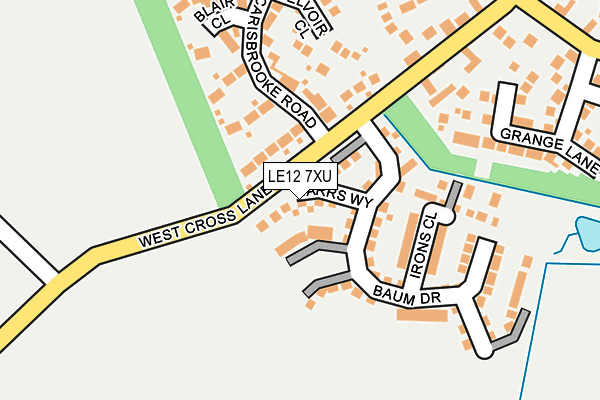
LE12 7XU is located in the Mountsorrel electoral ward, within the local authority district of Charnwood and the English Parliamentary constituency of Charnwood. The Sub Integrated Care Board (ICB) Location is NHS Leicester, Leicestershire and Rutland ICB - 04V and the police force is Leicestershire. This postcode has been in use since June 2016.


GetTheData
Source: OS OpenMap – Local (Ordnance Survey)
Source: OS VectorMap District (Ordnance Survey)
Licence: Open Government Licence (requires attribution)
| Easting | 457567 |
| Northing | 313477 |
| Latitude | 52.715916 |
| Longitude | -1.149235 |
GetTheData
Source: Open Postcode Geo
Licence: Open Government Licence
| Country | England |
| Postcode District | LE12 |
➜ See where LE12 is on a map ➜ Where is Mountsorrel? | |
GetTheData
Source: Land Registry Price Paid Data
Licence: Open Government Licence
Elevation or altitude of LE12 7XU as distance above sea level:
| Metres | Feet | |
|---|---|---|
| Elevation | 70m | 230ft |
Elevation is measured from the approximate centre of the postcode, to the nearest point on an OS contour line from OS Terrain 50, which has contour spacing of ten vertical metres.
➜ How high above sea level am I? Find the elevation of your current position using your device's GPS.
GetTheData
Source: Open Postcode Elevation
Licence: Open Government Licence
| Ward | Mountsorrel |
| Constituency | Charnwood |
GetTheData
Source: ONS Postcode Database
Licence: Open Government Licence
6, BARRS WAY, MOUNTSORREL, LOUGHBOROUGH, LE12 7XU 2017 26 MAY £359,995 |
12, BARRS WAY, MOUNTSORREL, LOUGHBOROUGH, LE12 7XU 2017 19 MAY £400,000 |
8, BARRS WAY, MOUNTSORREL, LOUGHBOROUGH, LE12 7XU 2016 19 DEC £359,995 |
10, BARRS WAY, MOUNTSORREL, LOUGHBOROUGH, LE12 7XU 2016 19 DEC £357,995 |
4, BARRS WAY, MOUNTSORREL, LEICESTER, LE12 7XU 2016 25 AUG £369,995 |
2, BARRS WAY, MOUNTSORREL, LOUGHBOROUGH, LE12 7XU 2016 30 JUN £274,995 |
GetTheData
Source: HM Land Registry Price Paid Data
Licence: Contains HM Land Registry data © Crown copyright and database right 2025. This data is licensed under the Open Government Licence v3.0.
| Cemetery (Mountsorrel Lane) | Rothley | 770m |
| Cemetery (Mountsorrel Lane) | Rothley | 782m |
| Walton Lane (Mountsorrel Lane) | Rothley | 851m |
| Garland (Mountsorrel Lane) | Rothley | 866m |
| Linkfield Road (Rothley Road) | Mountsorrel | 890m |
| Rothley (Great Central Railway) | Rothley | 1,443m |
| Sileby Station | 3.2km |
| Barrow upon Soar Station | 3.7km |
| Syston Station | 5.1km |
GetTheData
Source: NaPTAN
Licence: Open Government Licence
| Percentage of properties with Next Generation Access | 100.0% |
| Percentage of properties with Superfast Broadband | 100.0% |
| Percentage of properties with Ultrafast Broadband | 100.0% |
| Percentage of properties with Full Fibre Broadband | 0.0% |
Superfast Broadband is between 30Mbps and 300Mbps
Ultrafast Broadband is > 300Mbps
| Median download speed | 100.0Mbps |
| Average download speed | 121.6Mbps |
| Maximum download speed | 350.00Mbps |
| Median upload speed | 1.1Mbps |
| Average upload speed | 1.1Mbps |
| Maximum upload speed | 1.09Mbps |
| Percentage of properties unable to receive 2Mbps | 0.0% |
| Percentage of properties unable to receive 5Mbps | 0.0% |
| Percentage of properties unable to receive 10Mbps | 0.0% |
| Percentage of properties unable to receive 30Mbps | 0.0% |
GetTheData
Source: Ofcom
Licence: Ofcom Terms of Use (requires attribution)
GetTheData
Source: ONS Postcode Database
Licence: Open Government Licence


➜ Get more ratings from the Food Standards Agency
GetTheData
Source: Food Standards Agency
Licence: FSA terms & conditions
| Last Collection | |||
|---|---|---|---|
| Location | Mon-Fri | Sat | Distance |
| Cross Lane | 16:40 | 10:45 | 329m |
| Halstead Road | 16:45 | 10:45 | 806m |
| Linkfield Road | 16:45 | 10:45 | 916m |
GetTheData
Source: Dracos
Licence: Creative Commons Attribution-ShareAlike
The below table lists the International Territorial Level (ITL) codes (formerly Nomenclature of Territorial Units for Statistics (NUTS) codes) and Local Administrative Units (LAU) codes for LE12 7XU:
| ITL 1 Code | Name |
|---|---|
| TLF | East Midlands (England) |
| ITL 2 Code | Name |
| TLF2 | Leicestershire, Rutland and Northamptonshire |
| ITL 3 Code | Name |
| TLF22 | Leicestershire CC and Rutland |
| LAU 1 Code | Name |
| E07000130 | Charnwood |
GetTheData
Source: ONS Postcode Directory
Licence: Open Government Licence
The below table lists the Census Output Area (OA), Lower Layer Super Output Area (LSOA), and Middle Layer Super Output Area (MSOA) for LE12 7XU:
| Code | Name | |
|---|---|---|
| OA | E00130579 | |
| LSOA | E01025738 | Charnwood 016D |
| MSOA | E02005360 | Charnwood 016 |
GetTheData
Source: ONS Postcode Directory
Licence: Open Government Licence
| LE12 7EB | Glamis Close | 133m |
| LE12 7BS | West Cross Lane | 178m |
| LE12 7BL | Belvoir Close | 204m |
| LE12 7DG | Blair Close | 218m |
| LE12 7HY | Grange Lane | 237m |
| LE12 7HU | Montsoreau Way | 270m |
| LE12 7HT | York Close | 312m |
| LE12 7BR | Carisbrooke Road | 318m |
| LE12 7DY | Beaumaris Road | 320m |
| LE12 7EQ | Walton Way | 330m |
GetTheData
Source: Open Postcode Geo; Land Registry Price Paid Data
Licence: Open Government Licence