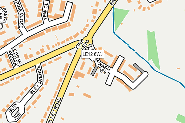
LE12 6WJ is located in the Leake electoral ward, within the local authority district of Rushcliffe and the English Parliamentary constituency of Rushcliffe. The Sub Integrated Care Board (ICB) Location is NHS Nottingham and Nottinghamshire ICB - 52R and the police force is Nottinghamshire. This postcode has been in use since February 2017.


GetTheData
Source: OS OpenMap – Local (Ordnance Survey)
Source: OS VectorMap District (Ordnance Survey)
Licence: Open Government Licence (requires attribution)
| Easting | 455129 |
| Northing | 325722 |
| Latitude | 52.826235 |
| Longitude | -1.183268 |
GetTheData
Source: Open Postcode Geo
Licence: Open Government Licence
| Country | England |
| Postcode District | LE12 |
➜ See where LE12 is on a map ➜ Where is East Leake? | |
GetTheData
Source: Land Registry Price Paid Data
Licence: Open Government Licence
| Ward | Leake |
| Constituency | Rushcliffe |
GetTheData
Source: ONS Postcode Database
Licence: Open Government Licence
2024 24 OCT £365,000 |
2023 20 JAN £345,000 |
2022 25 MAR £285,000 |
12, SHEEPWASH WAY, EAST LEAKE, LOUGHBOROUGH, LE12 6WJ 2021 10 SEP £269,995 |
2021 29 JUN £255,000 |
2021 6 APR £310,000 |
2021 6 APR £275,000 |
2020 11 DEC £305,000 |
2020 14 FEB £292,500 |
2018 22 JUN £269,995 |
GetTheData
Source: HM Land Registry Price Paid Data
Licence: Contains HM Land Registry data © Crown copyright and database right 2025. This data is licensed under the Open Government Licence v3.0.
| Woodgate Road (Kirk Ley Road) | East Leake | 132m |
| Woodgate Road (Kirk Ley Road) | East Leake | 143m |
| Kirk Ley Road | East Leake | 359m |
| Kirk Ley Road | East Leake | 371m |
| School Green (Main Street) | East Leake | 470m |
GetTheData
Source: NaPTAN
Licence: Open Government Licence
| Percentage of properties with Next Generation Access | 100.0% |
| Percentage of properties with Superfast Broadband | 100.0% |
| Percentage of properties with Ultrafast Broadband | 100.0% |
| Percentage of properties with Full Fibre Broadband | 0.0% |
Superfast Broadband is between 30Mbps and 300Mbps
Ultrafast Broadband is > 300Mbps
| Median download speed | 100.0Mbps |
| Average download speed | 119.6Mbps |
| Maximum download speed | 350.00Mbps |
Ofcom does not currently provide upload speed data for LE12 6WJ. This is because there are less than four broadband connections in this postcode.
| Percentage of properties unable to receive 2Mbps | 0.0% |
| Percentage of properties unable to receive 5Mbps | 0.0% |
| Percentage of properties unable to receive 10Mbps | 0.0% |
| Percentage of properties unable to receive 30Mbps | 0.0% |
GetTheData
Source: Ofcom
Licence: Ofcom Terms of Use (requires attribution)
GetTheData
Source: ONS Postcode Database
Licence: Open Government Licence


➜ Get more ratings from the Food Standards Agency
GetTheData
Source: Food Standards Agency
Licence: FSA terms & conditions
| Last Collection | |||
|---|---|---|---|
| Location | Mon-Fri | Sat | Distance |
| Manor Farm Meadow | 16:00 | 10:30 | 566m |
| Railway Station | 17:00 | 10:00 | 608m |
| East Leake Post Office | 17:00 | 10:30 | 722m |
GetTheData
Source: Dracos
Licence: Creative Commons Attribution-ShareAlike
The below table lists the International Territorial Level (ITL) codes (formerly Nomenclature of Territorial Units for Statistics (NUTS) codes) and Local Administrative Units (LAU) codes for LE12 6WJ:
| ITL 1 Code | Name |
|---|---|
| TLF | East Midlands (England) |
| ITL 2 Code | Name |
| TLF1 | Derbyshire and Nottinghamshire |
| ITL 3 Code | Name |
| TLF16 | South Nottinghamshire |
| LAU 1 Code | Name |
| E07000176 | Rushcliffe |
GetTheData
Source: ONS Postcode Directory
Licence: Open Government Licence
The below table lists the Census Output Area (OA), Lower Layer Super Output Area (LSOA), and Middle Layer Super Output Area (MSOA) for LE12 6WJ:
| Code | Name | |
|---|---|---|
| OA | E00144651 | |
| LSOA | E01028390 | Rushcliffe 015C |
| MSOA | E02005920 | Rushcliffe 015 |
GetTheData
Source: ONS Postcode Directory
Licence: Open Government Licence
| LE12 6PE | Kirk Ley Road | 226m |
| LE12 6PT | Sycamore Road | 259m |
| LE12 6PR | Sycamore Road | 290m |
| LE12 6NX | Bley Avenue | 318m |
| LE12 6LB | Burton Walk | 321m |
| LE12 6PZ | Yew Close | 333m |
| LE12 6PB | Brookside | 335m |
| LE12 6PA | Brookside Avenue | 340m |
| LE12 6PX | Woodgate Road | 346m |
| LE12 6PD | Cedar Avenue | 352m |
GetTheData
Source: Open Postcode Geo; Land Registry Price Paid Data
Licence: Open Government Licence