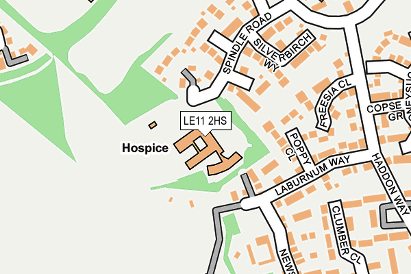
LE11 2HS is located in the Loughborough Woodthorpe electoral ward, within the local authority district of Charnwood and the English Parliamentary constituency of Loughborough. The Sub Integrated Care Board (ICB) Location is NHS Leicester, Leicestershire and Rutland ICB - 04V and the police force is Leicestershire. This postcode has been in use since January 1995.


GetTheData
Source: OS OpenMap – Local (Ordnance Survey)
Source: OS VectorMap District (Ordnance Survey)
Licence: Open Government Licence (requires attribution)
| Easting | 453033 |
| Northing | 316784 |
| Latitude | 52.746085 |
| Longitude | -1.215821 |
GetTheData
Source: Open Postcode Geo
Licence: Open Government Licence
| Country | England |
| Postcode District | LE11 |
➜ See where LE11 is on a map ➜ Where is Loughborough? | |
GetTheData
Source: Land Registry Price Paid Data
Licence: Open Government Licence
Elevation or altitude of LE11 2HS as distance above sea level:
| Metres | Feet | |
|---|---|---|
| Elevation | 70m | 230ft |
Elevation is measured from the approximate centre of the postcode, to the nearest point on an OS contour line from OS Terrain 50, which has contour spacing of ten vertical metres.
➜ How high above sea level am I? Find the elevation of your current position using your device's GPS.
GetTheData
Source: Open Postcode Elevation
Licence: Open Government Licence
| Ward | Loughborough Woodthorpe |
| Constituency | Loughborough |
GetTheData
Source: ONS Postcode Database
Licence: Open Government Licence
| Spindle Road (Fairmeadows Way) | Loughborough | 226m |
| Lemontree Lane (Fairmeadows Way) | Loughborough | 347m |
| Outwoods Edge School (Laurel Road) | Loughborough | 470m |
| Grasmere Road (Atherstone Road) | Loughborough | 482m |
| Laurel Road (The Osiers) | Loughborough | 591m |
| Loughborough (Leics) Station | 3.9km |
| Barrow upon Soar Station | 4.8km |
GetTheData
Source: NaPTAN
Licence: Open Government Licence
GetTheData
Source: ONS Postcode Database
Licence: Open Government Licence


➜ Get more ratings from the Food Standards Agency
GetTheData
Source: Food Standards Agency
Licence: FSA terms & conditions
| Last Collection | |||
|---|---|---|---|
| Location | Mon-Fri | Sat | Distance |
| Valley Road | 17:30 | 12:15 | 1,471m |
| Shelthorpe P.o. | 17:30 | 12:00 | 1,548m |
| Thirlemere Drive | 17:15 | 12:00 | 1,691m |
GetTheData
Source: Dracos
Licence: Creative Commons Attribution-ShareAlike
The below table lists the International Territorial Level (ITL) codes (formerly Nomenclature of Territorial Units for Statistics (NUTS) codes) and Local Administrative Units (LAU) codes for LE11 2HS:
| ITL 1 Code | Name |
|---|---|
| TLF | East Midlands (England) |
| ITL 2 Code | Name |
| TLF2 | Leicestershire, Rutland and Northamptonshire |
| ITL 3 Code | Name |
| TLF22 | Leicestershire CC and Rutland |
| LAU 1 Code | Name |
| E07000130 | Charnwood |
GetTheData
Source: ONS Postcode Directory
Licence: Open Government Licence
The below table lists the Census Output Area (OA), Lower Layer Super Output Area (LSOA), and Middle Layer Super Output Area (MSOA) for LE11 2HS:
| Code | Name | |
|---|---|---|
| OA | E00130472 | |
| LSOA | E01025714 | Charnwood 010F |
| MSOA | E02005354 | Charnwood 010 |
GetTheData
Source: ONS Postcode Directory
Licence: Open Government Licence
| LE11 2DQ | Maidenhair Close | 80m |
| LE11 2FA | Poppy Close | 110m |
| LE11 2BA | Rosewood Way | 127m |
| LE11 2FB | Laburnum Way | 128m |
| LE11 2DG | Almond Close | 155m |
| LE11 2DL | Spindle Road | 169m |
| LE11 2DH | Silverbirch Way | 174m |
| LE11 2FD | Freesia Close | 187m |
| LE11 2TH | Buttercup Road | 192m |
| LE11 2DJ | Mimosa Close | 226m |
GetTheData
Source: Open Postcode Geo; Land Registry Price Paid Data
Licence: Open Government Licence