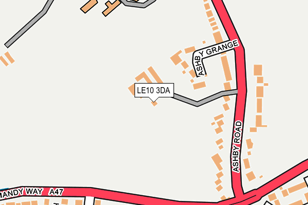
LE10 3DA is located in the Hinckley De Montfort electoral ward, within the local authority district of Hinckley and Bosworth and the English Parliamentary constituency of Bosworth. The Sub Integrated Care Board (ICB) Location is NHS Leicester, Leicestershire and Rutland ICB - 04V and the police force is Leicestershire. This postcode has been in use since January 1980.


GetTheData
Source: OS OpenMap – Local (Ordnance Survey)
Source: OS VectorMap District (Ordnance Survey)
Licence: Open Government Licence (requires attribution)
| Easting | 442641 |
| Northing | 295982 |
| Latitude | 52.560027 |
| Longitude | -1.372427 |
GetTheData
Source: Open Postcode Geo
Licence: Open Government Licence
| Country | England |
| Postcode District | LE10 |
➜ See where LE10 is on a map | |
GetTheData
Source: Land Registry Price Paid Data
Licence: Open Government Licence
Elevation or altitude of LE10 3DA as distance above sea level:
| Metres | Feet | |
|---|---|---|
| Elevation | 120m | 394ft |
Elevation is measured from the approximate centre of the postcode, to the nearest point on an OS contour line from OS Terrain 50, which has contour spacing of ten vertical metres.
➜ How high above sea level am I? Find the elevation of your current position using your device's GPS.
GetTheData
Source: Open Postcode Elevation
Licence: Open Government Licence
| Ward | Hinckley De Montfort |
| Constituency | Bosworth |
GetTheData
Source: ONS Postcode Database
Licence: Open Government Licence
| Community Hospital (Ashby Road) | Hinckley | 421m |
| Community Hospital (Ashby Road) | Hinckley | 434m |
| Ashby Grange (Ashby Road) | Hinckley | 466m |
| Ashby Grange (Ashby Road) | Hinckley | 485m |
| Hangmans Lane (Ashby Road) | Hinckley | 688m |
| Hinckley Station | 2.8km |
GetTheData
Source: NaPTAN
Licence: Open Government Licence
| Percentage of properties with Next Generation Access | 100.0% |
| Percentage of properties with Superfast Broadband | 0.0% |
| Percentage of properties with Ultrafast Broadband | 0.0% |
| Percentage of properties with Full Fibre Broadband | 0.0% |
Superfast Broadband is between 30Mbps and 300Mbps
Ultrafast Broadband is > 300Mbps
| Percentage of properties unable to receive 2Mbps | 0.0% |
| Percentage of properties unable to receive 5Mbps | 50.0% |
| Percentage of properties unable to receive 10Mbps | 50.0% |
| Percentage of properties unable to receive 30Mbps | 100.0% |
GetTheData
Source: Ofcom
Licence: Ofcom Terms of Use (requires attribution)
GetTheData
Source: ONS Postcode Database
Licence: Open Government Licence


➜ Get more ratings from the Food Standards Agency
GetTheData
Source: Food Standards Agency
Licence: FSA terms & conditions
| Last Collection | |||
|---|---|---|---|
| Location | Mon-Fri | Sat | Distance |
| Cornfield | 18:30 | 11:30 | 516m |
| Shentons Oak | 17:45 | 11:30 | 645m |
| Tudor Road Post Office | 17:45 | 11:00 | 983m |
GetTheData
Source: Dracos
Licence: Creative Commons Attribution-ShareAlike
The below table lists the International Territorial Level (ITL) codes (formerly Nomenclature of Territorial Units for Statistics (NUTS) codes) and Local Administrative Units (LAU) codes for LE10 3DA:
| ITL 1 Code | Name |
|---|---|
| TLF | East Midlands (England) |
| ITL 2 Code | Name |
| TLF2 | Leicestershire, Rutland and Northamptonshire |
| ITL 3 Code | Name |
| TLF22 | Leicestershire CC and Rutland |
| LAU 1 Code | Name |
| E07000132 | Hinckley and Bosworth |
GetTheData
Source: ONS Postcode Directory
Licence: Open Government Licence
The below table lists the Census Output Area (OA), Lower Layer Super Output Area (LSOA), and Middle Layer Super Output Area (MSOA) for LE10 3DA:
| Code | Name | |
|---|---|---|
| OA | E00131213 | |
| LSOA | E01025860 | Hinckley and Bosworth 009B |
| MSOA | E02005385 | Hinckley and Bosworth 009 |
GetTheData
Source: ONS Postcode Directory
Licence: Open Government Licence
| LE10 1PF | Hardy Close | 310m |
| LE10 1PE | Hawkins Close | 316m |
| LE10 1NB | Ashby Grange | 348m |
| LE10 1PG | Jarvis Close | 361m |
| LE10 1UW | Drake Way | 377m |
| LE10 1RX | Raleigh Close | 382m |
| LE10 1UP | Frobisher Close | 407m |
| LE10 1SJ | Ashby Road | 415m |
| LE10 1UR | Blake Close | 435m |
| LE10 1YG | Wheatfield Way | 449m |
GetTheData
Source: Open Postcode Geo; Land Registry Price Paid Data
Licence: Open Government Licence