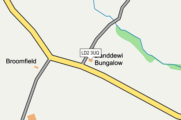
LD2 3UQ is in Llandewi Fach, Builth Wells. LD2 3UQ is located in the Glasbury electoral ward, within the unitary authority of Powys and the Welsh Parliamentary constituency of Brecon and Radnorshire. The Local Health Board is Powys Teaching and the police force is Dyfed-Powys. This postcode has been in use since January 1980.


GetTheData
Source: OS OpenMap – Local (Ordnance Survey)
Source: OS VectorMap District (Ordnance Survey)
Licence: Open Government Licence (requires attribution)
| Easting | 313066 |
| Northing | 244069 |
| Latitude | 52.088117 |
| Longitude | -3.270221 |
GetTheData
Source: Open Postcode Geo
Licence: Open Government Licence
| Locality | Llandewi Fach |
| Town/City | Builth Wells |
| Country | Wales |
| Postcode District | LD2 |
➜ See where LD2 is on a map | |
GetTheData
Source: Land Registry Price Paid Data
Licence: Open Government Licence
Elevation or altitude of LD2 3UQ as distance above sea level:
| Metres | Feet | |
|---|---|---|
| Elevation | 250m | 820ft |
Elevation is measured from the approximate centre of the postcode, to the nearest point on an OS contour line from OS Terrain 50, which has contour spacing of ten vertical metres.
➜ How high above sea level am I? Find the elevation of your current position using your device's GPS.
GetTheData
Source: Open Postcode Elevation
Licence: Open Government Licence
| Ward | Glasbury |
| Constituency | Brecon And Radnorshire |
GetTheData
Source: ONS Postcode Database
Licence: Open Government Licence
| Percentage of properties with Next Generation Access | 28.6% |
| Percentage of properties with Superfast Broadband | 0.0% |
| Percentage of properties with Ultrafast Broadband | 0.0% |
| Percentage of properties with Full Fibre Broadband | 0.0% |
Superfast Broadband is between 30Mbps and 300Mbps
Ultrafast Broadband is > 300Mbps
| Median download speed | 2.1Mbps |
| Average download speed | 2.1Mbps |
| Maximum download speed | 3.05Mbps |
| Median upload speed | 0.7Mbps |
| Average upload speed | 0.6Mbps |
| Maximum upload speed | 0.80Mbps |
| Percentage of properties unable to receive 2Mbps | 28.6% |
| Percentage of properties unable to receive 5Mbps | 85.7% |
| Percentage of properties unable to receive 10Mbps | 85.7% |
| Percentage of properties unable to receive 30Mbps | 100.0% |
GetTheData
Source: Ofcom
Licence: Ofcom Terms of Use (requires attribution)
Estimated total energy consumption in LD2 3UQ by fuel type, 2015.
| Consumption (kWh) | 81,863 |
|---|---|
| Meter count | 6 |
| Mean (kWh/meter) | 13,644 |
| Median (kWh/meter) | 8,943 |
GetTheData
Source: Postcode level gas estimates: 2015 (experimental)
Source: Postcode level electricity estimates: 2015 (experimental)
Licence: Open Government Licence
GetTheData
Source: ONS Postcode Database
Licence: Open Government Licence
The below table lists the International Territorial Level (ITL) codes (formerly Nomenclature of Territorial Units for Statistics (NUTS) codes) and Local Administrative Units (LAU) codes for LD2 3UQ:
| ITL 1 Code | Name |
|---|---|
| TLL | Wales |
| ITL 2 Code | Name |
| TLL2 | East Wales |
| ITL 3 Code | Name |
| TLL24 | Powys |
| LAU 1 Code | Name |
| W06000023 | Powys |
GetTheData
Source: ONS Postcode Directory
Licence: Open Government Licence
The below table lists the Census Output Area (OA), Lower Layer Super Output Area (LSOA), and Middle Layer Super Output Area (MSOA) for LD2 3UQ:
| Code | Name | |
|---|---|---|
| OA | W00002362 | |
| LSOA | W01000443 | Powys 015B |
| MSOA | W02000111 | Powys 015 |
GetTheData
Source: ONS Postcode Directory
Licence: Open Government Licence
| LD2 3JQ | 1554m | |
| LD2 3JF | 2036m | |
| LD3 0YR | 2507m | |
| LD2 3JH | 2660m | |
| HR3 5NB | 2753m | |
| LD2 3YQ | 2776m | |
| LD2 3SX | 2800m | |
| LD2 3SZ | 3029m | |
| LD3 0YT | Springfield Cottage | 3106m |
| LD2 3JN | 3261m |
GetTheData
Source: Open Postcode Geo; Land Registry Price Paid Data
Licence: Open Government Licence