LA2 6RE maps, stats, and open data
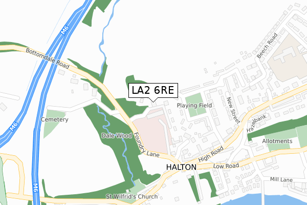
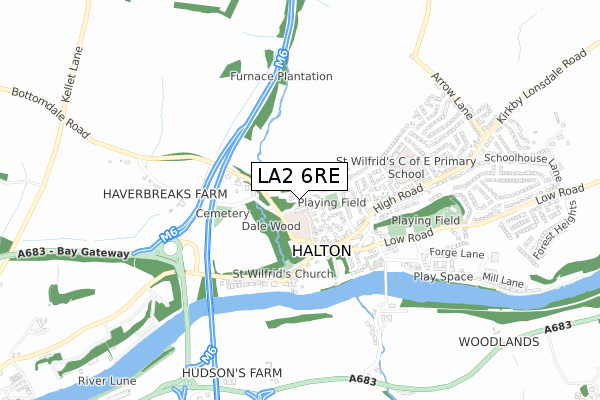
LA2 6RE lies on The Gardens in Halton, Lancaster. LA2 6RE is located in the Halton-with-Aughton & Kellet electoral ward, within the local authority district of Lancaster and the English Parliamentary constituency of Morecambe and Lunesdale. The Sub Integrated Care Board (ICB) Location is NHS Lancashire and South Cumbria ICB - 01K and the police force is Lancashire. This postcode has been in use since December 2000.
LA2 6RE maps


Licence: Open Government Licence (requires attribution)
Attribution: Contains OS data © Crown copyright and database right 2025
Source: Open Postcode Geo
Licence: Open Government Licence (requires attribution)
Attribution: Contains OS data © Crown copyright and database right 2025; Contains Royal Mail data © Royal Mail copyright and database right 2025; Source: Office for National Statistics licensed under the Open Government Licence v.3.0
LA2 6RE geodata
| Easting | 349985 |
| Northing | 465026 |
| Latitude | 54.078724 |
| Longitude | -2.765928 |
Where is LA2 6RE?
| Street | The Gardens |
| Locality | Halton |
| Town/City | Lancaster |
| Country | England |
| Postcode District | LA2 |
LA2 6RE Elevation
Elevation or altitude of LA2 6RE as distance above sea level:
| Metres | Feet | |
|---|---|---|
| Elevation | 40m | 131ft |
Elevation is measured from the approximate centre of the postcode, to the nearest point on an OS contour line from OS Terrain 50, which has contour spacing of ten vertical metres.
➜ How high above sea level am I? Find the elevation of your current position using your device's GPS.
Politics
| Ward | Halton-with-aughton & Kellet |
|---|---|
| Constituency | Morecambe And Lunesdale |
House Prices
Sales of detached houses in LA2 6RE
8, THE GARDENS, HALTON, LANCASTER, LA2 6RE 2018 3 DEC £350,000 |
10, THE GARDENS, HALTON, LANCASTER, LA2 6RE 2018 22 AUG £375,000 |
12, THE GARDENS, HALTON, LANCASTER, LA2 6RE 2017 10 NOV £380,000 |
6, THE GARDENS, HALTON, LANCASTER, LA2 6RE 2017 30 AUG £395,000 |
1, THE GARDENS, HALTON, LANCASTER, LA2 6RE 2001 28 FEB £182,500 |
2, THE GARDENS, HALTON, LANCASTER, LA2 6RE 2000 5 DEC £182,500 |
3, THE GARDENS, HALTON, LANCASTER, LA2 6RE 2000 28 FEB £192,500 |
4, THE GARDENS, HALTON, LANCASTER, LA2 6RE 2000 23 FEB £199,950 |
Licence: Contains HM Land Registry data © Crown copyright and database right 2025. This data is licensed under the Open Government Licence v3.0.
Transport
Nearest bus stops to LA2 6RE
| War Memorial (High Road) | Halton | 228m |
| War Memorial (Low Road) | Halton | 241m |
| New Street (High Road) | Halton | 288m |
| New Street (High Road) | Halton | 298m |
| Greyhound Hotel (Low Road) | Halton | 347m |
Nearest railway stations to LA2 6RE
| Lancaster Station | 4.3km |
| Bare Lane Station | 4.6km |
Broadband
Broadband access in LA2 6RE (2020 data)
| Percentage of properties with Next Generation Access | 100.0% |
| Percentage of properties with Superfast Broadband | 100.0% |
| Percentage of properties with Ultrafast Broadband | 0.0% |
| Percentage of properties with Full Fibre Broadband | 0.0% |
Superfast Broadband is between 30Mbps and 300Mbps
Ultrafast Broadband is > 300Mbps
Broadband speed in LA2 6RE (2019 data)
Download
| Median download speed | 40.0Mbps |
| Average download speed | 46.8Mbps |
| Maximum download speed | 73.35Mbps |
Upload
| Median upload speed | 9.0Mbps |
| Average upload speed | 8.3Mbps |
| Maximum upload speed | 10.00Mbps |
Broadband limitations in LA2 6RE (2020 data)
| Percentage of properties unable to receive 2Mbps | 0.0% |
| Percentage of properties unable to receive 5Mbps | 0.0% |
| Percentage of properties unable to receive 10Mbps | 0.0% |
| Percentage of properties unable to receive 30Mbps | 0.0% |
Deprivation
26.3% of English postcodes are less deprived than LA2 6RE:Food Standards Agency
Three nearest food hygiene ratings to LA2 6RE (metres)


➜ Get more ratings from the Food Standards Agency
Nearest post box to LA2 6RE
| Last Collection | |||
|---|---|---|---|
| Location | Mon-Fri | Sat | Distance |
| 4 Thrushgill Drive, Halton | 16:30 | 07:30 | 798m |
| Lansil Industrial Estate | 17:30 | 10:30 | 2,232m |
| Lansil Industrial Estate | 17:30 | 2,232m | |
LA2 6RE ITL and LA2 6RE LAU
The below table lists the International Territorial Level (ITL) codes (formerly Nomenclature of Territorial Units for Statistics (NUTS) codes) and Local Administrative Units (LAU) codes for LA2 6RE:
| ITL 1 Code | Name |
|---|---|
| TLD | North West (England) |
| ITL 2 Code | Name |
| TLD4 | Lancashire |
| ITL 3 Code | Name |
| TLD44 | Lancaster and Wyre |
| LAU 1 Code | Name |
| E07000121 | Lancaster |
LA2 6RE census areas
The below table lists the Census Output Area (OA), Lower Layer Super Output Area (LSOA), and Middle Layer Super Output Area (MSOA) for LA2 6RE:
| Code | Name | |
|---|---|---|
| OA | E00127432 | |
| LSOA | E01025108 | Lancaster 005A |
| MSOA | E02005225 | Lancaster 005 |
Nearest postcodes to LA2 6RE
| LA2 6PN | St Wilfrids Park | 130m |
| LA2 6LL | Rectory Paddock | 154m |
| LA2 6PW | St Wilfrids Park | 186m |
| LA2 6LT | Foundry Lane | 199m |
| LA2 6LY | Victoria Place | 211m |
| LA2 6LX | High Road | 230m |
| LA2 6PR | New Street | 263m |
| LA2 6LU | Foundry Lane | 264m |
| LA2 6PP | High Road | 274m |
| LA2 6PT | Meadowfield | 274m |