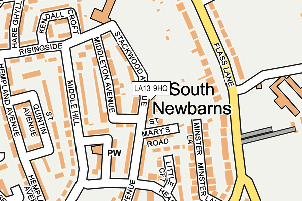
LA13 9HQ is located in the Hawcoat and Newbarns electoral ward, within the unitary authority of Westmorland and Furness and the English Parliamentary constituency of Barrow and Furness. The Sub Integrated Care Board (ICB) Location is NHS Lancashire and South Cumbria ICB - 01K and the police force is Cumbria. This postcode has been in use since January 1980.


GetTheData
Source: OS OpenMap – Local (Ordnance Survey)
Source: OS VectorMap District (Ordnance Survey)
Licence: Open Government Licence (requires attribution)
| Easting | 321474 |
| Northing | 470086 |
| Latitude | 54.120625 |
| Longitude | -3.202924 |
GetTheData
Source: Open Postcode Geo
Licence: Open Government Licence
| Country | England |
| Postcode District | LA13 |
➜ See where LA13 is on a map ➜ Where is Barrow-in-Furness? | |
GetTheData
Source: Land Registry Price Paid Data
Licence: Open Government Licence
Elevation or altitude of LA13 9HQ as distance above sea level:
| Metres | Feet | |
|---|---|---|
| Elevation | 20m | 66ft |
Elevation is measured from the approximate centre of the postcode, to the nearest point on an OS contour line from OS Terrain 50, which has contour spacing of ten vertical metres.
➜ How high above sea level am I? Find the elevation of your current position using your device's GPS.
GetTheData
Source: Open Postcode Elevation
Licence: Open Government Licence
| Ward | Hawcoat And Newbarns |
| Constituency | Barrow And Furness |
GetTheData
Source: ONS Postcode Database
Licence: Open Government Licence
| St Aidans Church (Middle Hill) | Newbarns | 154m |
| Risingside (Middle Hill) | Newbarns | 202m |
| Friars Lane (Flass Lane) | Newbarns | 206m |
| Harrel Lane Terminus (Flass Lane) | Newbarns | 254m |
| Bridgegate Avenue | Newbarns | 276m |
| Roose Station | 0.8km |
| Barrow-in-Furness Station | 1.5km |
| Dalton Station | 4.1km |
GetTheData
Source: NaPTAN
Licence: Open Government Licence
GetTheData
Source: ONS Postcode Database
Licence: Open Government Licence


➜ Get more ratings from the Food Standards Agency
GetTheData
Source: Food Standards Agency
Licence: FSA terms & conditions
| Last Collection | |||
|---|---|---|---|
| Location | Mon-Fri | Sat | Distance |
| Victoria Avenue | 17:30 | 11:00 | 987m |
| Westway | 17:30 | 11:15 | 998m |
| Greengate Street | 17:30 | 11:00 | 1,196m |
GetTheData
Source: Dracos
Licence: Creative Commons Attribution-ShareAlike
The below table lists the International Territorial Level (ITL) codes (formerly Nomenclature of Territorial Units for Statistics (NUTS) codes) and Local Administrative Units (LAU) codes for LA13 9HQ:
| ITL 1 Code | Name |
|---|---|
| TLD | North West (England) |
| ITL 2 Code | Name |
| TLD1 | Cumbria |
| ITL 3 Code | Name |
| TLD11 | West Cumbria |
| LAU 1 Code | Name |
| E07000027 | Barrow-in-Furness |
GetTheData
Source: ONS Postcode Directory
Licence: Open Government Licence
The below table lists the Census Output Area (OA), Lower Layer Super Output Area (LSOA), and Middle Layer Super Output Area (MSOA) for LA13 9HQ:
| Code | Name | |
|---|---|---|
| OA | E00096857 | |
| LSOA | E01019161 | Barrow-in-Furness 006A |
| MSOA | E02003982 | Barrow-in-Furness 006 |
GetTheData
Source: ONS Postcode Directory
Licence: Open Government Licence
| LA13 9HT | St Marys Road | 53m |
| LA13 9HN | Middleton Avenue | 81m |
| LA13 9HG | Stackwood Avenue | 83m |
| LA13 9PN | St Marys Road | 94m |
| LA13 9HH | Stackwood Avenue | 95m |
| LA13 9HL | Woodward Avenue | 98m |
| LA13 9HW | Little Croft | 107m |
| LA13 9HS | Headmeadow | 128m |
| LA13 9NY | Minster Lane | 134m |
| LA13 0DF | Flass Lane | 136m |
GetTheData
Source: Open Postcode Geo; Land Registry Price Paid Data
Licence: Open Government Licence