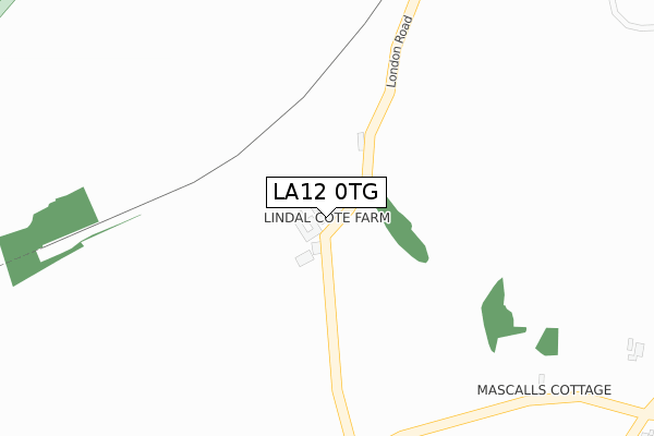
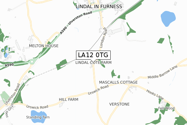
LA12 0TG is located in the Dalton North electoral ward, within the unitary authority of Westmorland and Furness and the English Parliamentary constituency of Barrow and Furness. The Sub Integrated Care Board (ICB) Location is NHS Lancashire and South Cumbria ICB - 01K and the police force is Cumbria. This postcode has been in use since January 1980.


GetTheData
Source: OS Open Zoomstack (Ordnance Survey)
Licence: Open Government Licence (requires attribution)
Attribution: Contains OS data © Crown copyright and database right 2025
Source: Open Postcode Geo
Licence: Open Government Licence (requires attribution)
Attribution: Contains OS data © Crown copyright and database right 2025; Contains Royal Mail data © Royal Mail copyright and database right 2025; Source: Office for National Statistics licensed under the Open Government Licence v.3.0
| Easting | 324991 |
| Northing | 475170 |
| Latitude | 54.166834 |
| Longitude | -3.150395 |
GetTheData
Source: Open Postcode Geo
Licence: Open Government Licence
| Country | England |
| Postcode District | LA12 |
➜ See where LA12 is on a map | |
GetTheData
Source: Land Registry Price Paid Data
Licence: Open Government Licence
Elevation or altitude of LA12 0TG as distance above sea level:
| Metres | Feet | |
|---|---|---|
| Elevation | 70m | 230ft |
Elevation is measured from the approximate centre of the postcode, to the nearest point on an OS contour line from OS Terrain 50, which has contour spacing of ten vertical metres.
➜ How high above sea level am I? Find the elevation of your current position using your device's GPS.
GetTheData
Source: Open Postcode Elevation
Licence: Open Government Licence
| Ward | Dalton North |
| Constituency | Barrow And Furness |
GetTheData
Source: ONS Postcode Database
Licence: Open Government Licence
| Anchor Hotel (A590) | Lindal-in-furness | 612m |
| The Anchor (A590) | Lindal-in-furness | 637m |
| South Lakes Wild Animal Park (A590) | Dalton-in-furness | 774m |
| South Lakes Wild Animal Park (A590) | Dalton-in-furness | 808m |
| Pennington Lane (A590) | Lindal-in-furness | 847m |
| Dalton Station | 2.3km |
| Askam Station | 4.3km |
| Ulverston Station | 4.4km |
GetTheData
Source: NaPTAN
Licence: Open Government Licence
| Percentage of properties with Next Generation Access | 100.0% |
| Percentage of properties with Superfast Broadband | 0.0% |
| Percentage of properties with Ultrafast Broadband | 0.0% |
| Percentage of properties with Full Fibre Broadband | 0.0% |
Superfast Broadband is between 30Mbps and 300Mbps
Ultrafast Broadband is > 300Mbps
| Percentage of properties unable to receive 2Mbps | 0.0% |
| Percentage of properties unable to receive 5Mbps | 0.0% |
| Percentage of properties unable to receive 10Mbps | 100.0% |
| Percentage of properties unable to receive 30Mbps | 100.0% |
GetTheData
Source: Ofcom
Licence: Ofcom Terms of Use (requires attribution)
GetTheData
Source: ONS Postcode Database
Licence: Open Government Licence


➜ Get more ratings from the Food Standards Agency
GetTheData
Source: Food Standards Agency
Licence: FSA terms & conditions
| Last Collection | |||
|---|---|---|---|
| Location | Mon-Fri | Sat | Distance |
| Ulverston Road, Lindal | 15:15 | 08:00 | 604m |
| High Carley Lane | 15:30 | 09:00 | 1,940m |
| Martin | 12:00 | 10:15 | 1,969m |
GetTheData
Source: Dracos
Licence: Creative Commons Attribution-ShareAlike
The below table lists the International Territorial Level (ITL) codes (formerly Nomenclature of Territorial Units for Statistics (NUTS) codes) and Local Administrative Units (LAU) codes for LA12 0TG:
| ITL 1 Code | Name |
|---|---|
| TLD | North West (England) |
| ITL 2 Code | Name |
| TLD1 | Cumbria |
| ITL 3 Code | Name |
| TLD11 | West Cumbria |
| LAU 1 Code | Name |
| E07000027 | Barrow-in-Furness |
GetTheData
Source: ONS Postcode Directory
Licence: Open Government Licence
The below table lists the Census Output Area (OA), Lower Layer Super Output Area (LSOA), and Middle Layer Super Output Area (MSOA) for LA12 0TG:
| Code | Name | |
|---|---|---|
| OA | E00096779 | |
| LSOA | E01019146 | Barrow-in-Furness 001C |
| MSOA | E02003977 | Barrow-in-Furness 001 |
GetTheData
Source: ONS Postcode Directory
Licence: Open Government Licence
| LA12 0LW | Station Terrace | 300m |
| LA12 0LL | London Road | 433m |
| LA12 0LR | Emplands Cottages | 578m |
| LA12 0LP | Ulverston Road | 578m |
| LA12 0LN | Ulverston Road | 591m |
| LA12 0LS | Church Close | 619m |
| LA12 0TQ | 638m | |
| LA12 0NZ | Low Farm Close | 644m |
| LA12 0LQ | Railway Terrace | 663m |
| LA12 0TJ | Queensberry Court | 671m |
GetTheData
Source: Open Postcode Geo; Land Registry Price Paid Data
Licence: Open Government Licence