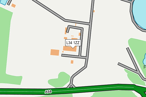
L34 1ZZ is located in the Prescot North electoral ward, within the metropolitan district of Knowsley and the English Parliamentary constituency of Knowsley. The Sub Integrated Care Board (ICB) Location is NHS Cheshire and Merseyside ICB - 01J and the police force is Merseyside. This postcode has been in use since July 1995.


GetTheData
Source: OS OpenMap – Local (Ordnance Survey)
Source: OS VectorMap District (Ordnance Survey)
Licence: Open Government Licence (requires attribution)
| Easting | 346720 |
| Northing | 393480 |
| Latitude | 53.435393 |
| Longitude | -2.803457 |
GetTheData
Source: Open Postcode Geo
Licence: Open Government Licence
| Country | England |
| Postcode District | L34 |
➜ See where L34 is on a map | |
GetTheData
Source: Land Registry Price Paid Data
Licence: Open Government Licence
Elevation or altitude of L34 1ZZ as distance above sea level:
| Metres | Feet | |
|---|---|---|
| Elevation | 80m | 262ft |
Elevation is measured from the approximate centre of the postcode, to the nearest point on an OS contour line from OS Terrain 50, which has contour spacing of ten vertical metres.
➜ How high above sea level am I? Find the elevation of your current position using your device's GPS.
GetTheData
Source: Open Postcode Elevation
Licence: Open Government Licence
| Ward | Prescot North |
| Constituency | Knowsley |
GetTheData
Source: ONS Postcode Database
Licence: Open Government Licence
| Cross Street (St Helens Road) | Prescot | 409m |
| Evans Street (St Helens Road) | Prescot | 444m |
| Rowson Street (St Helens Road) | Prescot | 464m |
| Atherton Street (High Street) | Prescot | 574m |
| Grosvenor Road | Prescot | 586m |
| Prescot Station | 1.3km |
| Eccleston Park Station | 1.6km |
| Whiston Station | 2.4km |
GetTheData
Source: NaPTAN
Licence: Open Government Licence
GetTheData
Source: ONS Postcode Database
Licence: Open Government Licence


➜ Get more ratings from the Food Standards Agency
GetTheData
Source: Food Standards Agency
Licence: FSA terms & conditions
| Last Collection | |||
|---|---|---|---|
| Location | Mon-Fri | Sat | Distance |
| Police Station/ High Street | 17:30 | 12:00 | 740m |
| Prescot Station | 17:30 | 12:00 | 986m |
| Beechwood Grove | 17:15 | 12:00 | 1,633m |
GetTheData
Source: Dracos
Licence: Creative Commons Attribution-ShareAlike
The below table lists the International Territorial Level (ITL) codes (formerly Nomenclature of Territorial Units for Statistics (NUTS) codes) and Local Administrative Units (LAU) codes for L34 1ZZ:
| ITL 1 Code | Name |
|---|---|
| TLD | North West (England) |
| ITL 2 Code | Name |
| TLD7 | Merseyside |
| ITL 3 Code | Name |
| TLD71 | East Merseyside |
| LAU 1 Code | Name |
| E08000011 | Knowsley |
GetTheData
Source: ONS Postcode Directory
Licence: Open Government Licence
The below table lists the Census Output Area (OA), Lower Layer Super Output Area (LSOA), and Middle Layer Super Output Area (MSOA) for L34 1ZZ:
| Code | Name | |
|---|---|---|
| OA | E00032645 | |
| LSOA | E01006440 | Knowsley 010A |
| MSOA | E02001336 | Knowsley 010 |
GetTheData
Source: ONS Postcode Directory
Licence: Open Government Licence
| L34 6HP | St Helens Road | 372m |
| L34 6JJ | Ward Street | 377m |
| L34 6HU | Evans Street | 406m |
| L34 6HW | St Helens Road | 421m |
| L34 6HT | St Helens Road | 422m |
| L34 6HS | St Helens Road | 447m |
| L34 6LB | Belvedere Close | 451m |
| L34 6LD | Harvard Grove | 455m |
| L34 6NE | Rio Court | 460m |
| L34 6HL | Moss Street | 467m |
GetTheData
Source: Open Postcode Geo; Land Registry Price Paid Data
Licence: Open Government Licence