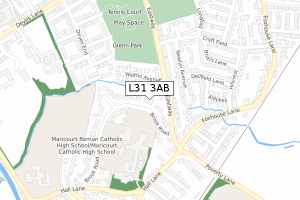
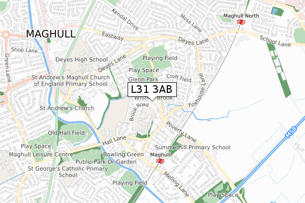
L31 3AB is located in the Sudell electoral ward, within the metropolitan district of Sefton and the English Parliamentary constituency of Sefton Central. The Sub Integrated Care Board (ICB) Location is NHS Cheshire and Merseyside ICB - 01T and the police force is Merseyside. This postcode has been in use since January 2019.


GetTheData
Source: OS Open Zoomstack (Ordnance Survey)
Licence: Open Government Licence (requires attribution)
Attribution: Contains OS data © Crown copyright and database right 2024
Source: Open Postcode Geo
Licence: Open Government Licence (requires attribution)
Attribution: Contains OS data © Crown copyright and database right 2024; Contains Royal Mail data © Royal Mail copyright and database right 2024; Source: Office for National Statistics licensed under the Open Government Licence v.3.0
| Easting | 338284 |
| Northing | 401975 |
| Latitude | 53.510834 |
| Longitude | -2.932093 |
GetTheData
Source: Open Postcode Geo
Licence: Open Government Licence
| Country | England |
| Postcode District | L31 |
| ➜ L31 open data dashboard ➜ See where L31 is on a map ➜ Where is Maghull? | |
GetTheData
Source: Land Registry Price Paid Data
Licence: Open Government Licence
| Ward | Sudell |
| Constituency | Sefton Central |
GetTheData
Source: ONS Postcode Database
Licence: Open Government Licence
| June 2022 | Violence and sexual offences | On or near The Brook | 153m |
| June 2022 | Violence and sexual offences | On or near The Brook | 153m |
| June 2022 | Violence and sexual offences | On or near The Brook | 153m |
| ➜ Get more crime data in our Crime section | |||
GetTheData
Source: data.police.uk
Licence: Open Government Licence
| Brook Road (Eastway) | Kennessee Green | 86m |
| Brook Road (Eastway) | Maghull | 96m |
| Spring Gardens (Hall Lane) | Kennessee Green | 237m |
| Spring Gardens (Hall Lane) | Kennessee Green | 260m |
| Hillcrest (Fox House Lane) | Maghull | 286m |
| Maghull Station | 0.5km |
| Old Roan Station | 2.9km |
| Kirkby Station | 3.4km |
GetTheData
Source: NaPTAN
Licence: Open Government Licence
GetTheData
Source: ONS Postcode Database
Licence: Open Government Licence


➜ Get more ratings from the Food Standards Agency
GetTheData
Source: Food Standards Agency
Licence: FSA terms & conditions
| Last Collection | |||
|---|---|---|---|
| Location | Mon-Fri | Sat | Distance |
| Dodds Lane | 17:30 | 12:00 | 1,149m |
| Moorhey Road | 17:00 | 12:00 | 1,274m |
| Dover Road Post Office | 17:15 | 12:00 | 1,487m |
GetTheData
Source: Dracos
Licence: Creative Commons Attribution-ShareAlike
| Facility | Distance |
|---|---|
| Whinney Brook Playing Fields Maghull, Liverpool Grass Pitches | 367m |
| Maricourt Catholic High School Hall Lane, Liverpool Health and Fitness Gym, Grass Pitches, Sports Hall, Studio, Outdoor Tennis Courts | 450m |
| Summerhill Primary School Poverty Lane, Liverpool Grass Pitches | 568m |
GetTheData
Source: Active Places
Licence: Open Government Licence
| School | Phase of Education | Distance |
|---|---|---|
| Maricourt Catholic High School Hall Lane, Maghull, Liverpool, L31 3DZ | Secondary | 528m |
| St Andrews Church of England Primary School, Maghull Deyes Lane, Maghull, Liverpool, L31 6DE | Primary | 563m |
| Summerhill Primary School Poverty Lane, Maghull, Liverpool, L31 3DT | Primary | 568m |
GetTheData
Source: Edubase
Licence: Open Government Licence
| Risk of L31 3AB flooding from rivers and sea | Medium |
| ➜ L31 3AB flood map | |
GetTheData
Source: Open Flood Risk by Postcode
Licence: Open Government Licence
The below table lists the International Territorial Level (ITL) codes (formerly Nomenclature of Territorial Units for Statistics (NUTS) codes) and Local Administrative Units (LAU) codes for L31 3AB:
| ITL 1 Code | Name |
|---|---|
| TLD | North West (England) |
| ITL 2 Code | Name |
| TLD7 | Merseyside |
| ITL 3 Code | Name |
| TLD73 | Sefton |
| LAU 1 Code | Name |
| E08000014 | Sefton |
GetTheData
Source: ONS Postcode Directory
Licence: Open Government Licence
The below table lists the Census Output Area (OA), Lower Layer Super Output Area (LSOA), and Middle Layer Super Output Area (MSOA) for L31 3AB:
| Code | Name | |
|---|---|---|
| OA | E00035936 | |
| LSOA | E01007099 | Sefton 019D |
| MSOA | E02001447 | Sefton 019 |
GetTheData
Source: ONS Postcode Directory
Licence: Open Government Licence
| L31 6BA | Eastway | 52m |
| L31 6AZ | Eastway | 88m |
| L31 6BE | Waltho Avenue | 116m |
| L31 6AX | Newlyn Avenue | 119m |
| L31 3HG | The Brook | 126m |
| L31 3EP | Colbern Close | 133m |
| L31 3EQ | Brook Road | 140m |
| L31 6DU | Brookside | 164m |
| L31 3EN | Foxhouse Lane | 164m |
| L31 6AT | Leathwood | 174m |
GetTheData
Source: Open Postcode Geo; Land Registry Price Paid Data
Licence: Open Government Licence