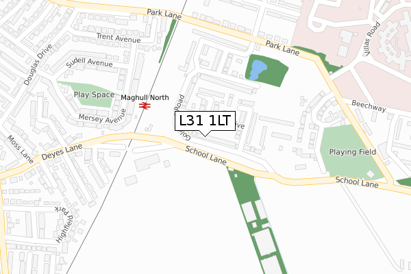
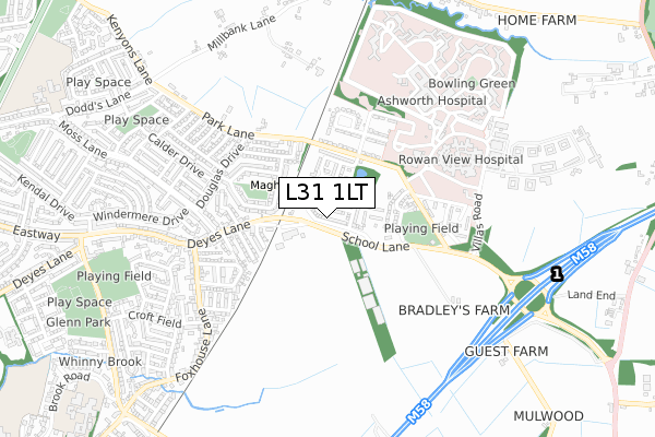
L31 1LT is located in the Sudell electoral ward, within the metropolitan district of Sefton and the English Parliamentary constituency of Sefton Central. The Sub Integrated Care Board (ICB) Location is NHS Cheshire and Merseyside ICB - 01T and the police force is Merseyside. This postcode has been in use since November 2017.


GetTheData
Source: OS Open Zoomstack (Ordnance Survey)
Licence: Open Government Licence (requires attribution)
Attribution: Contains OS data © Crown copyright and database right 2025
Source: Open Postcode Geo
Licence: Open Government Licence (requires attribution)
Attribution: Contains OS data © Crown copyright and database right 2025; Contains Royal Mail data © Royal Mail copyright and database right 2025; Source: Office for National Statistics licensed under the Open Government Licence v.3.0
| Easting | 339225 |
| Northing | 402674 |
| Latitude | 53.517226 |
| Longitude | -2.918041 |
GetTheData
Source: Open Postcode Geo
Licence: Open Government Licence
| Country | England |
| Postcode District | L31 |
➜ See where L31 is on a map ➜ Where is Maghull? | |
GetTheData
Source: Land Registry Price Paid Data
Licence: Open Government Licence
| Ward | Sudell |
| Constituency | Sefton Central |
GetTheData
Source: ONS Postcode Database
Licence: Open Government Licence
2025 31 JAN £280,000 |
2024 15 NOV £336,600 |
2024 25 OCT £303,000 |
2024 15 JUL £247,000 |
2024 9 MAY £258,000 |
2024 27 MAR £285,000 |
2023 17 MAR £312,000 |
2022 22 AUG £355,000 |
2022 8 JUL £252,500 |
2022 13 JUN £255,000 |
GetTheData
Source: HM Land Registry Price Paid Data
Licence: Contains HM Land Registry data © Crown copyright and database right 2025. This data is licensed under the Open Government Licence v3.0.
| Parkbourn Drive (Park Lane) | Moss Side | 139m |
| Parkbourn Drive (Park Lane) | Moss Side | 151m |
| Beechway (Park Lane) | Moss Side | 332m |
| School Lane (Park Lane) | Moss Side | 339m |
| Ashworth Hospital (Villas Road) | Moss Side | 348m |
| Maghull Station | 1.5km |
| Town Green Station | 3km |
| Kirkby Station | 3.6km |
GetTheData
Source: NaPTAN
Licence: Open Government Licence
| Percentage of properties with Next Generation Access | 97.7% |
| Percentage of properties with Superfast Broadband | 93.2% |
| Percentage of properties with Ultrafast Broadband | 93.2% |
| Percentage of properties with Full Fibre Broadband | 93.2% |
Superfast Broadband is between 30Mbps and 300Mbps
Ultrafast Broadband is > 300Mbps
| Percentage of properties unable to receive 2Mbps | 0.0% |
| Percentage of properties unable to receive 5Mbps | 0.0% |
| Percentage of properties unable to receive 10Mbps | 0.0% |
| Percentage of properties unable to receive 30Mbps | 4.5% |
GetTheData
Source: Ofcom
Licence: Ofcom Terms of Use (requires attribution)
GetTheData
Source: ONS Postcode Database
Licence: Open Government Licence


➜ Get more ratings from the Food Standards Agency
GetTheData
Source: Food Standards Agency
Licence: FSA terms & conditions
| Last Collection | |||
|---|---|---|---|
| Location | Mon-Fri | Sat | Distance |
| Lydiate Church | 17:00 | 12:00 | 956m |
| Dodds Lane | 17:30 | 12:00 | 1,812m |
| Moorhey Road | 17:00 | 12:00 | 2,367m |
GetTheData
Source: Dracos
Licence: Creative Commons Attribution-ShareAlike
The below table lists the International Territorial Level (ITL) codes (formerly Nomenclature of Territorial Units for Statistics (NUTS) codes) and Local Administrative Units (LAU) codes for L31 1LT:
| ITL 1 Code | Name |
|---|---|
| TLD | North West (England) |
| ITL 2 Code | Name |
| TLD7 | Merseyside |
| ITL 3 Code | Name |
| TLD73 | Sefton |
| LAU 1 Code | Name |
| E08000014 | Sefton |
GetTheData
Source: ONS Postcode Directory
Licence: Open Government Licence
The below table lists the Census Output Area (OA), Lower Layer Super Output Area (LSOA), and Middle Layer Super Output Area (MSOA) for L31 1LT:
| Code | Name | |
|---|---|---|
| OA | E00035945 | |
| LSOA | E01033096 | Sefton 018F |
| MSOA | E02001446 | Sefton 018 |
GetTheData
Source: ONS Postcode Directory
Licence: Open Government Licence
| L31 1HE | Park Lane | 145m |
| L31 1JD | Parkbourn Square | 207m |
| L31 1LH | Parkbourn | 244m |
| L31 9PJ | Mersey Avenue | 282m |
| L31 9DE | Trent Avenue | 296m |
| L31 1JB | Parkbourn North | 296m |
| L31 9PL | Mersey Avenue | 326m |
| L31 9AS | Park Lane | 339m |
| L31 9PN | Sudell Avenue | 360m |
| L31 9BX | Hesketh Drive | 397m |
GetTheData
Source: Open Postcode Geo; Land Registry Price Paid Data
Licence: Open Government Licence