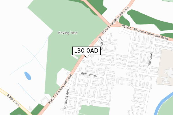
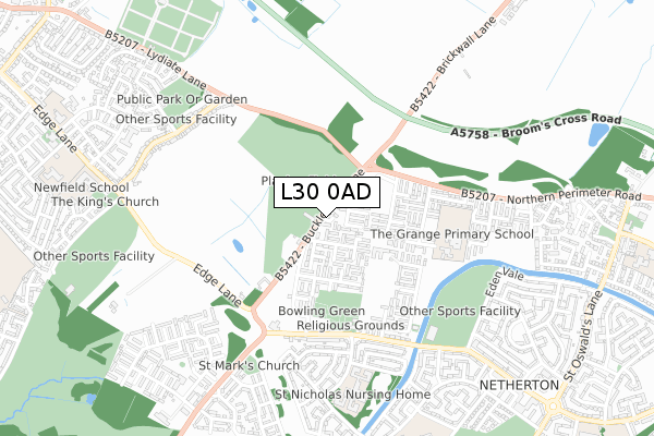
L30 0AD is located in the St Oswald electoral ward, within the metropolitan district of Sefton and the English Parliamentary constituency of Bootle. The Sub Integrated Care Board (ICB) Location is NHS Cheshire and Merseyside ICB - 01T and the police force is Merseyside. This postcode has been in use since June 2017.


GetTheData
Source: OS Open Zoomstack (Ordnance Survey)
Licence: Open Government Licence (requires attribution)
Attribution: Contains OS data © Crown copyright and database right 2024
Source: Open Postcode Geo
Licence: Open Government Licence (requires attribution)
Attribution: Contains OS data © Crown copyright and database right 2024; Contains Royal Mail data © Royal Mail copyright and database right 2024; Source: Office for National Statistics licensed under the Open Government Licence v.3.0
| Easting | 334776 |
| Northing | 400162 |
| Latitude | 53.494117 |
| Longitude | -2.984604 |
GetTheData
Source: Open Postcode Geo
Licence: Open Government Licence
| Country | England |
| Postcode District | L30 |
| ➜ L30 open data dashboard ➜ See where L30 is on a map ➜ Where is Bootle? | |
GetTheData
Source: Land Registry Price Paid Data
Licence: Open Government Licence
| Ward | St Oswald |
| Constituency | Bootle |
GetTheData
Source: ONS Postcode Database
Licence: Open Government Licence
| January 2024 | Criminal damage and arson | On or near Fleetwood'S Lane | 460m |
| January 2024 | Violence and sexual offences | On or near Fleetwood'S Lane | 460m |
| January 2024 | Violence and sexual offences | On or near Fleetwood'S Lane | 460m |
| ➜ Get more crime data in our Crime section | |||
GetTheData
Source: data.police.uk
Licence: Open Government Licence
| Great Hey (Buckley Hill Lane) | Sefton | 34m |
| Red Lomes (Buckley Hill Lane) | Sefton | 66m |
| Granams Croft (Almonds Turn) | Buckley Hill | 261m |
| Granams Croft (Almonds Turn) | Buckley Hill | 291m |
| Higher End Park (Northern Perimeter Road) | Netherton | 340m |
| Old Roan Station | 2.4km |
| Aintree Station | 2.9km |
| Seaforth & Litherland Station | 3.4km |
GetTheData
Source: NaPTAN
Licence: Open Government Licence
➜ Broadband speed and availability dashboard for L30 0AD
| Percentage of properties with Next Generation Access | 100.0% |
| Percentage of properties with Superfast Broadband | 100.0% |
| Percentage of properties with Ultrafast Broadband | 100.0% |
| Percentage of properties with Full Fibre Broadband | 0.0% |
Superfast Broadband is between 30Mbps and 300Mbps
Ultrafast Broadband is > 300Mbps
| Median download speed | 52.5Mbps |
| Average download speed | 97.9Mbps |
| Maximum download speed | 350.00Mbps |
| Median upload speed | 9.8Mbps |
| Average upload speed | 9.8Mbps |
| Maximum upload speed | 10.00Mbps |
| Percentage of properties unable to receive 2Mbps | 0.0% |
| Percentage of properties unable to receive 5Mbps | 0.0% |
| Percentage of properties unable to receive 10Mbps | 0.0% |
| Percentage of properties unable to receive 30Mbps | 0.0% |
➜ Broadband speed and availability dashboard for L30 0AD
GetTheData
Source: Ofcom
Licence: Ofcom Terms of Use (requires attribution)
GetTheData
Source: ONS Postcode Database
Licence: Open Government Licence


➜ Get more ratings from the Food Standards Agency
GetTheData
Source: Food Standards Agency
Licence: FSA terms & conditions
| Last Collection | |||
|---|---|---|---|
| Location | Mon-Fri | Sat | Distance |
| Swifts Lane | 17:15 | 12:00 | 452m |
| Marion Square Post Office | 17:00 | 12:00 | 1,021m |
| Poulsom Drive | 17:00 | 12:00 | 1,123m |
GetTheData
Source: Dracos
Licence: Creative Commons Attribution-ShareAlike
| Facility | Distance |
|---|---|
| Buckley Hill Playing Fields Buckley Hill Lane, Sefton Grass Pitches | 69m |
| Grange Primary School Stonyfield, Bootle Grass Pitches | 490m |
| Netherton Activity Centre Glovers Lane, Bootle Health and Fitness Gym, Sports Hall, Studio, Artificial Grass Pitch, Grass Pitches | 597m |
GetTheData
Source: Active Places
Licence: Open Government Licence
| School | Phase of Education | Distance |
|---|---|---|
| The Grange Primary School Stonyfield, Sefton, Bootle, L30 0QS | Primary | 490m |
| IMPACT Daleacre Campus, Daleacre Drive, Bootle, Liverpool, L30 2QQ | Not applicable | 872m |
| Netherton Moss Primary School Swifts Lane, Netherton, Bootle, L30 3RU | Primary | 915m |
GetTheData
Source: Edubase
Licence: Open Government Licence
The below table lists the International Territorial Level (ITL) codes (formerly Nomenclature of Territorial Units for Statistics (NUTS) codes) and Local Administrative Units (LAU) codes for L30 0AD:
| ITL 1 Code | Name |
|---|---|
| TLD | North West (England) |
| ITL 2 Code | Name |
| TLD7 | Merseyside |
| ITL 3 Code | Name |
| TLD73 | Sefton |
| LAU 1 Code | Name |
| E08000014 | Sefton |
GetTheData
Source: ONS Postcode Directory
Licence: Open Government Licence
The below table lists the Census Output Area (OA), Lower Layer Super Output Area (LSOA), and Middle Layer Super Output Area (MSOA) for L30 0AD:
| Code | Name | |
|---|---|---|
| OA | E00170479 | |
| LSOA | E01007092 | Sefton 023E |
| MSOA | E02001451 | Sefton 023 |
GetTheData
Source: ONS Postcode Directory
Licence: Open Government Licence
| L30 0PR | Pickering Rake | 82m |
| L30 0PU | Harrocks Close | 89m |
| L30 0PS | Red Lomes | 122m |
| L30 0QE | Stanton Close | 124m |
| L30 0PT | Buckley Way | 129m |
| L30 0QA | Tarbrock Court | 135m |
| L30 0QB | Muttocks Rake | 160m |
| L30 0PP | Mill Court | 168m |
| L30 0QD | Maypole Court | 178m |
| L30 0PW | Rushtons Walk | 192m |
GetTheData
Source: Open Postcode Geo; Land Registry Price Paid Data
Licence: Open Government Licence