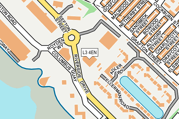
L3 4EN is located in the Festival Gardens electoral ward, within the metropolitan district of Liverpool and the English Parliamentary constituency of Liverpool, Riverside. The Sub Integrated Care Board (ICB) Location is NHS Cheshire and Merseyside ICB - 99A and the police force is Merseyside. This postcode has been in use since December 2000.


GetTheData
Source: OS OpenMap – Local (Ordnance Survey)
Source: OS VectorMap District (Ordnance Survey)
Licence: Open Government Licence (requires attribution)
| Easting | 335548 |
| Northing | 387419 |
| Latitude | 53.379689 |
| Longitude | -2.970358 |
GetTheData
Source: Open Postcode Geo
Licence: Open Government Licence
| Country | England |
| Postcode District | L3 |
➜ See where L3 is on a map ➜ Where is Liverpool? | |
GetTheData
Source: Land Registry Price Paid Data
Licence: Open Government Licence
Elevation or altitude of L3 4EN as distance above sea level:
| Metres | Feet | |
|---|---|---|
| Elevation | 10m | 33ft |
Elevation is measured from the approximate centre of the postcode, to the nearest point on an OS contour line from OS Terrain 50, which has contour spacing of ten vertical metres.
➜ How high above sea level am I? Find the elevation of your current position using your device's GPS.
GetTheData
Source: Open Postcode Elevation
Licence: Open Government Licence
| Ward | Festival Gardens |
| Constituency | Liverpool, Riverside |
GetTheData
Source: ONS Postcode Database
Licence: Open Government Licence
| Columbus Quay (Riverside Drive) | Dingle | 167m |
| Columbus Quay (Riverside Drive) | Dingle | 184m |
| Cockburn Street | Dingle | 189m |
| Malwood Street (Cockburn Street) | Dingle | 199m |
| Riverside Drive (Sefton Street) | Toxteth | 200m |
| Brunswick Station | 0.5km |
| St Michaels Station | 1.3km |
| Rock Ferry Station | 2.8km |
GetTheData
Source: NaPTAN
Licence: Open Government Licence
GetTheData
Source: ONS Postcode Database
Licence: Open Government Licence

➜ Get more ratings from the Food Standards Agency
GetTheData
Source: Food Standards Agency
Licence: FSA terms & conditions
| Last Collection | |||
|---|---|---|---|
| Location | Mon-Fri | Sat | Distance |
| Bersford Road | 17:00 | 12:00 | 241m |
| Cockburn Street Post Office | 17:00 | 12:00 | 369m |
| Mill Street | 17:00 | 12:00 | 405m |
GetTheData
Source: Dracos
Licence: Creative Commons Attribution-ShareAlike
The below table lists the International Territorial Level (ITL) codes (formerly Nomenclature of Territorial Units for Statistics (NUTS) codes) and Local Administrative Units (LAU) codes for L3 4EN:
| ITL 1 Code | Name |
|---|---|
| TLD | North West (England) |
| ITL 2 Code | Name |
| TLD7 | Merseyside |
| ITL 3 Code | Name |
| TLD72 | Liverpool |
| LAU 1 Code | Name |
| E08000012 | Liverpool |
GetTheData
Source: ONS Postcode Directory
Licence: Open Government Licence
The below table lists the Census Output Area (OA), Lower Layer Super Output Area (LSOA), and Middle Layer Super Output Area (MSOA) for L3 4EN:
| Code | Name | |
|---|---|---|
| OA | E00176607 | |
| LSOA | E01033748 | Liverpool 050I |
| MSOA | E02001396 | Liverpool 050 |
GetTheData
Source: ONS Postcode Directory
Licence: Open Government Licence
| L8 4QX | Grafton Street | 74m |
| L3 4FX | Adler Way | 108m |
| L8 4RX | Netherby Street | 126m |
| L8 4RU | Sandbeck Street | 134m |
| L8 4SA | Malwood Street | 136m |
| L3 4FG | Ellerman Road | 143m |
| L8 4RT | Bowood Street | 144m |
| L8 4SB | Gosford Street | 149m |
| L8 4RS | Althorp Street | 168m |
| L3 4FD | Ellerman Road | 176m |
GetTheData
Source: Open Postcode Geo; Land Registry Price Paid Data
Licence: Open Government Licence