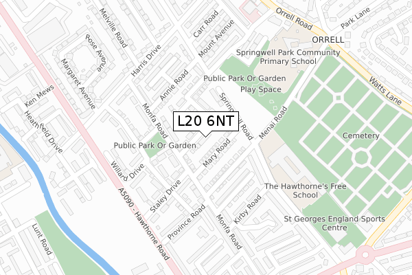
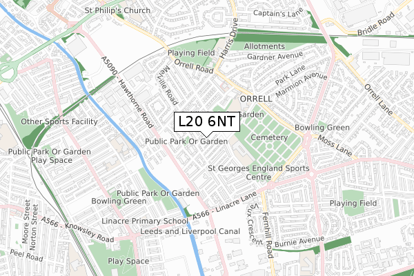
L20 6NT is located in the Litherland electoral ward, within the metropolitan district of Sefton and the English Parliamentary constituency of Bootle. The Sub Integrated Care Board (ICB) Location is NHS Cheshire and Merseyside ICB - 01T and the police force is Merseyside. This postcode has been in use since July 2018.


GetTheData
Source: OS Open Zoomstack (Ordnance Survey)
Licence: Open Government Licence (requires attribution)
Attribution: Contains OS data © Crown copyright and database right 2024
Source: Open Postcode Geo
Licence: Open Government Licence (requires attribution)
Attribution: Contains OS data © Crown copyright and database right 2024; Contains Royal Mail data © Royal Mail copyright and database right 2024; Source: Office for National Statistics licensed under the Open Government Licence v.3.0
| Easting | 334643 |
| Northing | 396810 |
| Latitude | 53.463975 |
| Longitude | -2.985910 |
GetTheData
Source: Open Postcode Geo
Licence: Open Government Licence
| Country | England |
| Postcode District | L20 |
| ➜ L20 open data dashboard ➜ See where L20 is on a map ➜ Where is Bootle? | |
GetTheData
Source: Land Registry Price Paid Data
Licence: Open Government Licence
| Ward | Litherland |
| Constituency | Bootle |
GetTheData
Source: ONS Postcode Database
Licence: Open Government Licence
2022 25 FEB £240,000 |
2021 7 JUN £195,000 |
14, ELEANOR ROAD, BOOTLE, L20 6NT 2019 31 JUL £185,995 |
2019 21 JUN £186,995 |
11, ELEANOR ROAD, BOOTLE, L20 6NT 2019 14 JUN £186,995 |
15, ELEANOR ROAD, BOOTLE, L20 6NT 2019 31 MAY £186,995 |
7, ELEANOR ROAD, BOOTLE, L20 6NT 2019 29 MAR £187,995 |
16, ELEANOR ROAD, BOOTLE, L20 6NT 2019 14 MAR £185,995 |
12, ELEANOR ROAD, BOOTLE, L20 6NT 2019 4 MAR £185,995 |
6, ELEANOR ROAD, BOOTLE, L20 6NT 2019 28 FEB £189,995 |
GetTheData
Source: HM Land Registry Price Paid Data
Licence: Contains HM Land Registry data © Crown copyright and database right 2024. This data is licensed under the Open Government Licence v3.0.
| June 2022 | Public order | On or near Elizabeth Road | 23m |
| June 2022 | Drugs | On or near Springwell Road | 122m |
| June 2022 | Anti-social behaviour | On or near Arvon Street | 128m |
| ➜ Get more crime data in our Crime section | |||
GetTheData
Source: data.police.uk
Licence: Open Government Licence
| Menai Road (Fernhill Road) | Orrell | 148m |
| Kirby Road (Fernhill Road) | Orrell | 178m |
| Humphrey Street (Hawthorne Road) | Orrell | 252m |
| Harris Drive (Hawthorne Road) | Orrell | 262m |
| Orrell Road (Menai Road) | Orrell | 317m |
| Bootle New Strand Station | 1.3km |
| Seaforth & Litherland Station | 1.3km |
| Orrell Park Station | 1.5km |
GetTheData
Source: NaPTAN
Licence: Open Government Licence
| Percentage of properties with Next Generation Access | 100.0% |
| Percentage of properties with Superfast Broadband | 100.0% |
| Percentage of properties with Ultrafast Broadband | 75.8% |
| Percentage of properties with Full Fibre Broadband | 75.8% |
Superfast Broadband is between 30Mbps and 300Mbps
Ultrafast Broadband is > 300Mbps
| Percentage of properties unable to receive 2Mbps | 0.0% |
| Percentage of properties unable to receive 5Mbps | 0.0% |
| Percentage of properties unable to receive 10Mbps | 0.0% |
| Percentage of properties unable to receive 30Mbps | 0.0% |
GetTheData
Source: Ofcom
Licence: Ofcom Terms of Use (requires attribution)
GetTheData
Source: ONS Postcode Database
Licence: Open Government Licence


➜ Get more ratings from the Food Standards Agency
GetTheData
Source: Food Standards Agency
Licence: FSA terms & conditions
| Last Collection | |||
|---|---|---|---|
| Location | Mon-Fri | Sat | Distance |
| Bailey Drive | 17:15 | 12:00 | 725m |
| Moss Lane Post Office | 17:00 | 12:00 | 1,067m |
| Wembley Gardens | 16:00 | 12:00 | 1,097m |
GetTheData
Source: Dracos
Licence: Creative Commons Attribution-ShareAlike
| Facility | Distance |
|---|---|
| King's Leadership Academy Hawthornes Fernhill Road, Bootle Sports Hall, Studio, Health and Fitness Gym | 215m |
| Orrell Mount Park Orrell Road, Bootle Grass Pitches, Artificial Grass Pitch | 526m |
| St Wilfrid's Catholic High School (Closed) Orrell Road, Litherland , Liverpool Sports Hall, Grass Pitches | 775m |
GetTheData
Source: Active Places
Licence: Open Government Licence
| School | Phase of Education | Distance |
|---|---|---|
| King's Leadership Academy Hawthornes Fernhill Road, Bootle, L20 6AQ | Secondary | 217m |
| Greenacre Community Nursery School Province Place, Bootle, L20 6PJ | Nursery | 230m |
| Springwell Park Community Primary School Menai Road, Bootle, L20 6PG | Primary | 299m |
GetTheData
Source: Edubase
Licence: Open Government Licence
The below table lists the International Territorial Level (ITL) codes (formerly Nomenclature of Territorial Units for Statistics (NUTS) codes) and Local Administrative Units (LAU) codes for L20 6NT:
| ITL 1 Code | Name |
|---|---|
| TLD | North West (England) |
| ITL 2 Code | Name |
| TLD7 | Merseyside |
| ITL 3 Code | Name |
| TLD73 | Sefton |
| LAU 1 Code | Name |
| E08000014 | Sefton |
GetTheData
Source: ONS Postcode Directory
Licence: Open Government Licence
The below table lists the Census Output Area (OA), Lower Layer Super Output Area (LSOA), and Middle Layer Super Output Area (MSOA) for L20 6NT:
| Code | Name | |
|---|---|---|
| OA | E00170486 | |
| LSOA | E01033095 | Sefton 033F |
| MSOA | E02001461 | Sefton 033 |
GetTheData
Source: ONS Postcode Directory
Licence: Open Government Licence
| L20 6AW | Menai Road | 86m |
| L20 6LP | Monfa Road | 89m |
| L20 6BE | Monfa Road | 96m |
| L20 6NA | Marion Road | 98m |
| L20 6LU | Springwell Road | 114m |
| L20 6NQ | Annie Road | 136m |
| L20 6FB | Glynne Drive | 141m |
| L20 6NG | Annie Road | 159m |
| L20 6FA | St Elizabeth Avenue | 166m |
| L20 6JS | Monfa Road | 167m |
GetTheData
Source: Open Postcode Geo; Land Registry Price Paid Data
Licence: Open Government Licence