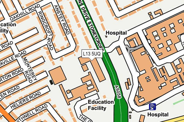
L13 5UQ is located in the Broadgreen electoral ward, within the metropolitan district of Liverpool and the English Parliamentary constituency of Liverpool, Wavertree. The Sub Integrated Care Board (ICB) Location is NHS Cheshire and Merseyside ICB - 99A and the police force is Merseyside. This postcode has been in use since January 1980.


GetTheData
Source: OS OpenMap – Local (Ordnance Survey)
Source: OS VectorMap District (Ordnance Survey)
Licence: Open Government Licence (requires attribution)
| Easting | 340026 |
| Northing | 390783 |
| Latitude | 53.410450 |
| Longitude | -2.903691 |
GetTheData
Source: Open Postcode Geo
Licence: Open Government Licence
| Country | England |
| Postcode District | L13 |
➜ See where L13 is on a map ➜ Where is Liverpool? | |
GetTheData
Source: Land Registry Price Paid Data
Licence: Open Government Licence
Elevation or altitude of L13 5UQ as distance above sea level:
| Metres | Feet | |
|---|---|---|
| Elevation | 60m | 197ft |
Elevation is measured from the approximate centre of the postcode, to the nearest point on an OS contour line from OS Terrain 50, which has contour spacing of ten vertical metres.
➜ How high above sea level am I? Find the elevation of your current position using your device's GPS.
GetTheData
Source: Open Postcode Elevation
Licence: Open Government Licence
| Ward | Broadgreen |
| Constituency | Liverpool, Wavertree |
GetTheData
Source: ONS Postcode Database
Licence: Open Government Licence
| Broadgeen Hospital (Queens Drive) | Stoneycroft | 145m |
| Thomas Drive (Queens Drive) | Stoneycroft | 194m |
| Edge Lane Drive (Queens Drive) | Broad Green | 240m |
| The Green (Broadgreen Road) | Oak Vale Park | 247m |
| Oakhill Road (Queens Drive) | Stoneycroft | 249m |
| Broad Green Station | 0.8km |
| Wavertree Technology Park Station | 1.4km |
| Edge Hill Station | 3km |
GetTheData
Source: NaPTAN
Licence: Open Government Licence
GetTheData
Source: ONS Postcode Database
Licence: Open Government Licence


➜ Get more ratings from the Food Standards Agency
GetTheData
Source: Food Standards Agency
Licence: FSA terms & conditions
| Last Collection | |||
|---|---|---|---|
| Location | Mon-Fri | Sat | Distance |
| Broadgreen Road | 16:15 | 12:00 | 359m |
| Northway | 16:30 | 12:00 | 722m |
| Edge Lane Drive | 16:15 | 12:00 | 729m |
GetTheData
Source: Dracos
Licence: Creative Commons Attribution-ShareAlike
The below table lists the International Territorial Level (ITL) codes (formerly Nomenclature of Territorial Units for Statistics (NUTS) codes) and Local Administrative Units (LAU) codes for L13 5UQ:
| ITL 1 Code | Name |
|---|---|
| TLD | North West (England) |
| ITL 2 Code | Name |
| TLD7 | Merseyside |
| ITL 3 Code | Name |
| TLD72 | Liverpool |
| LAU 1 Code | Name |
| E08000012 | Liverpool |
GetTheData
Source: ONS Postcode Directory
Licence: Open Government Licence
The below table lists the Census Output Area (OA), Lower Layer Super Output Area (LSOA), and Middle Layer Super Output Area (MSOA) for L13 5UQ:
| Code | Name | |
|---|---|---|
| OA | E00033284 | |
| LSOA | E01006567 | Liverpool 026A |
| MSOA | E02001372 | Liverpool 026 |
GetTheData
Source: ONS Postcode Directory
Licence: Open Government Licence
| L13 4BY | The Green | 80m |
| L13 4DD | Withnell Close | 112m |
| L13 4BX | The Green | 123m |
| L13 4DH | Heliers Road | 154m |
| L13 4DB | Withnell Road | 159m |
| L13 4DF | Glen Road | 166m |
| L13 4DA | Whitehouse Road | 178m |
| L13 4DE | Glen Road | 186m |
| L13 5UP | Anstey Road | 189m |
| L13 4DQ | Gorton Road | 195m |
GetTheData
Source: Open Postcode Geo; Land Registry Price Paid Data
Licence: Open Government Licence