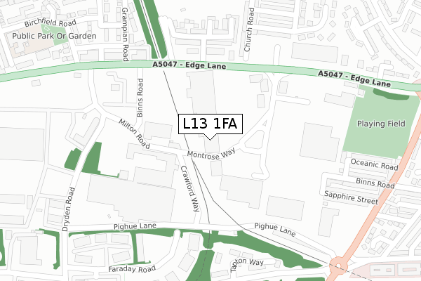
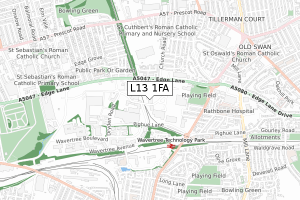
L13 1FA is located in the Old Swan West electoral ward, within the metropolitan district of Liverpool and the English Parliamentary constituency of Liverpool, Wavertree. The Sub Integrated Care Board (ICB) Location is NHS Cheshire and Merseyside ICB - 99A and the police force is Merseyside. This postcode has been in use since August 2017.


GetTheData
Source: OS Open Zoomstack (Ordnance Survey)
Licence: Open Government Licence (requires attribution)
Attribution: Contains OS data © Crown copyright and database right 2024
Source: Open Postcode Geo
Licence: Open Government Licence (requires attribution)
Attribution: Contains OS data © Crown copyright and database right 2024; Contains Royal Mail data © Royal Mail copyright and database right 2024; Source: Office for National Statistics licensed under the Open Government Licence v.3.0
| Easting | 338564 |
| Northing | 390602 |
| Latitude | 53.408655 |
| Longitude | -2.925646 |
GetTheData
Source: Open Postcode Geo
Licence: Open Government Licence
| Country | England |
| Postcode District | L13 |
| ➜ L13 open data dashboard ➜ See where L13 is on a map ➜ Where is Liverpool? | |
GetTheData
Source: Land Registry Price Paid Data
Licence: Open Government Licence
| Ward | Old Swan West |
| Constituency | Liverpool, Wavertree |
GetTheData
Source: ONS Postcode Database
Licence: Open Government Licence
| December 2023 | Violence and sexual offences | On or near Parking Area | 466m |
| October 2023 | Other theft | On or near Parking Area | 466m |
| October 2023 | Vehicle crime | On or near Parking Area | 466m |
| ➜ Get more crime data in our Crime section | |||
GetTheData
Source: data.police.uk
Licence: Open Government Licence
| Edge Lane Retail Park (Binns Road) | Old Swan | 160m |
| Henry Street (Edge Lane) | Old Swan | 169m |
| Ardleigh Road (Edge Lane) | Old Swan | 198m |
| Grampian Road (Edge Lane) | Fairfield | 296m |
| Elmway Close (Edge Lane) | Old Swan | 356m |
| Wavertree Technology Park Station | 0.4km |
| Edge Hill Station | 1.5km |
| Broad Green Station | 2.2km |
GetTheData
Source: NaPTAN
Licence: Open Government Licence
| Median download speed | 10.0Mbps |
| Average download speed | 25.7Mbps |
| Maximum download speed | 80.00Mbps |
| Median upload speed | 0.9Mbps |
| Average upload speed | 5.2Mbps |
| Maximum upload speed | 20.00Mbps |
GetTheData
Source: Ofcom
Licence: Ofcom Terms of Use (requires attribution)
GetTheData
Source: ONS Postcode Database
Licence: Open Government Licence


➜ Get more ratings from the Food Standards Agency
GetTheData
Source: Food Standards Agency
Licence: FSA terms & conditions
| Last Collection | |||
|---|---|---|---|
| Location | Mon-Fri | Sat | Distance |
| Church Road | 16:00 | 12:00 | 211m |
| Edge Lane Drive | 16:15 | 12:00 | 744m |
| Sandown Lane | 16:00 | 12:00 | 773m |
GetTheData
Source: Dracos
Licence: Creative Commons Attribution-ShareAlike
| Facility | Distance |
|---|---|
| Total Fitness (Liverpool - Edge Lane) (Closed) Binns Road, Edge Lane Retail Park, Liverpool Swimming Pool, Health and Fitness Gym, Studio | 48m |
| Jd Gyms (Liverpool Edge Lane) Edge Lane, Fairfield, Liverpool Health and Fitness Gym | 544m |
| Fairfield Police Club (Closed) Prescot Road, Fairfield, Liverpool Grass Pitches | 706m |
GetTheData
Source: Active Places
Licence: Open Government Licence
| School | Phase of Education | Distance |
|---|---|---|
| Nazene Danielle School of Performing Arts 3 Newton Court, Farraday Road, Wavertree Technology Park, Liverpool, L13 1EJ | Not applicable | 354m |
| Phoenix Primary School Birchfield Road, Liverpool, L7 9LY | Primary | 536m |
| St Cuthbert's Catholic Primary and Nursery School 30 Church Road, Liverpool, L13 2BA | Primary | 588m |
GetTheData
Source: Edubase
Licence: Open Government Licence
The below table lists the International Territorial Level (ITL) codes (formerly Nomenclature of Territorial Units for Statistics (NUTS) codes) and Local Administrative Units (LAU) codes for L13 1FA:
| ITL 1 Code | Name |
|---|---|
| TLD | North West (England) |
| ITL 2 Code | Name |
| TLD7 | Merseyside |
| ITL 3 Code | Name |
| TLD72 | Liverpool |
| LAU 1 Code | Name |
| E08000012 | Liverpool |
GetTheData
Source: ONS Postcode Directory
Licence: Open Government Licence
The below table lists the Census Output Area (OA), Lower Layer Super Output Area (LSOA), and Middle Layer Super Output Area (MSOA) for L13 1FA:
| Code | Name | |
|---|---|---|
| OA | E00165727 | |
| LSOA | E01032509 | Liverpool 027H |
| MSOA | E02001373 | Liverpool 027 |
GetTheData
Source: ONS Postcode Directory
Licence: Open Government Licence
| L7 9NF | Binns Road | 81m |
| L13 1AD | Edge Lane | 213m |
| L13 2BD | Ardleigh Road | 260m |
| L13 1DA | Tapton Way | 272m |
| L13 2BQ | Ardleigh Grove | 275m |
| L13 2BE | Ardleigh Place | 288m |
| L13 2BG | Ardleigh Close | 291m |
| L13 2AY | Church Road | 298m |
| L13 1BR | Runic Street | 318m |
| L13 2BH | Pensarn Road | 319m |
GetTheData
Source: Open Postcode Geo; Land Registry Price Paid Data
Licence: Open Government Licence