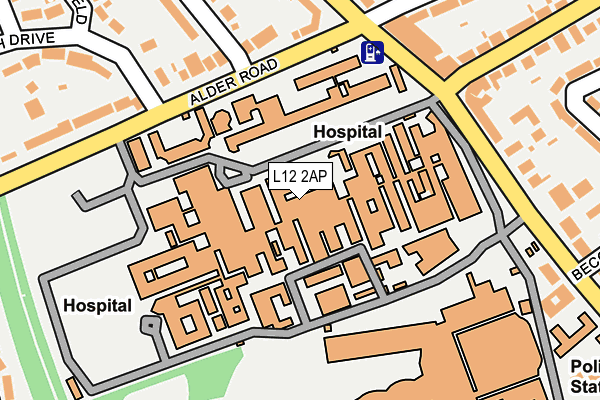
L12 2AP is located in the Sandfield Park electoral ward, within the metropolitan district of Liverpool and the English Parliamentary constituency of Liverpool, West Derby. The Sub Integrated Care Board (ICB) Location is NHS Cheshire and Merseyside ICB - 99A and the police force is Merseyside. This postcode has been in use since January 1980.


GetTheData
Source: OS OpenMap – Local (Ordnance Survey)
Source: OS VectorMap District (Ordnance Survey)
Licence: Open Government Licence (requires attribution)
| Easting | 340433 |
| Northing | 391981 |
| Latitude | 53.421263 |
| Longitude | -2.897795 |
GetTheData
Source: Open Postcode Geo
Licence: Open Government Licence
| Country | England |
| Postcode District | L12 |
➜ See where L12 is on a map ➜ Where is Liverpool? | |
GetTheData
Source: Land Registry Price Paid Data
Licence: Open Government Licence
Elevation or altitude of L12 2AP as distance above sea level:
| Metres | Feet | |
|---|---|---|
| Elevation | 40m | 131ft |
Elevation is measured from the approximate centre of the postcode, to the nearest point on an OS contour line from OS Terrain 50, which has contour spacing of ten vertical metres.
➜ How high above sea level am I? Find the elevation of your current position using your device's GPS.
GetTheData
Source: Open Postcode Elevation
Licence: Open Government Licence
| Ward | Sandfield Park |
| Constituency | Liverpool, West Derby |
GetTheData
Source: ONS Postcode Database
Licence: Open Government Licence
| Alder Road (Eaton Road) | West Derby | 41m |
| Eaton Road (Alder Road) | West Derby | 87m |
| Honeys Green Lane (Eaton Road) | West Derby | 109m |
| Honeys Green Lane (Eaton Road) | West Derby | 131m |
| Whinmoor Road (Alder Road) | West Derby | 171m |
| Broad Green Station | 1.7km |
| Wavertree Technology Park Station | 2.4km |
| Roby Station | 3km |
GetTheData
Source: NaPTAN
Licence: Open Government Licence
GetTheData
Source: ONS Postcode Database
Licence: Open Government Licence

➜ Get more ratings from the Food Standards Agency
GetTheData
Source: Food Standards Agency
Licence: FSA terms & conditions
| Last Collection | |||
|---|---|---|---|
| Location | Mon-Fri | Sat | Distance |
| Eaton Road North | 16:15 | 12:00 | 416m |
| Town Row Delivery Office | 17:30 | 12:00 | 1,041m |
| Derby Lane | 17:30 | 12:00 | 1,117m |
GetTheData
Source: Dracos
Licence: Creative Commons Attribution-ShareAlike
The below table lists the International Territorial Level (ITL) codes (formerly Nomenclature of Territorial Units for Statistics (NUTS) codes) and Local Administrative Units (LAU) codes for L12 2AP:
| ITL 1 Code | Name |
|---|---|
| TLD | North West (England) |
| ITL 2 Code | Name |
| TLD7 | Merseyside |
| ITL 3 Code | Name |
| TLD72 | Liverpool |
| LAU 1 Code | Name |
| E08000012 | Liverpool |
GetTheData
Source: ONS Postcode Directory
Licence: Open Government Licence
The below table lists the Census Output Area (OA), Lower Layer Super Output Area (LSOA), and Middle Layer Super Output Area (MSOA) for L12 2AP:
| Code | Name | |
|---|---|---|
| OA | E00033294 | |
| LSOA | E01006570 | Liverpool 026C |
| MSOA | E02001372 | Liverpool 026 |
GetTheData
Source: ONS Postcode Directory
Licence: Open Government Licence
| L12 2AH | Eaton Road | 73m |
| L12 9ES | Alder Road | 155m |
| L12 9EN | Honeys Green Lane | 165m |
| L12 2AJ | Eaton Road | 176m |
| L12 9EU | Agincourt Road | 195m |
| L12 9EW | Honeys Green Lane | 202m |
| L12 2BA | Alder Road | 241m |
| L12 9EX | Valescourt Road | 244m |
| L12 9ET | Sibford Road | 250m |
| L12 2AN | Eaton Road | 263m |
GetTheData
Source: Open Postcode Geo; Land Registry Price Paid Data
Licence: Open Government Licence