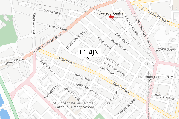
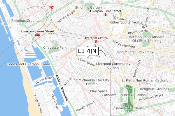
L1 4JN lies on Parr Street in Liverpool. L1 4JN is located in the City Centre South electoral ward, within the metropolitan district of Liverpool and the English Parliamentary constituency of Liverpool, Riverside. The Sub Integrated Care Board (ICB) Location is NHS Cheshire and Merseyside ICB - 99A and the police force is Merseyside. This postcode has been in use since January 1980.


GetTheData
Source: OS Open Zoomstack (Ordnance Survey)
Licence: Open Government Licence (requires attribution)
Attribution: Contains OS data © Crown copyright and database right 2025
Source: Open Postcode Geo
Licence: Open Government Licence (requires attribution)
Attribution: Contains OS data © Crown copyright and database right 2025; Contains Royal Mail data © Royal Mail copyright and database right 2025; Source: Office for National Statistics licensed under the Open Government Licence v.3.0
| Easting | 334874 |
| Northing | 389928 |
| Latitude | 53.402155 |
| Longitude | -2.981007 |
GetTheData
Source: Open Postcode Geo
Licence: Open Government Licence
| Street | Parr Street |
| Town/City | Liverpool |
| Country | England |
| Postcode District | L1 |
➜ See where L1 is on a map ➜ Where is Liverpool? | |
GetTheData
Source: Land Registry Price Paid Data
Licence: Open Government Licence
Elevation or altitude of L1 4JN as distance above sea level:
| Metres | Feet | |
|---|---|---|
| Elevation | 20m | 66ft |
Elevation is measured from the approximate centre of the postcode, to the nearest point on an OS contour line from OS Terrain 50, which has contour spacing of ten vertical metres.
➜ How high above sea level am I? Find the elevation of your current position using your device's GPS.
GetTheData
Source: Open Postcode Elevation
Licence: Open Government Licence
| Ward | City Centre South |
| Constituency | Liverpool, Riverside |
GetTheData
Source: ONS Postcode Database
Licence: Open Government Licence
| Slater Street (Duke Street) | Liverpool | 66m |
| Suffolk Street (Duke Street) | Liverpool | 68m |
| Campbell Street (Duke Street) | Liverpool | 203m |
| Seel Street (Hanover Street) | Liverpool | 227m |
| Hanover Street | Liverpool | 237m |
| Liverpool Central Station | 0.3km |
| Liverpool Lime Street Station | 0.6km |
| Liverpool Lime Street Low Level Station | 0.7km |
GetTheData
Source: NaPTAN
Licence: Open Government Licence
| Percentage of properties with Next Generation Access | 0.0% |
| Percentage of properties with Superfast Broadband | 0.0% |
| Percentage of properties with Ultrafast Broadband | 0.0% |
| Percentage of properties with Full Fibre Broadband | 0.0% |
Superfast Broadband is between 30Mbps and 300Mbps
Ultrafast Broadband is > 300Mbps
| Median download speed | 19.0Mbps |
| Average download speed | 27.7Mbps |
| Maximum download speed | 76.10Mbps |
| Median upload speed | 0.9Mbps |
| Average upload speed | 4.1Mbps |
| Maximum upload speed | 20.00Mbps |
| Percentage of properties unable to receive 2Mbps | 0.0% |
| Percentage of properties unable to receive 5Mbps | 0.0% |
| Percentage of properties unable to receive 10Mbps | 0.0% |
| Percentage of properties unable to receive 30Mbps | 100.0% |
GetTheData
Source: Ofcom
Licence: Ofcom Terms of Use (requires attribution)
GetTheData
Source: ONS Postcode Database
Licence: Open Government Licence


➜ Get more ratings from the Food Standards Agency
GetTheData
Source: Food Standards Agency
Licence: FSA terms & conditions
| Last Collection | |||
|---|---|---|---|
| Location | Mon-Fri | Sat | Distance |
| Duke Street | 18:15 | 12:00 | 124m |
| Bold Street | 18:30 | 12:00 | 194m |
| Lyceum | 18:30 | 259m | |
GetTheData
Source: Dracos
Licence: Creative Commons Attribution-ShareAlike
The below table lists the International Territorial Level (ITL) codes (formerly Nomenclature of Territorial Units for Statistics (NUTS) codes) and Local Administrative Units (LAU) codes for L1 4JN:
| ITL 1 Code | Name |
|---|---|
| TLD | North West (England) |
| ITL 2 Code | Name |
| TLD7 | Merseyside |
| ITL 3 Code | Name |
| TLD72 | Liverpool |
| LAU 1 Code | Name |
| E08000012 | Liverpool |
GetTheData
Source: ONS Postcode Directory
Licence: Open Government Licence
The below table lists the Census Output Area (OA), Lower Layer Super Output Area (LSOA), and Middle Layer Super Output Area (MSOA) for L1 4JN:
| Code | Name | |
|---|---|---|
| OA | E00176735 | |
| LSOA | E01033761 | Liverpool 060D |
| MSOA | E02006932 | Liverpool 060 |
GetTheData
Source: ONS Postcode Directory
Licence: Open Government Licence
| L1 4BX | Slater Street | 35m |
| L1 4BE | Seel Street | 46m |
| L1 5AA | Duke Street | 86m |
| L1 5AT | Duke Street | 88m |
| L1 4BN | Concert Street | 98m |
| L1 4BS | Slater Street | 109m |
| L1 4AR | Fleet Street | 121m |
| L1 4AN | Fleet Street | 122m |
| L1 5AY | Henry Street | 124m |
| L1 5FE | Henry Street | 138m |
GetTheData
Source: Open Postcode Geo; Land Registry Price Paid Data
Licence: Open Government Licence