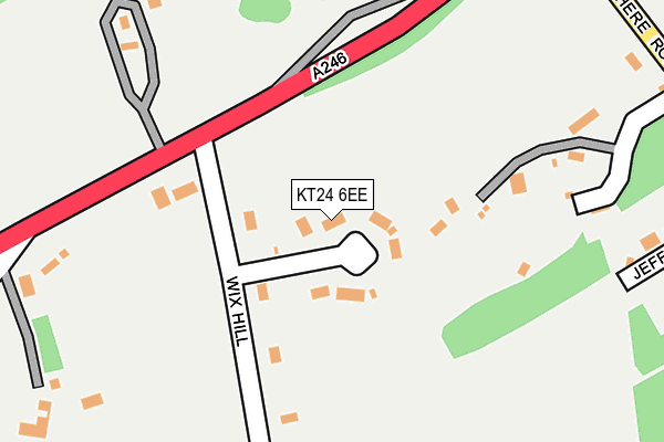
KT24 6EE lies on Wix Hill Close in West Horsley, Leatherhead. KT24 6EE is located in the Clandon & Horsley electoral ward, within the local authority district of Guildford and the English Parliamentary constituency of Mole Valley. The Sub Integrated Care Board (ICB) Location is NHS Surrey Heartlands ICB - 92A and the police force is Surrey. This postcode has been in use since January 1980.


GetTheData
Source: OS OpenMap – Local (Ordnance Survey)
Source: OS VectorMap District (Ordnance Survey)
Licence: Open Government Licence (requires attribution)
| Easting | 507693 |
| Northing | 152034 |
| Latitude | 51.257309 |
| Longitude | -0.458084 |
GetTheData
Source: Open Postcode Geo
Licence: Open Government Licence
| Street | Wix Hill Close |
| Locality | West Horsley |
| Town/City | Leatherhead |
| Country | England |
| Postcode District | KT24 |
➜ See where KT24 is on a map ➜ Where is West Horsley? | |
GetTheData
Source: Land Registry Price Paid Data
Licence: Open Government Licence
Elevation or altitude of KT24 6EE as distance above sea level:
| Metres | Feet | |
|---|---|---|
| Elevation | 100m | 328ft |
Elevation is measured from the approximate centre of the postcode, to the nearest point on an OS contour line from OS Terrain 50, which has contour spacing of ten vertical metres.
➜ How high above sea level am I? Find the elevation of your current position using your device's GPS.
GetTheData
Source: Open Postcode Elevation
Licence: Open Government Licence
| Ward | Clandon & Horsley |
| Constituency | Mole Valley |
GetTheData
Source: ONS Postcode Database
Licence: Open Government Licence
| Blakes Lane (Epsom Road) | West Horsley | 293m |
| Blakes Lane (Epsom Road) | West Horsley | 298m |
| Pumping Station (Epsom Road) | West Horsley | 317m |
| Pumping Station (Epsom Road) | West Horsley | 318m |
| Cranmore Lane (The Street) | West Horsley | 683m |
| Horsley Station | 2.9km |
| Clandon Station | 3.2km |
| Gomshall Station | 4.4km |
GetTheData
Source: NaPTAN
Licence: Open Government Licence
| Percentage of properties with Next Generation Access | 100.0% |
| Percentage of properties with Superfast Broadband | 100.0% |
| Percentage of properties with Ultrafast Broadband | 0.0% |
| Percentage of properties with Full Fibre Broadband | 0.0% |
Superfast Broadband is between 30Mbps and 300Mbps
Ultrafast Broadband is > 300Mbps
| Percentage of properties unable to receive 2Mbps | 0.0% |
| Percentage of properties unable to receive 5Mbps | 0.0% |
| Percentage of properties unable to receive 10Mbps | 0.0% |
| Percentage of properties unable to receive 30Mbps | 0.0% |
GetTheData
Source: Ofcom
Licence: Ofcom Terms of Use (requires attribution)
GetTheData
Source: ONS Postcode Database
Licence: Open Government Licence


➜ Get more ratings from the Food Standards Agency
GetTheData
Source: Food Standards Agency
Licence: FSA terms & conditions
| Last Collection | |||
|---|---|---|---|
| Location | Mon-Fri | Sat | Distance |
| Mount Pleasant | 17:15 | 12:00 | 782m |
| West Horsley Village | 17:15 | 12:00 | 1,014m |
| West Horsley Station | 17:15 | 12:00 | 1,453m |
GetTheData
Source: Dracos
Licence: Creative Commons Attribution-ShareAlike
The below table lists the International Territorial Level (ITL) codes (formerly Nomenclature of Territorial Units for Statistics (NUTS) codes) and Local Administrative Units (LAU) codes for KT24 6EE:
| ITL 1 Code | Name |
|---|---|
| TLJ | South East (England) |
| ITL 2 Code | Name |
| TLJ2 | Surrey, East and West Sussex |
| ITL 3 Code | Name |
| TLJ25 | West Surrey |
| LAU 1 Code | Name |
| E07000209 | Guildford |
GetTheData
Source: ONS Postcode Directory
Licence: Open Government Licence
The below table lists the Census Output Area (OA), Lower Layer Super Output Area (LSOA), and Middle Layer Super Output Area (MSOA) for KT24 6EE:
| Code | Name | |
|---|---|---|
| OA | E00155287 | |
| LSOA | E01030441 | Guildford 003A |
| MSOA | E02006346 | Guildford 003 |
GetTheData
Source: ONS Postcode Directory
Licence: Open Government Licence
| KT24 6EJ | Shere Road | 168m |
| KT24 6ED | Wix Hill | 181m |
| KT24 6DY | Epsom Road | 284m |
| KT24 6EN | Jeffries Road | 322m |
| KT24 6EL | Shere Road | 351m |
| KT24 6AY | The Street | 352m |
| KT24 6EF | Shere Road | 362m |
| KT24 6AZ | Butlers Hill | 368m |
| KT24 6BA | The Street | 388m |
| KT24 6EA | Blakes Lane | 420m |
GetTheData
Source: Open Postcode Geo; Land Registry Price Paid Data
Licence: Open Government Licence