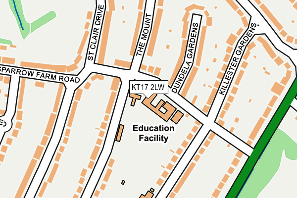
KT17 2LW is located in the Stoneleigh electoral ward, within the local authority district of Epsom and Ewell and the English Parliamentary constituency of Epsom and Ewell. The Sub Integrated Care Board (ICB) Location is NHS Surrey Heartlands ICB - 92A and the police force is Surrey. This postcode has been in use since January 1980.


GetTheData
Source: OS OpenMap – Local (Ordnance Survey)
Source: OS VectorMap District (Ordnance Survey)
Licence: Open Government Licence (requires attribution)
| Easting | 522830 |
| Northing | 164526 |
| Latitude | 51.366524 |
| Longitude | -0.236967 |
GetTheData
Source: Open Postcode Geo
Licence: Open Government Licence
| Country | England |
| Postcode District | KT17 |
➜ See where KT17 is on a map ➜ Where is Stoneleigh? | |
GetTheData
Source: Land Registry Price Paid Data
Licence: Open Government Licence
Elevation or altitude of KT17 2LW as distance above sea level:
| Metres | Feet | |
|---|---|---|
| Elevation | 50m | 164ft |
Elevation is measured from the approximate centre of the postcode, to the nearest point on an OS contour line from OS Terrain 50, which has contour spacing of ten vertical metres.
➜ How high above sea level am I? Find the elevation of your current position using your device's GPS.
GetTheData
Source: Open Postcode Elevation
Licence: Open Government Licence
| Ward | Stoneleigh |
| Constituency | Epsom And Ewell |
GetTheData
Source: ONS Postcode Database
Licence: Open Government Licence
| St. Clair Drive (Sparrow Farm Road) | Stoneleigh | 97m |
| St. Clair Drive | Stoneleigh | 146m |
| Sparrow Farm Road (London Road) | Stoneleigh | 258m |
| Sparrow Farm Road (London Road) | Stoneleigh | 259m |
| Woodstone Avenue | Stoneleigh | 273m |
| Stoneleigh Station | 0.9km |
| Worcester Park Station | 1.7km |
| Cheam Station | 2km |
GetTheData
Source: NaPTAN
Licence: Open Government Licence
GetTheData
Source: ONS Postcode Database
Licence: Open Government Licence


➜ Get more ratings from the Food Standards Agency
GetTheData
Source: Food Standards Agency
Licence: FSA terms & conditions
| Last Collection | |||
|---|---|---|---|
| Location | Mon-Fri | Sat | Distance |
| 105 St Clair Drive | 17:30 | 12:00 | 151m |
| Wickham Avenue (170) | 17:00 | 12:00 | 310m |
| 65 Oaks Avenue | 17:30 | 12:00 | 417m |
GetTheData
Source: Dracos
Licence: Creative Commons Attribution-ShareAlike
The below table lists the International Territorial Level (ITL) codes (formerly Nomenclature of Territorial Units for Statistics (NUTS) codes) and Local Administrative Units (LAU) codes for KT17 2LW:
| ITL 1 Code | Name |
|---|---|
| TLJ | South East (England) |
| ITL 2 Code | Name |
| TLJ2 | Surrey, East and West Sussex |
| ITL 3 Code | Name |
| TLJ26 | East Surrey |
| LAU 1 Code | Name |
| E07000208 | Epsom and Ewell |
GetTheData
Source: ONS Postcode Directory
Licence: Open Government Licence
The below table lists the Census Output Area (OA), Lower Layer Super Output Area (LSOA), and Middle Layer Super Output Area (MSOA) for KT17 2LW:
| Code | Name | |
|---|---|---|
| OA | E00155094 | |
| LSOA | E01030408 | Epsom and Ewell 003E |
| MSOA | E02006337 | Epsom and Ewell 003 |
GetTheData
Source: ONS Postcode Directory
Licence: Open Government Licence
| KT17 2LP | Sparrow Farm Road | 68m |
| KT17 2LN | Waverley Road | 107m |
| KT4 8UB | Dundela Gardens | 121m |
| KT17 2HQ | Chadacre Road | 128m |
| KT4 8TZ | Killester Gardens | 154m |
| KT4 8UA | Killester Gardens | 175m |
| KT17 2HG | Chadacre Road | 179m |
| KT17 2LG | Bradstock Road | 180m |
| KT4 8UD | The Mount | 185m |
| KT17 2LR | Sparrow Farm Road | 194m |
GetTheData
Source: Open Postcode Geo; Land Registry Price Paid Data
Licence: Open Government Licence