KT16 0BE maps, stats, and open data
KT16 0BE is located in the Thorpe electoral ward, within the local authority district of Runnymede and the English Parliamentary constituency of Runnymede and Weybridge. The Sub Integrated Care Board (ICB) Location is NHS Surrey Heartlands ICB - 92A and the police force is Surrey. This postcode has been in use since January 2019.
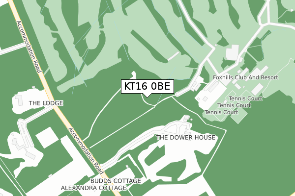
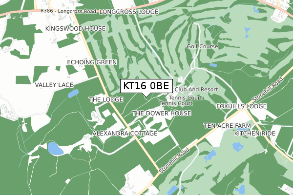
KT16 0BE maps


Licence: Open Government Licence (requires attribution)
Attribution: Contains OS data © Crown copyright and database right 2025
Source: Open Postcode Geo
Licence: Open Government Licence (requires attribution)
Attribution: Contains OS data © Crown copyright and database right 2025; Contains Royal Mail data © Royal Mail copyright and database right 2025; Source: Office for National Statistics licensed under the Open Government Licence v.3.0
KT16 0BE geodata
| Easting | 501523 |
| Northing | 168003 |
| Latitude | 51.401982 |
| Longitude | -0.541907 |
Where is KT16 0BE?
| Country | England |
| Postcode District | KT16 |
KT16 0BE Elevation
Elevation or altitude of KT16 0BE as distance above sea level:
| Metres | Feet | |
|---|---|---|
| Elevation | 20m | 66ft |
Elevation is measured from the approximate centre of the postcode, to the nearest point on an OS contour line from OS Terrain 50, which has contour spacing of ten vertical metres.
➜ How high above sea level am I? Find the elevation of your current position using your device's GPS.
Politics
| Ward | Thorpe |
|---|---|
| Constituency | Runnymede And Weybridge |
Transport
Nearest bus stops to KT16 0BE
| Thorpe Green (Green Road) | Thorpe Green | 228m |
| Thorpe Green (Green Road) | Thorpe Green | 243m |
| M25 Flyover (Green Road) | Thorpe | 288m |
| M25 Flyover (Green Road) | Thorpe | 391m |
| Rose And Crown (Green Road) | Thorpe Green | 453m |
Nearest railway stations to KT16 0BE
| Virginia Water Station | 1.4km |
| Chertsey Station | 2.8km |
| Egham Station | 3.1km |
Deprivation
13.2% of English postcodes are less deprived than KT16 0BE:Food Standards Agency
Three nearest food hygiene ratings to KT16 0BE (metres)


➜ Get more ratings from the Food Standards Agency
Nearest post box to KT16 0BE
| Last Collection | |||
|---|---|---|---|
| Location | Mon-Fri | Sat | Distance |
| Post Office, Green Road | 18:30 | 11:15 | 657m |
| Village Road | 16:45 | 11:15 | 930m |
| Stroude Road | 16:15 | 11:00 | 1,380m |
KT16 0BE ITL and KT16 0BE LAU
The below table lists the International Territorial Level (ITL) codes (formerly Nomenclature of Territorial Units for Statistics (NUTS) codes) and Local Administrative Units (LAU) codes for KT16 0BE:
| ITL 1 Code | Name |
|---|---|
| TLJ | South East (England) |
| ITL 2 Code | Name |
| TLJ2 | Surrey, East and West Sussex |
| ITL 3 Code | Name |
| TLJ25 | West Surrey |
| LAU 1 Code | Name |
| E07000212 | Runnymede |
KT16 0BE census areas
The below table lists the Census Output Area (OA), Lower Layer Super Output Area (LSOA), and Middle Layer Super Output Area (MSOA) for KT16 0BE:
| Code | Name | |
|---|---|---|
| OA | E00156500 | |
| LSOA | E01030685 | Runnymede 004C |
| MSOA | E02006396 | Runnymede 004 |
Nearest postcodes to KT16 0BE
| TW20 8QP | Green Road | 209m |
| TW20 8QN | Green Road | 252m |
| TW20 8QW | Green Road | 277m |
| TW20 8QR | Mill House Lane | 376m |
| TW20 8QH | Bourne Meadow | 403m |
| TW20 8QS | Green Road | 568m |
| GU25 4BT | Sandhills Lane | 576m |
| TW20 8QL | Green Road | 585m |
| TW20 8QT | Green Road | 609m |
| GU25 4BS | Sandhills Lane | 612m |