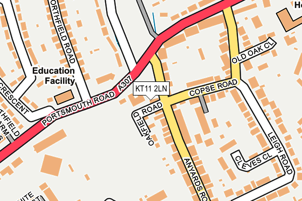
KT11 2LN lies on Oakfield Road in Cobham. KT11 2LN is located in the Cobham and Downside electoral ward, within the local authority district of Elmbridge and the English Parliamentary constituency of Esher and Walton. The Sub Integrated Care Board (ICB) Location is NHS Surrey Heartlands ICB - 92A and the police force is Surrey. This postcode has been in use since January 1980.


GetTheData
Source: OS OpenMap – Local (Ordnance Survey)
Source: OS VectorMap District (Ordnance Survey)
Licence: Open Government Licence (requires attribution)
| Easting | 510694 |
| Northing | 160553 |
| Latitude | 51.333306 |
| Longitude | -0.412456 |
GetTheData
Source: Open Postcode Geo
Licence: Open Government Licence
| Street | Oakfield Road |
| Town/City | Cobham |
| Country | England |
| Postcode District | KT11 |
➜ See where KT11 is on a map ➜ Where is Cobham? | |
GetTheData
Source: Land Registry Price Paid Data
Licence: Open Government Licence
Elevation or altitude of KT11 2LN as distance above sea level:
| Metres | Feet | |
|---|---|---|
| Elevation | 30m | 98ft |
Elevation is measured from the approximate centre of the postcode, to the nearest point on an OS contour line from OS Terrain 50, which has contour spacing of ten vertical metres.
➜ How high above sea level am I? Find the elevation of your current position using your device's GPS.
GetTheData
Source: Open Postcode Elevation
Licence: Open Government Licence
| Ward | Cobham And Downside |
| Constituency | Esher And Walton |
GetTheData
Source: ONS Postcode Database
Licence: Open Government Licence
| Police Station (Portsmouth Road) | Cobham | 73m |
| Police Station (Portsmouth Road) | Cobham | 233m |
| Oakdene Road | Cobham | 295m |
| Cottage Hospital (Portsmouth Road) | Cobham | 334m |
| Cottage Hospital (Portsmouth Road) | Cobham | 359m |
| Cobham & Stoke d'Abernon Station | 2.3km |
| Oxshott Station | 3.5km |
| Walton-on-Thames Station | 4.4km |
GetTheData
Source: NaPTAN
Licence: Open Government Licence
| Percentage of properties with Next Generation Access | 100.0% |
| Percentage of properties with Superfast Broadband | 100.0% |
| Percentage of properties with Ultrafast Broadband | 100.0% |
| Percentage of properties with Full Fibre Broadband | 0.0% |
Superfast Broadband is between 30Mbps and 300Mbps
Ultrafast Broadband is > 300Mbps
| Percentage of properties unable to receive 2Mbps | 0.0% |
| Percentage of properties unable to receive 5Mbps | 0.0% |
| Percentage of properties unable to receive 10Mbps | 0.0% |
| Percentage of properties unable to receive 30Mbps | 0.0% |
GetTheData
Source: Ofcom
Licence: Ofcom Terms of Use (requires attribution)
GetTheData
Source: ONS Postcode Database
Licence: Open Government Licence


➜ Get more ratings from the Food Standards Agency
GetTheData
Source: Food Standards Agency
Licence: FSA terms & conditions
| Last Collection | |||
|---|---|---|---|
| Location | Mon-Fri | Sat | Distance |
| Anyards Road | 17:45 | 11:15 | 101m |
| Winstanley Close | 17:15 | 12:00 | 255m |
| Leigh Road | 17:45 | 11:15 | 316m |
GetTheData
Source: Dracos
Licence: Creative Commons Attribution-ShareAlike
The below table lists the International Territorial Level (ITL) codes (formerly Nomenclature of Territorial Units for Statistics (NUTS) codes) and Local Administrative Units (LAU) codes for KT11 2LN:
| ITL 1 Code | Name |
|---|---|
| TLJ | South East (England) |
| ITL 2 Code | Name |
| TLJ2 | Surrey, East and West Sussex |
| ITL 3 Code | Name |
| TLJ25 | West Surrey |
| LAU 1 Code | Name |
| E07000207 | Elmbridge |
GetTheData
Source: ONS Postcode Directory
Licence: Open Government Licence
The below table lists the Census Output Area (OA), Lower Layer Super Output Area (LSOA), and Middle Layer Super Output Area (MSOA) for KT11 2LN:
| Code | Name | |
|---|---|---|
| OA | E00154579 | |
| LSOA | E01030300 | Elmbridge 017A |
| MSOA | E02006333 | Elmbridge 017 |
GetTheData
Source: ONS Postcode Directory
Licence: Open Government Licence
| KT11 2LH | Anyards Road | 43m |
| KT11 2LL | Oakfield Villas | 48m |
| KT11 2LJ | Anyards Road | 62m |
| KT11 2LQ | Anyards Road | 86m |
| KT11 2TW | Copse Road | 106m |
| KT11 1HX | Portsmouth Road | 167m |
| KT11 2LG | Anyards Road | 183m |
| KT11 2LE | Cleves Close | 193m |
| KT11 1BZ | Old Common Road | 201m |
| KT11 2TN | Copse Road | 217m |
GetTheData
Source: Open Postcode Geo; Land Registry Price Paid Data
Licence: Open Government Licence