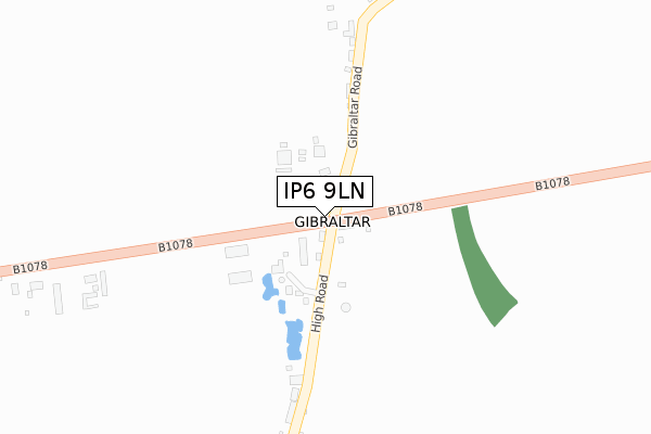
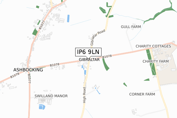
IP6 9LN is located in the Carlford & Fynn Valley electoral ward, within the local authority district of East Suffolk and the English Parliamentary constituency of Central Suffolk and North Ipswich. The Sub Integrated Care Board (ICB) Location is NHS Suffolk and North East Essex ICB - 06L and the police force is Suffolk. This postcode has been in use since January 2018.


GetTheData
Source: OS Open Zoomstack (Ordnance Survey)
Licence: Open Government Licence (requires attribution)
Attribution: Contains OS data © Crown copyright and database right 2024
Source: Open Postcode Geo
Licence: Open Government Licence (requires attribution)
Attribution: Contains OS data © Crown copyright and database right 2024; Contains Royal Mail data © Royal Mail copyright and database right 2024; Source: Office for National Statistics licensed under the Open Government Licence v.3.0
| Easting | 619053 |
| Northing | 253972 |
| Latitude | 52.140602 |
| Longitude | 1.199808 |
GetTheData
Source: Open Postcode Geo
Licence: Open Government Licence
| Country | England |
| Postcode District | IP6 |
| ➜ IP6 open data dashboard ➜ See where IP6 is on a map | |
GetTheData
Source: Land Registry Price Paid Data
Licence: Open Government Licence
| Ward | Carlford & Fynn Valley |
| Constituency | Central Suffolk And North Ipswich |
GetTheData
Source: ONS Postcode Database
Licence: Open Government Licence
| Forge Cottage (B1078) | Gibraltar | 12m |
| Forge Cottage (High Road) | Gibraltar | 19m |
| Forge Cottage (B1078) | Gibraltar | 23m |
| Forge Cottage (High Road) | Gibraltar | 24m |
| College (B1078) | Otley | 786m |
GetTheData
Source: NaPTAN
Licence: Open Government Licence
GetTheData
Source: ONS Postcode Database
Licence: Open Government Licence


➜ Get more ratings from the Food Standards Agency
GetTheData
Source: Food Standards Agency
Licence: FSA terms & conditions
| Last Collection | |||
|---|---|---|---|
| Location | Mon-Fri | Sat | Distance |
| Debenham Road | 16:00 | 10:15 | 840m |
| 3 The Square | 15:45 | 09:00 | 1,615m |
| Post Office, Chapel Road | 16:15 | 10:15 | 1,883m |
GetTheData
Source: Dracos
Licence: Creative Commons Attribution-ShareAlike
| Facility | Distance |
|---|---|
| Suffolk New College Charity Lane, Otley, Ipswich Health and Fitness Gym, Outdoor Tennis Courts | 923m |
| Swilland & Witnesham Playing Field High Road, Witnesham, Ipswich Grass Pitches | 1.8km |
| Otley Recreation Ground (Closed) Chapel Road, Otley, Ipswich Grass Pitches | 2.1km |
GetTheData
Source: Active Places
Licence: Open Government Licence
| School | Phase of Education | Distance |
|---|---|---|
| Witnesham Primary School High Road, Witnesham, Ipswich, IP6 9EX | Primary | 1.7km |
| Otley Primary School Chapel Road, Otley, Ipswich, IP6 9NT | Primary | 2.1km |
| Henley Primary School Ashbocking Road, Henley, Ipswich, IP6 0QX | Primary | 3.8km |
GetTheData
Source: Edubase
Licence: Open Government Licence
The below table lists the International Territorial Level (ITL) codes (formerly Nomenclature of Territorial Units for Statistics (NUTS) codes) and Local Administrative Units (LAU) codes for IP6 9LN:
| ITL 1 Code | Name |
|---|---|
| TLH | East |
| ITL 2 Code | Name |
| TLH1 | East Anglia |
| ITL 3 Code | Name |
| TLH14 | Suffolk CC |
| LAU 1 Code | Name |
| E07000244 | East Suffolk |
GetTheData
Source: ONS Postcode Directory
Licence: Open Government Licence
The below table lists the Census Output Area (OA), Lower Layer Super Output Area (LSOA), and Middle Layer Super Output Area (MSOA) for IP6 9LN:
| Code | Name | |
|---|---|---|
| OA | E00154002 | |
| LSOA | E01030200 | Suffolk Coastal 006B |
| MSOA | E02006292 | Suffolk Coastal 006 |
GetTheData
Source: ONS Postcode Directory
Licence: Open Government Licence
| IP6 9LL | Gibraltar Road | 251m |
| IP6 9LW | High Road | 252m |
| IP6 9LJ | Ashbocking Road | 374m |
| IP6 9LH | Ashbocking Road | 524m |
| IP6 9JH | The Green | 783m |
| IP6 9JY | The Green | 799m |
| IP6 9JZ | The Green | 837m |
| IP6 9LA | 848m | |
| IP6 9JT | The Green | 853m |
| IP6 9JX | The Green | 862m |
GetTheData
Source: Open Postcode Geo; Land Registry Price Paid Data
Licence: Open Government Licence