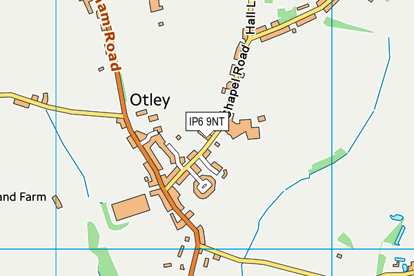
Otley Recreation Ground (Closed)
Otley Recreation Ground (Closed) is located in Otley, Ipswich (IP6).
| Address | Chapel Road, Otley, Ipswich, IP6 9NT |
| Car Park | Yes |
| Car Park Capacity | 35 |
| Management Type | Trust |
| Management Group | Trust |
| Owner Type | Community Organisation |
| Owner Group | Community Organisation |
| Education Phase | Not Known |
| Closure Date | 1st Jul 2008 |
| Closure Reason | Unclassified |
Facilities
| Closure Date | 1st Jul 2008 |
| Closure Reason | Unclassified |
| Accessibility | Pay and Play |
| Management Type | Not Known |
| Year Built | 1963 |
| Changing Rooms | No |
| Date Record Checked | 4th Dec 2012 |
| Opening Times | Detailed Timings |
Facility specifics
Contact
Where is Otley Recreation Ground (Closed)?
| Sub Building Name | |
| Building Name | |
| Building Number | 0 |
| Dependent Thoroughfare | |
| Thoroughfare Name | Chapel Road |
| Double Dependent Locality | |
| Dependent Locality | Otley |
| PostTown | Ipswich |
| Postcode | IP6 9NT |
Otley Recreation Ground (Closed) on a map

Otley Recreation Ground (Closed) geodata
| Easting | 620565 |
| Northing | 255488 |
| Latitude | 52.153593 |
| Longitude | 1.222819 |
| Local Authority Name | East Suffolk |
| Local Authority Code | E07000244 |
| Parliamentary Constituency Name | Central Suffolk and North Ipswich |
| Parliamentary Constituency Code | E14000624 |
| Region Name | Eastern |
| Region Code | E15000006 |
| Ward Name | Carlford & Fynn Valley |
| Ward Code | E05012737 |
| Output Area Code | E00154001 |
About this data
This data is open data sourced from Active Places Power and licenced under the Active Places Open Data Licence.
| Created On | 18th May 2007 |
| Audited On | 26th Jan 2015 |
| Checked On | 4th Dec 2012 |
