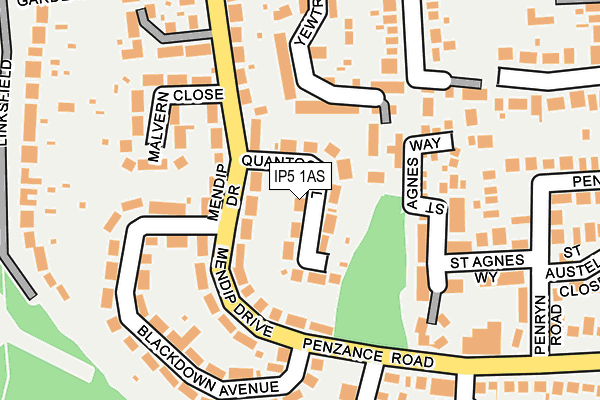
IP5 1AS lies on Quantock Close in Rushmere St Andrew, Ipswich. IP5 1AS is located in the Kesgrave electoral ward, within the local authority district of East Suffolk and the English Parliamentary constituency of Central Suffolk and North Ipswich. The Sub Integrated Care Board (ICB) Location is NHS Suffolk and North East Essex ICB - 06L and the police force is Suffolk. This postcode has been in use since June 1997.


GetTheData
Source: OS OpenMap – Local (Ordnance Survey)
Source: OS VectorMap District (Ordnance Survey)
Licence: Open Government Licence (requires attribution)
| Easting | 620770 |
| Northing | 245023 |
| Latitude | 52.059574 |
| Longitude | 1.219033 |
GetTheData
Source: Open Postcode Geo
Licence: Open Government Licence
| Street | Quantock Close |
| Locality | Rushmere St Andrew |
| Town/City | Ipswich |
| Country | England |
| Postcode District | IP5 |
➜ See where IP5 is on a map ➜ Where is Kesgrave? | |
GetTheData
Source: Land Registry Price Paid Data
Licence: Open Government Licence
Elevation or altitude of IP5 1AS as distance above sea level:
| Metres | Feet | |
|---|---|---|
| Elevation | 30m | 98ft |
Elevation is measured from the approximate centre of the postcode, to the nearest point on an OS contour line from OS Terrain 50, which has contour spacing of ten vertical metres.
➜ How high above sea level am I? Find the elevation of your current position using your device's GPS.
GetTheData
Source: Open Postcode Elevation
Licence: Open Government Licence
| Ward | Kesgrave |
| Constituency | Central Suffolk And North Ipswich |
GetTheData
Source: ONS Postcode Database
Licence: Open Government Licence
| Beech Road Shops (Mendip Drive) | Rushmere St Andrew | 74m |
| Beech Road Shops (Mendip Drive) | Rushmere St Andrew | 79m |
| Brendon Drive (Penzance Road) | Rushmere St Andrew | 159m |
| Brendon Drive | Rushmere St Andrew | 189m |
| Brendon Drive (Penzance Road) | Rushmere St Andrew | 198m |
| Derby Road (Ipswich) Station | 2.7km |
| Westerfield Station | 4.4km |
GetTheData
Source: NaPTAN
Licence: Open Government Licence
| Percentage of properties with Next Generation Access | 100.0% |
| Percentage of properties with Superfast Broadband | 100.0% |
| Percentage of properties with Ultrafast Broadband | 0.0% |
| Percentage of properties with Full Fibre Broadband | 0.0% |
Superfast Broadband is between 30Mbps and 300Mbps
Ultrafast Broadband is > 300Mbps
| Median download speed | 32.4Mbps |
| Average download speed | 29.0Mbps |
| Maximum download speed | 51.42Mbps |
| Median upload speed | 7.5Mbps |
| Average upload speed | 6.4Mbps |
| Maximum upload speed | 15.02Mbps |
| Percentage of properties unable to receive 2Mbps | 0.0% |
| Percentage of properties unable to receive 5Mbps | 0.0% |
| Percentage of properties unable to receive 10Mbps | 0.0% |
| Percentage of properties unable to receive 30Mbps | 0.0% |
GetTheData
Source: Ofcom
Licence: Ofcom Terms of Use (requires attribution)
Estimated total energy consumption in IP5 1AS by fuel type, 2015.
| Consumption (kWh) | 381,609 |
|---|---|
| Meter count | 26 |
| Mean (kWh/meter) | 14,677 |
| Median (kWh/meter) | 13,502 |
| Consumption (kWh) | 88,245 |
|---|---|
| Meter count | 26 |
| Mean (kWh/meter) | 3,394 |
| Median (kWh/meter) | 2,957 |
GetTheData
Source: Postcode level gas estimates: 2015 (experimental)
Source: Postcode level electricity estimates: 2015 (experimental)
Licence: Open Government Licence
GetTheData
Source: ONS Postcode Database
Licence: Open Government Licence


➜ Get more ratings from the Food Standards Agency
GetTheData
Source: Food Standards Agency
Licence: FSA terms & conditions
| Last Collection | |||
|---|---|---|---|
| Location | Mon-Fri | Sat | Distance |
| 59 Beech Road | 17:15 | 12:30 | 85m |
| 1 Main Road | 17:15 | 12:30 | 557m |
| Penzance Road Post Office | 17:00 | 12:20 | 707m |
GetTheData
Source: Dracos
Licence: Creative Commons Attribution-ShareAlike
The below table lists the International Territorial Level (ITL) codes (formerly Nomenclature of Territorial Units for Statistics (NUTS) codes) and Local Administrative Units (LAU) codes for IP5 1AS:
| ITL 1 Code | Name |
|---|---|
| TLH | East |
| ITL 2 Code | Name |
| TLH1 | East Anglia |
| ITL 3 Code | Name |
| TLH14 | Suffolk CC |
| LAU 1 Code | Name |
| E07000244 | East Suffolk |
GetTheData
Source: ONS Postcode Directory
Licence: Open Government Licence
The below table lists the Census Output Area (OA), Lower Layer Super Output Area (LSOA), and Middle Layer Super Output Area (MSOA) for IP5 1AS:
| Code | Name | |
|---|---|---|
| OA | E00154044 | |
| LSOA | E01030207 | Suffolk Coastal 009E |
| MSOA | E02006295 | Suffolk Coastal 009 |
GetTheData
Source: ONS Postcode Directory
Licence: Open Government Licence
| IP5 1AT | Mendip Drive | 86m |
| IP5 1AP | Beech Road | 89m |
| IP5 1AU | Mendip Drive | 104m |
| IP5 1AR | Beech Road | 107m |
| IP5 1AW | Malvern Close | 148m |
| IP5 2GL | Yewtree Grove | 155m |
| IP5 1JZ | St Agnes Way | 156m |
| IP5 1AZ | Blackdown Avenue | 165m |
| IP5 1AY | Blackdown Avenue | 190m |
| IP5 2GN | Pinetree Close | 216m |
GetTheData
Source: Open Postcode Geo; Land Registry Price Paid Data
Licence: Open Government Licence