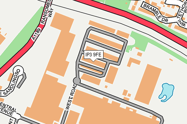
IP3 9FE lies on Beta Terrace in Ipswich. IP3 9FE is located in the Priory Heath electoral ward, within the local authority district of Ipswich and the English Parliamentary constituency of Ipswich. The Sub Integrated Care Board (ICB) Location is NHS Suffolk and North East Essex ICB - 06L and the police force is Suffolk. This postcode has been in use since July 2007.


GetTheData
Source: OS OpenMap – Local (Ordnance Survey)
Source: OS VectorMap District (Ordnance Survey)
Licence: Open Government Licence (requires attribution)
| Easting | 620239 |
| Northing | 242103 |
| Latitude | 52.033588 |
| Longitude | 1.209451 |
GetTheData
Source: Open Postcode Geo
Licence: Open Government Licence
| Street | Beta Terrace |
| Town/City | Ipswich |
| Country | England |
| Postcode District | IP3 |
➜ See where IP3 is on a map ➜ Where is Ipswich? | |
GetTheData
Source: Land Registry Price Paid Data
Licence: Open Government Licence
Elevation or altitude of IP3 9FE as distance above sea level:
| Metres | Feet | |
|---|---|---|
| Elevation | 30m | 98ft |
Elevation is measured from the approximate centre of the postcode, to the nearest point on an OS contour line from OS Terrain 50, which has contour spacing of ten vertical metres.
➜ How high above sea level am I? Find the elevation of your current position using your device's GPS.
GetTheData
Source: Open Postcode Elevation
Licence: Open Government Licence
| Ward | Priory Heath |
| Constituency | Ipswich |
GetTheData
Source: ONS Postcode Database
Licence: Open Government Licence
| Pearse Way (Murrills Road) | Warren Heath | 239m |
| Pearse Way (Murrills Road) | Warren Heath | 250m |
| West Road | Ransomes Europark | 258m |
| Euro Retail Park (Ransomes Way) | Warren Heath | 273m |
| Euro Retail Park (Ransomes Way) | Warren Heath | 304m |
| Derby Road (Ipswich) Station | 2.6km |
| Ipswich Station | 4.8km |
GetTheData
Source: NaPTAN
Licence: Open Government Licence
| Median download speed | 8.8Mbps |
| Average download speed | 8.6Mbps |
| Maximum download speed | 10.49Mbps |
| Median upload speed | 1.0Mbps |
| Average upload speed | 0.9Mbps |
| Maximum upload speed | 1.15Mbps |
GetTheData
Source: Ofcom
Licence: Ofcom Terms of Use (requires attribution)
GetTheData
Source: ONS Postcode Database
Licence: Open Government Licence


➜ Get more ratings from the Food Standards Agency
GetTheData
Source: Food Standards Agency
Licence: FSA terms & conditions
| Last Collection | |||
|---|---|---|---|
| Location | Mon-Fri | Sat | Distance |
| Murrells Road | 17:30 | 12:10 | 256m |
| Murrels Road | 17:30 | 12:00 | 440m |
| 44 Felix Road | 17:15 | 12:00 | 472m |
GetTheData
Source: Dracos
Licence: Creative Commons Attribution-ShareAlike
The below table lists the International Territorial Level (ITL) codes (formerly Nomenclature of Territorial Units for Statistics (NUTS) codes) and Local Administrative Units (LAU) codes for IP3 9FE:
| ITL 1 Code | Name |
|---|---|
| TLH | East |
| ITL 2 Code | Name |
| TLH1 | East Anglia |
| ITL 3 Code | Name |
| TLH14 | Suffolk CC |
| LAU 1 Code | Name |
| E07000202 | Ipswich |
GetTheData
Source: ONS Postcode Directory
Licence: Open Government Licence
The below table lists the Census Output Area (OA), Lower Layer Super Output Area (LSOA), and Middle Layer Super Output Area (MSOA) for IP3 9FE:
| Code | Name | |
|---|---|---|
| OA | E00170860 | |
| LSOA | E01033127 | Ipswich 014E |
| MSOA | E02006258 | Ipswich 014 |
GetTheData
Source: ONS Postcode Directory
Licence: Open Government Licence
| IP3 9FF | Gamma Terrace | 41m |
| IP3 9FH | Delta Terrace | 77m |
| IP3 9SN | The Sandlings | 149m |
| IP3 8ST | Bramble Drive | 242m |
| IP3 8TF | Pearse Way | 293m |
| IP3 8SN | Essex Way | 307m |
| IP3 8SR | Blackthorn Close | 318m |
| IP3 8XB | Acacia Close | 319m |
| IP3 8SS | Whitethorn Road | 321m |
| IP3 8RE | Foxglove Crescent | 361m |
GetTheData
Source: Open Postcode Geo; Land Registry Price Paid Data
Licence: Open Government Licence