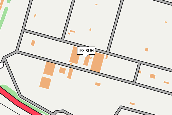
IP3 8UH is located in the Martlesham & Purdis Farm electoral ward, within the local authority district of East Suffolk and the English Parliamentary constituency of Suffolk Coastal. The Sub Integrated Care Board (ICB) Location is NHS Suffolk and North East Essex ICB - 06L and the police force is Suffolk. This postcode has been in use since January 1980.


GetTheData
Source: OS OpenMap – Local (Ordnance Survey)
Source: OS VectorMap District (Ordnance Survey)
Licence: Open Government Licence (requires attribution)
| Easting | 621184 |
| Northing | 242053 |
| Latitude | 52.032749 |
| Longitude | 1.223142 |
GetTheData
Source: Open Postcode Geo
Licence: Open Government Licence
| Country | England |
| Postcode District | IP3 |
➜ See where IP3 is on a map ➜ Where is Ipswich? | |
GetTheData
Source: Land Registry Price Paid Data
Licence: Open Government Licence
Elevation or altitude of IP3 8UH as distance above sea level:
| Metres | Feet | |
|---|---|---|
| Elevation | 30m | 98ft |
Elevation is measured from the approximate centre of the postcode, to the nearest point on an OS contour line from OS Terrain 50, which has contour spacing of ten vertical metres.
➜ How high above sea level am I? Find the elevation of your current position using your device's GPS.
GetTheData
Source: Open Postcode Elevation
Licence: Open Government Licence
| Ward | Martlesham & Purdis Farm |
| Constituency | Suffolk Coastal |
GetTheData
Source: ONS Postcode Database
Licence: Open Government Licence
| Suffolk Show Ground (On Site) | Warren Heath | 313m |
| Trinity Park (Murrils Road) | Warren Heath | 334m |
| Trinity Park (Murrils Road) | Warren Heath | 345m |
| Makro (Wentworth Road) | Ransomes Europark | 406m |
| The Pathway (Murrills Road) | Warren Heath | 555m |
| Derby Road (Ipswich) Station | 3.4km |
GetTheData
Source: NaPTAN
Licence: Open Government Licence
GetTheData
Source: ONS Postcode Database
Licence: Open Government Licence


➜ Get more ratings from the Food Standards Agency
GetTheData
Source: Food Standards Agency
Licence: FSA terms & conditions
| Last Collection | |||
|---|---|---|---|
| Location | Mon-Fri | Sat | Distance |
| Murrels Road | 17:30 | 12:00 | 620m |
| 44 Felix Road | 17:15 | 12:00 | 627m |
| Shepherd & Dog P/H | 17:15 | 11:30 | 756m |
GetTheData
Source: Dracos
Licence: Creative Commons Attribution-ShareAlike
The below table lists the International Territorial Level (ITL) codes (formerly Nomenclature of Territorial Units for Statistics (NUTS) codes) and Local Administrative Units (LAU) codes for IP3 8UH:
| ITL 1 Code | Name |
|---|---|
| TLH | East |
| ITL 2 Code | Name |
| TLH1 | East Anglia |
| ITL 3 Code | Name |
| TLH14 | Suffolk CC |
| LAU 1 Code | Name |
| E07000244 | East Suffolk |
GetTheData
Source: ONS Postcode Directory
Licence: Open Government Licence
The below table lists the Census Output Area (OA), Lower Layer Super Output Area (LSOA), and Middle Layer Super Output Area (MSOA) for IP3 8UH:
| Code | Name | |
|---|---|---|
| OA | E00153983 | |
| LSOA | E01030197 | Suffolk Coastal 011B |
| MSOA | E02006297 | Suffolk Coastal 011 |
GetTheData
Source: ONS Postcode Directory
Licence: Open Government Licence
| IP3 9GU | Edison Close | 372m |
| IP3 8UX | Penny Lane | 389m |
| IP3 8GA | Ash Close | 403m |
| IP3 8UD | Bucklesham Road | 404m |
| IP3 8UZ | Routh Avenue | 426m |
| IP3 8US | Murrills Road | 447m |
| IP3 8GD | Meadow Crescent | 447m |
| IP3 8GB | Holly Close | 454m |
| IP3 8UY | Porter Road | 488m |
| IP10 0DF | Felixstowe Road | 506m |
GetTheData
Source: Open Postcode Geo; Land Registry Price Paid Data
Licence: Open Government Licence