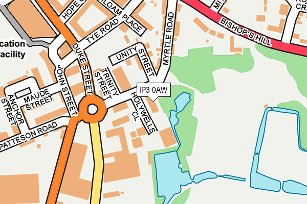
IP3 0AW is located in the Holywells electoral ward, within the local authority district of Ipswich and the English Parliamentary constituency of Ipswich. The Sub Integrated Care Board (ICB) Location is NHS Suffolk and North East Essex ICB - 06L and the police force is Suffolk. This postcode has been in use since October 1987.


GetTheData
Source: OS OpenMap – Local (Ordnance Survey)
Source: OS VectorMap District (Ordnance Survey)
Licence: Open Government Licence (requires attribution)
| Easting | 617350 |
| Northing | 243668 |
| Latitude | 52.048762 |
| Longitude | 1.168366 |
GetTheData
Source: Open Postcode Geo
Licence: Open Government Licence
| Country | England |
| Postcode District | IP3 |
➜ See where IP3 is on a map ➜ Where is Ipswich? | |
GetTheData
Source: Land Registry Price Paid Data
Licence: Open Government Licence
Elevation or altitude of IP3 0AW as distance above sea level:
| Metres | Feet | |
|---|---|---|
| Elevation | 10m | 33ft |
Elevation is measured from the approximate centre of the postcode, to the nearest point on an OS contour line from OS Terrain 50, which has contour spacing of ten vertical metres.
➜ How high above sea level am I? Find the elevation of your current position using your device's GPS.
GetTheData
Source: Open Postcode Elevation
Licence: Open Government Licence
| Ward | Holywells |
| Constituency | Ipswich |
GetTheData
Source: ONS Postcode Database
Licence: Open Government Licence
| John Street (Duke Street) | Holywells Park | 120m |
| Industrial Estate (Holywells Road) | Holywells Park | 137m |
| Cavendish Street (Bishops Hill) | Rose Hill | 229m |
| Cavendish Street (Bishops Hill) | Rose Hill | 243m |
| Bishops Hill Junction (Felixstowe Road) | Rose Hill | 380m |
| Derby Road (Ipswich) Station | 1km |
| Ipswich Station | 1.7km |
| Westerfield Station | 3.6km |
GetTheData
Source: NaPTAN
Licence: Open Government Licence
GetTheData
Source: ONS Postcode Database
Licence: Open Government Licence


➜ Get more ratings from the Food Standards Agency
GetTheData
Source: Food Standards Agency
Licence: FSA terms & conditions
| Last Collection | |||
|---|---|---|---|
| Location | Mon-Fri | Sat | Distance |
| Duke Street | 17:30 | 11:30 | 195m |
| Foxhall Road | 17:15 | 12:15 | 200m |
| Bishops Hill | 17:30 | 12:25 | 252m |
GetTheData
Source: Dracos
Licence: Creative Commons Attribution-ShareAlike
The below table lists the International Territorial Level (ITL) codes (formerly Nomenclature of Territorial Units for Statistics (NUTS) codes) and Local Administrative Units (LAU) codes for IP3 0AW:
| ITL 1 Code | Name |
|---|---|
| TLH | East |
| ITL 2 Code | Name |
| TLH1 | East Anglia |
| ITL 3 Code | Name |
| TLH14 | Suffolk CC |
| LAU 1 Code | Name |
| E07000202 | Ipswich |
GetTheData
Source: ONS Postcode Directory
Licence: Open Government Licence
The below table lists the Census Output Area (OA), Lower Layer Super Output Area (LSOA), and Middle Layer Super Output Area (MSOA) for IP3 0AW:
| Code | Name | |
|---|---|---|
| OA | E00152840 | |
| LSOA | E01029991 | Ipswich 011C |
| MSOA | E02006255 | Ipswich 011 |
GetTheData
Source: ONS Postcode Directory
Licence: Open Government Licence
| IP3 0AP | Unity Street | 88m |
| IP3 0AL | Myrtle Road | 146m |
| IP3 0AN | Myrtle Road | 150m |
| IP3 0FF | Siloam Place | 159m |
| IP3 0FG | Siloam Place | 166m |
| IP3 0AH | John Street | 173m |
| IP3 8EN | Bishops Hill | 174m |
| IP3 0FJ | Tye Road | 187m |
| IP3 0AT | Cliff Road | 188m |
| IP3 8EL | Bishops Hill | 188m |
GetTheData
Source: Open Postcode Geo; Land Registry Price Paid Data
Licence: Open Government Licence