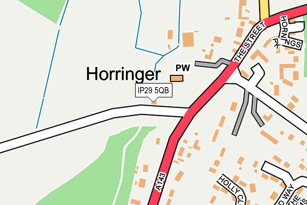
IP29 5QB is located in the Horringer electoral ward, within the local authority district of West Suffolk and the English Parliamentary constituency of Bury St Edmunds. The Sub Integrated Care Board (ICB) Location is NHS Suffolk and North East Essex ICB - 07K and the police force is Suffolk. This postcode has been in use since January 1980.


GetTheData
Source: OS OpenMap – Local (Ordnance Survey)
Source: OS VectorMap District (Ordnance Survey)
Licence: Open Government Licence (requires attribution)
| Easting | 582536 |
| Northing | 261978 |
| Latitude | 52.225749 |
| Longitude | 0.671122 |
GetTheData
Source: Open Postcode Geo
Licence: Open Government Licence
| Country | England |
| Postcode District | IP29 |
➜ See where IP29 is on a map ➜ Where is Horringer? | |
GetTheData
Source: Land Registry Price Paid Data
Licence: Open Government Licence
Elevation or altitude of IP29 5QB as distance above sea level:
| Metres | Feet | |
|---|---|---|
| Elevation | 80m | 262ft |
Elevation is measured from the approximate centre of the postcode, to the nearest point on an OS contour line from OS Terrain 50, which has contour spacing of ten vertical metres.
➜ How high above sea level am I? Find the elevation of your current position using your device's GPS.
GetTheData
Source: Open Postcode Elevation
Licence: Open Government Licence
| Ward | Horringer |
| Constituency | Bury St Edmunds |
GetTheData
Source: ONS Postcode Database
Licence: Open Government Licence
| Park Gates (A143) | Ickworth | 73m |
| Park Gates (A143) | Ickworth | 79m |
| Meadow Drive (The Street) | Horringer | 214m |
| Meadow Drive (The Street) | Horringer | 262m |
| School (Meadow Drive) | Horringer | 342m |
| Bury St Edmunds Station | 4.2km |
GetTheData
Source: NaPTAN
Licence: Open Government Licence
GetTheData
Source: ONS Postcode Database
Licence: Open Government Licence


➜ Get more ratings from the Food Standards Agency
GetTheData
Source: Food Standards Agency
Licence: FSA terms & conditions
| Last Collection | |||
|---|---|---|---|
| Location | Mon-Fri | Sat | Distance |
| Sharpes Lane | 16:00 | 10:00 | 952m |
| Post Office, Glastonbury Road | 17:15 | 11:30 | 1,665m |
| Scarlin Road | 17:00 | 11:30 | 1,674m |
GetTheData
Source: Dracos
Licence: Creative Commons Attribution-ShareAlike
The below table lists the International Territorial Level (ITL) codes (formerly Nomenclature of Territorial Units for Statistics (NUTS) codes) and Local Administrative Units (LAU) codes for IP29 5QB:
| ITL 1 Code | Name |
|---|---|
| TLH | East |
| ITL 2 Code | Name |
| TLH1 | East Anglia |
| ITL 3 Code | Name |
| TLH14 | Suffolk CC |
| LAU 1 Code | Name |
| E07000245 | West Suffolk |
GetTheData
Source: ONS Postcode Directory
Licence: Open Government Licence
The below table lists the Census Output Area (OA), Lower Layer Super Output Area (LSOA), and Middle Layer Super Output Area (MSOA) for IP29 5QB:
| Code | Name | |
|---|---|---|
| OA | E00153548 | |
| LSOA | E01030119 | St Edmundsbury 008C |
| MSOA | E02006280 | St Edmundsbury 008 |
GetTheData
Source: ONS Postcode Directory
Licence: Open Government Licence
| IP29 5RU | The Street | 138m |
| IP29 5SA | The Street | 182m |
| IP29 5RX | The Green | 188m |
| IP29 5RY | The Street | 217m |
| IP29 5SZ | Holly Close | 239m |
| IP29 5PY | Manor Lane | 277m |
| IP29 5AL | Hornings Park | 282m |
| IP29 5SF | Orchard Way | 329m |
| IP29 5RZ | Westley Lane | 342m |
| IP29 5SJ | The Street | 343m |
GetTheData
Source: Open Postcode Geo; Land Registry Price Paid Data
Licence: Open Government Licence